Observatory Adds Satellite Imagery for Monitoring Volcanic Activity

Observatory Adds Satellite Imagery for Monitoring Volcanic Activity
Tang Wai-ho
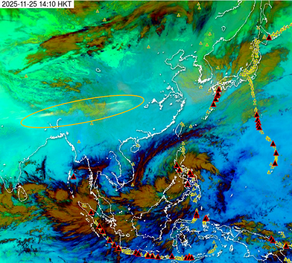
In June 2026, the Observatory added new satellite imagery for monitoring volcanic activity, releasing “Sulfur Dioxide” satellite imagery based on the Japan Meteorological Agency's “Himawari” geostationary satellite. A special colour scheme is used to highlight the distribution of atmospheric sulfur dioxide, enabling users to observe the distribution and dispersion of volcanic ash and volcanic gases containing sulfur dioxide following volcanic eruptions in Eastern Asia. Members of the public can browse the images via the Weather Satellite Imagery webpage.
Areas with volcanic ash and volcanic gases appear as a pale yellow, narrow, and generally east-west oriented band (indicated by the orange-yellow ellipse) in this “Sulfur Dioxide” satellite image.