Nangka x Monsoon

Nangka x Monsoon
Lai Wang-chun, Andy
On 13 October, Tropical Cyclone Nangka necessitated the issuance of Tropical Cyclone Signal No. 8 in Hong Kong. There were three main reasons for issuing Typhoon Signal No.8.
-
High winds were predicted
With a combination of Nangka (low air pressure) and the "assistance" of the northeast monsoon (high air pressure), the pressure difference between the two increased, and the air flow into the low pressure was strengthened, giving rise to high winds (Fig. 1). This was the "combined effect" of Nangka and the northeast monsoon.
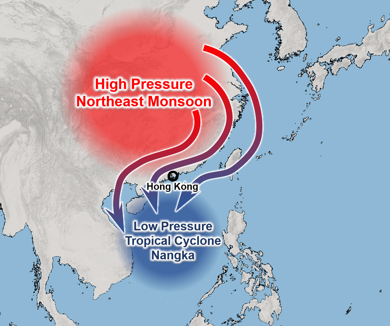
Fig. 1: The combined effect of a tropical cyclone and the northeast monsoon resulted in high winds along the South China coast
The computer model also showed that high winds would occur from time to time near Hong Kong on 13 October (Fig. 2).
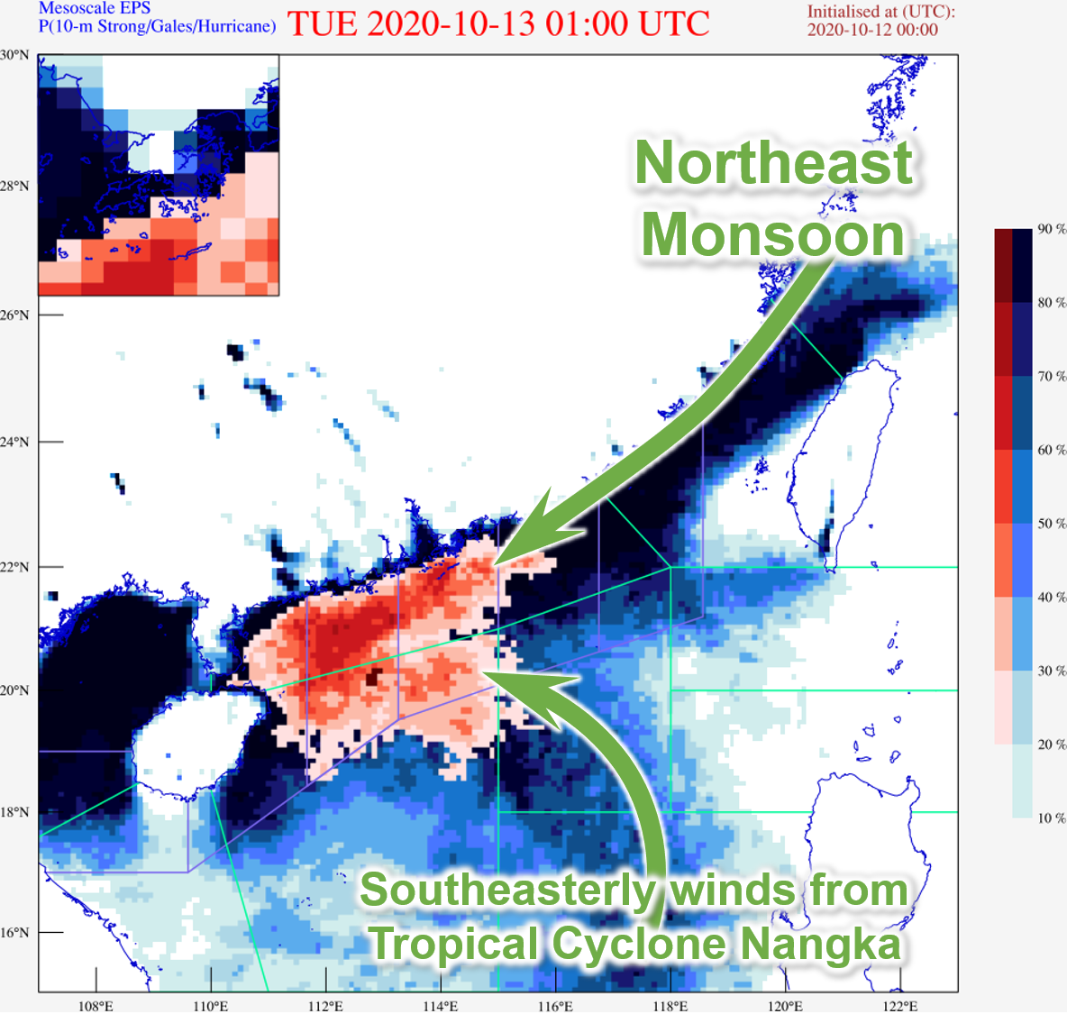
Fig. 2: On 12 October, the computer model predicted that the southern part of Hong Kong could be affected by high winds on 13 October 2020 (orange-red area)
-
High ground and offshore affected by high winds
Gale winds had occasionally occurred in some high ground and offshore areas in Hong Kong before the issuance of Tropical Cyclone Signal No. 8. After the signal was issued, winds were even stronger over the southern part of Hong Kong, with occasional gales at Green Island, and storm-force winds recorded at Wong Mau Chou.
-
High winds and heavy rain were predicted
As the northeasterly winds of the monsoon and the southeasterly wind of Nangka converged near the South China coast, rainfall was expected (Fig. 2). Computer models predicted likewise (Fig. 3), including heavier rain. However, as the drier northeast monsoon prevailed, the strong rain belt over the northern part of the South China Sea weakened as it approached the coast, and the actual rainfall was much weaker than predicted by the computer models.
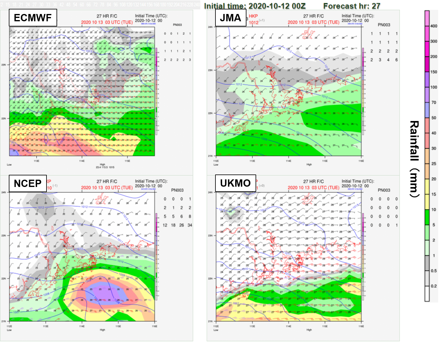
Fig. 3: On 12 October, major computer models predicted there would be high winds and heavy rain in Hong Kong or nearby coastal areas on 13 October 2020
Typically, even if a tropical cyclone is quite far away from Hong Kong, with the "assistance" of the monsoon in the autumn, the wind force in Hong Kong and nearby region can never be ignored.