Skip Content
Report on Super Typhoon Man-yi (2424)
Report on Super Typhoon Man-yi (2424)
Figures
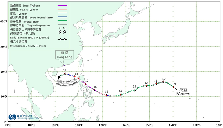
Figure 1: Provisional track of Man-yi (2424): 9 – 19 November 2024
Figure 2: Traces of sea level and sea level rise recorded at Quarry Bay, Tai O and Tai Po Kau on 18 - 19 November 2024
Figure 3: Visible satellite imagery at around 8 a.m. on 16 November 2024
Figure 4: Radar echoes captured at 8:00 a.m. on 19 November 2024
Figure 5: Minor flooding over the cycle tracks near Shing Mun River on the night of 18 November 2024
Figure 6: Minor flooding in Tai O on the night of 18 November 2024
Tables
Table 1: Maximum gust peak speeds and maximum hourly mean winds with associated wind directions recorded at various stations when the tropical cyclone warning signals for Man-yi were in force
Table 2: Daily rainfall amounts recorded at the Hong Kong Observatory Headquarters and other stations during the passage of Man-yi
Table 3: Times and heights of the maximum sea level and the maximum sea level rise recorded at tide stations in Hong Kong during the passage of Man-yi