|
|
|
|
|
| |
| Case 1: Air mass reaching Hong Kong from the north |
| |
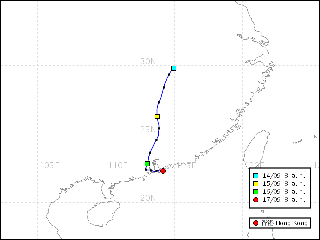 Backward trajectory of air mass reaching Hong Kong ending at 8 a.m. 17 Sep 2008
 |
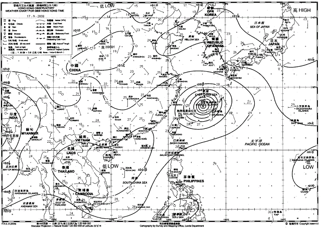 Weather chart at 8 a.m. on 17 Sep 2008
 |
|
| |
|
Under the combined effect of a weak northeast monsoon and Tropical Storm Sinlaku, a dry continental airstream affected southern China. The backward trajectory map showed that the air mass reaching Hong Kong originated from the north. The continental air mass brought relatively dry and hazy conditions with sunny periods to the territory on 17 Sep 2008. Visibilities at the Hong Kong Observatory lingered between 4000 and 8000 metres.
|
|
| |
| Case 2: Air mass reaching Hong Kong from the northeast |
| |
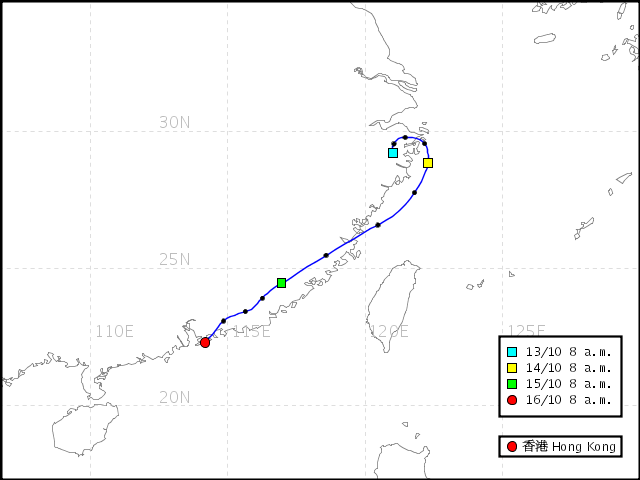 Backward trajectory of air mass reaching Hong Kong ending at 8 a.m. 16 Oct 2008
 |
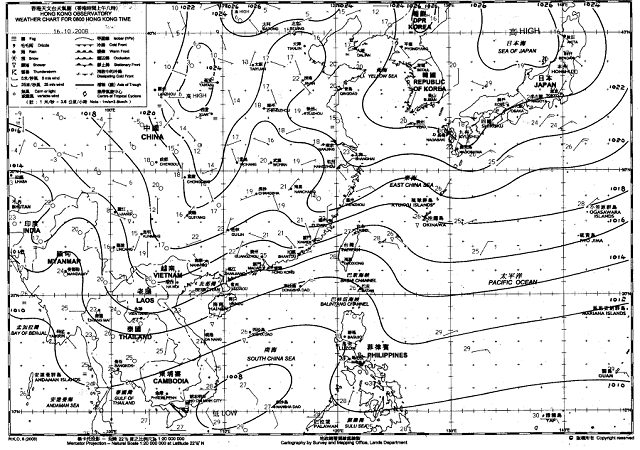 Weather chart at 8 a.m. on 16 Oct 2008
 |
|
| |
| A northeast monsoon affected southern China. The backward trajectory map showed that the air mass reaching Hong Kong originated from the northeast. Winds were of a continental origin and picked up during the day. The weather turned cloudy with the strengthening winds and visibility dropped from over 10 km in the small hours of the morning to between 5000 and 7000 metres during the day. |
|
| |
| Case 3: Air mass reaching Hong Kong from the south |
| |
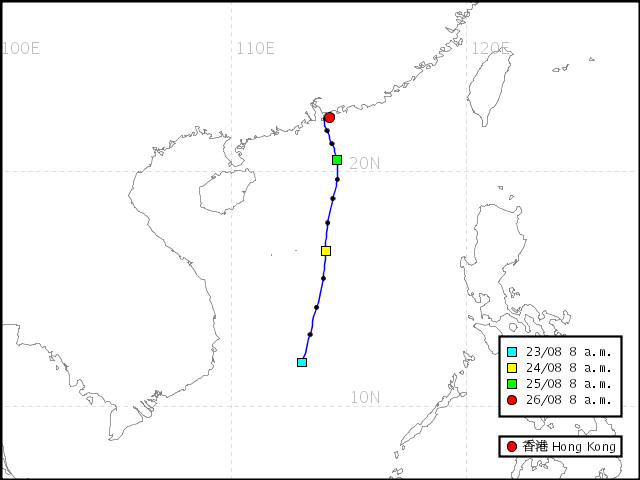 Backward trajectory of air mass reaching Hong Kong ending at 8 a.m. 26 Aug 2008
 |
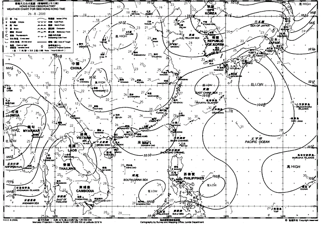 Weather chart at 8:00am on 26 Aug 2008
 |
|
| |
|
On 26 Aug 2008, a weak area of high pressure prevailed over Hong Kong and the adjacent sea areas. The backward trajectory map showed that the air mass reaching Hong Kong originated from the South China Sea. Locally, it was hot with light to moderate southwesterly winds. Visibilities at the Hong Kong Observatory ranged between 12 and 27 kilometres.
|
|
| |
| Case 4: Air mass moving slowly near Hong Kong |
| |
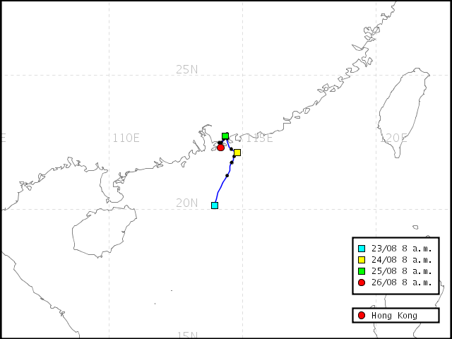 Backward trajectory of air mass reaching Hong Kong ending at 8 a.m. 26 Aug 2007
 |
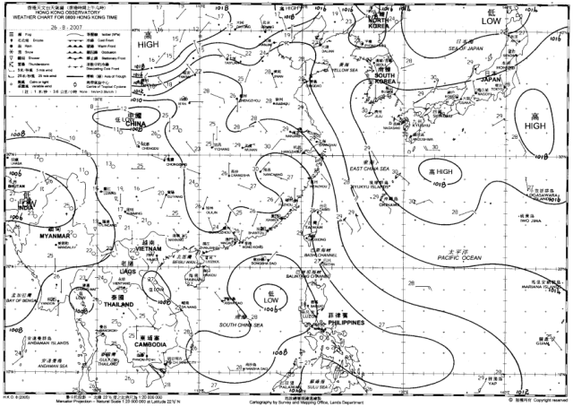 Weather chart at 8:00am on 26 August 2007
 |
|
| |
|
On 26 August 2007, the weather chart showed that pressure gradient was relatively slack over the coastal area of Guangdong and winds over the region were light. From the backward trajectory map, we can see that the air mass was moving slowly near Hong Kong during the period from 24 to 26 August 2007. In Hong Kong, under the influence of light northerly winds, visibilities at the Hong Kong Observatory dropped to about 5000 metres on the morning of 26 August 2007.
|
| |
|
| |
| Case 5: Routes of air mass arriving Hong Kong in winter
|
| |
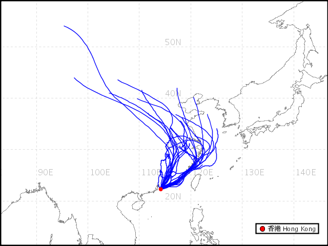 Backward trajectory of air mass reaching Hong Kong in January 2009
 |
|
| |
|
Under the influence of winter monsoon, the air masses affecting Hong Kong during winter are mainly originated from the north or northeast. From the backward trajectory map in January 2009 which shows typical paths of air masses affecting Hong Kong in winter, it can be seen that air masses reaching Hong Kong can even come from Siberia, bringing us dry and cold weather to Hong Kong.
|
| |
|
| |
| Case 6: Routes of air mass arriving Hong Kong in summer
|
| |
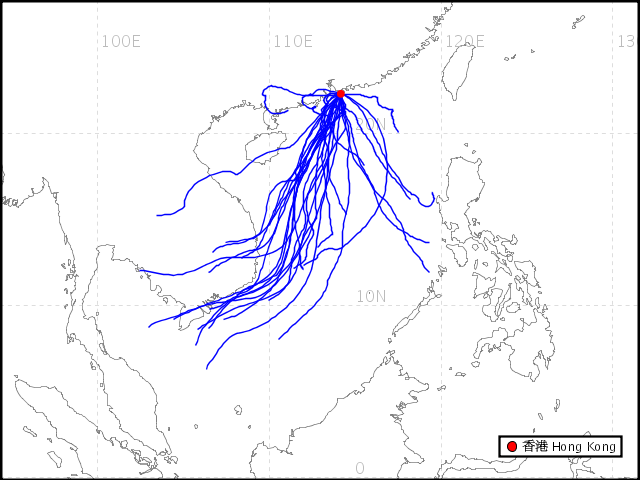 Backward trajectory of air mass reaching Hong Kong in July 2008
 |
|
| |
|
Under the influence of southwest monsoon, the air masses affecting Hong Kong during summer are mainly originated from the south or southwest. The backward trajectory map in July 2008 shows typical paths of air masses affecting Hong Kong in summer, indicating that air masses are originated from hot and humid Indochina and South China Sea, bringing us wet and hot weather in summer.
|
| |
|
|