Thunderstorm Warning
 The Thunderstorm Warning
Thunderstorm warnings issued by the Hong Kong Observatory are intended to give short-term (within one to a few hours) notice of the likelihood of thunderstorms affecting any part of Hong Kong. Once issued, the warning is broadcast over radio and television, and announced on the Observatory's website, the “MyObservatory” mobile app and the Dial-a-Weather system (1878200).
Thunderstorm warnings are issued irrespective of whether thunderstorms are widespread or isolated. For isolated thunderstorms, the warning issued by the Observatory will indicate the regions that will be affected during the warning period to alert members of the public to take appropriate precautions. If thunderstorms are expected to persist or affect other parts of the territory, the warning will be extended. When thunderstorms are widespread or the areas being affected vary, it will be mentioned in the thunderstorm warning that Hong Kong will be affected by thunderstorms without specific reference to individual regions.
When inclement weather comes with thunderstorms, the Observatory will mention “severe squally thunderstorms” and the associated high-impact weather information in the Thunderstorm Warning with regard to the circumstances, including:
• Violent gusts
• Hail
• Waterspout
• Tornado
The development, movement and dissipation of thunderstorms can be quite rapid and fairly localized. Thunderstorm warnings supplement the forecast of thunderstorms in routine weather forecasts by drawing people's attention to thunderstorms that are about to or have already taken place, or to warn people of thunderstorms not previously expected. The warning is intended to assist engineers, contractors or other people who are likely to be affected by thunderstorms. It also alerts relevant government departments and organizations to take appropriate actions.
While a thunderstorm warning is in force, managers of outdoor sports facilities, playgrounds or lifeguards at swimming pools should be vigilant about changes of the state of sky and give appropriate instructions to users of the facilities.
Lightning Location Information
In 2005, the Hong Kong Observatory set up a lightning location network in cooperation with the Guangdong Meteorological Bureau and the Macao Meteorological and Geophysical Bureau. The network monitors lightning activities over the Pearl River Estuary round the clock. After lightning has been detected by the network, the locations where lightning occurs are recorded and shown graphically on the Observatory's webpage and “MyObservatory”. A digest of the information is also made available to radio and television stations, and given in the Observatory's Dial-a-Weather system. When the Thunderstorm Warning is in force, the lightning location information enables the public to identify areas affected by the thunderstorms.
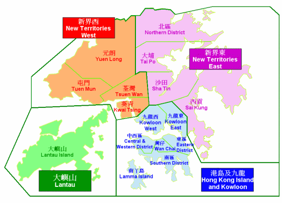
When situation warrants, the Observatory will mention the region(s) affected in the Thunderstorm Warning: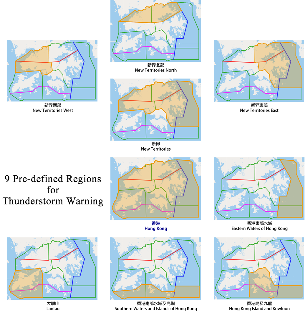
![]()
If regional information is included in the Thunderstorm Warning, a dot will appear on the warning icon. When the icon is clicked, the regions affected by the Thunderstorm Warning will be shown.
Members of the public can click directly on the map in the “Location-specific Lightning Alert Webpage” to select the location of interest and the alert range according to user needs. The “Regional Information on Heavy Rain and Thunderstorm” webpage of the Observatory also displays dynamical information about Thunderstorm Warning and lightning locations.
Besides, the Observatory also provides one-hour lightning nowcast service. Members of the public can appreciate lightning information in advance by browsing the “Automatic Regional Weather Forecast in Hong Kong & Pearl River Delta Region” webpage or using the “Location-based Rain & Lightning Forecast” function on “MyObservatory”.
As errors in the lightning locations, missed detections and false alarms of lightning are unavoidable, one should always refer to the Thunderstorm Warning issued by the Observatory as well as radar imageries and rainfall distribution available on the Observatory's website when using the lightning location information.
1. Seek safe shelter immediate or as soon as possible if you are staying outdoors.
2. Leave the water. Do not swim outdoors or engage in other outdoor water sports.
3. Do not stand on high grounds. Keep away from highly conductive objects, trees or masts.
4. Take precautions against intense or violent gusts. Beware of flying debris and falling objects.
5. Drivers using highways and flyovers should reduce speed and be alert to intense or violent gusts.
6. If you witness a tornado or waterspout:
- Do not attempt to approach it. Stay calm. Quickly move away and seek a safe shelter such as a sturdy building.
- If the tornado or waterspout is too close to avoid, quickly lie down in low-lying areas and stay away from advertising signs, lamp posts, and large trees as far as possible.
- If you are indoors, stay away from windows, crouch down on the ground, and protect your head with your hands or a thick cushion.
- If you are outdoors, stay away from trees, cars, and other objects that could be picked up by the tornado.
7. People on small boats on the open sea should watch out for the approach of squalls or waterspouts.
8. Evacuate from heavy rain affected low-lying areas with poor drainage to avoid flooding.
Infographic: Thunderstorm | Tornado and Waterspout | Hail
What are "Thunderstorms"?
Can outdoor activities continue under thunderstorm warning?
Observe the Observatory to Prevent Lightning Strokes
Beware of Gusts
Waterspout over the Victoria Harbour (Chinese only)