Weather On Wings Issue No. 19

|
||
| Newsletter for the Aviation Community |
 |
No. 19 - June 2003 |
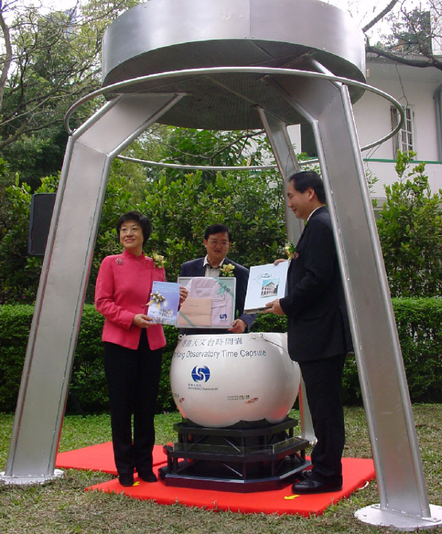
Observatory's 120th anniversary |
 |
The Secretary for Economic Development and Labour, the Honourable Stephen Ip, the Permanent Secretary for Economic Development and Labour, Ms. Sandra Lee and the Director of the Observatory, Dr. H.K. Lam, officiated at the time capsule laying ceremony on 2 March 2003 to mark the Observatory's 120th Anniversary.
|
||
|
Among the articles inside the time capsule, two items represent important milestones for aviation weather service in Hong Kong. One is the image of the first microburst detected by the Terminal Doppler Weather Radar (TDWR) in 1996 and the other is the first image of wind variation around the Hong Kong International Airport (HKIA) captured by the LIght Detection And Ranging (LIDAR) system in 2002.
The development of aviation weather service in Hong Kong dated to the 1930s when a forecaster worked part-time at Kai Tak providing aviation forecasts. The Airport Meteorological Office (AMO) at Kai Tak came into existence in 1939. After an interruption due to the Second World War, the HKO resumed its aviation weather service in August 1947. The post-war rapid growth in air traffic resulted in the recruitment of a team of aviation forecasters to man the AMO in 1957. Since then the AMO witnessed continuous development with steady growth in the air traffic, culminating in a world-class office with the latest facilities with the operation of HKIA at Clek Lap Kok in July 1998.
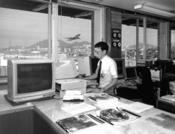
| Figure 4: | K.K. Lam, former aviation weather forecaster, pictured here preparing a weather forecast in the Kai Tak days |
International accolades
Ms. Sharon Lau, officer-in-charge of the Observatory's Airport Meteorological Office (AMO), was recently invited to serve on the Management Group of the Commission on Aeronautical Meteorology, one of the eight technical commissions under the World Meteorological Organization (WMO). She would also take up co-chairpersonship of the TREND (Training, the Environment and New Developments) working group, one of the two open working groups under the Commission.
This is the first time a Hong Kong woman meteorologist taking up an important position in an esteemed international organization. ” I am grateful for the recognition by the international community, and for the support colleagues at the Observatory have given me over the years. The position at the Commission is a great opportunity for me to work with renowned experts in the field of aeronautical meteorology." said Sharon.
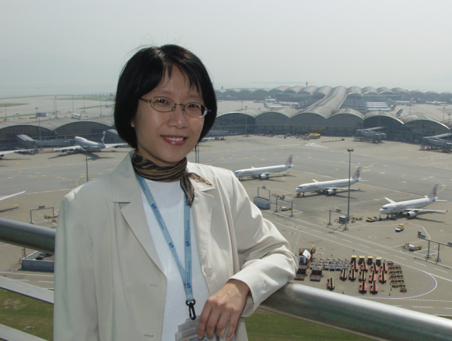
Figure 5: Sharon Lau looking forward to her international role in aviation meteorology
Sharon's connection with aviation dated back to 1992 when she was tasked with the planning of weather facilities for the new international airport at Chek Lap Kok. In the few years before and after the airport opening in 1998, her focus was on the development of the Observatory's windshear and turbulence alerting service and its improvement. Since taking charge of AMO in 2002, she successfully led the ISO 9001 certification process, making the Observatory one of the first weather services to be awarded such a certification in recognition of its quality service for international aviation.
In her spare time, Sharon loses no time in better equipping herself. To know more about flying, she has taken a course on fix-wing aircraft. This is also helpful to her job.
Sharon recently represented the Observatory in the WMO Conference on Women in Meteorology and Hydrology held in Geneva, March 2003. During the conference she shared experience with reputable women meteorologists from many parts of the world. Her report on the work of woman meteorologists at the Hong Kong Observatory was well received.

| Figure 6: | Sharon Lau (2nd from the left) pictured here with participants of the WMO Conference on Women in Meteorology and Hydrology |
New products and service development
______________________________________________________
The Observatory writing in the ICAO Journal
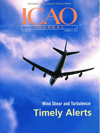
The renowned ICAO Journal has recently published an article ”Ongoing research in Hong Kong has led to improved wind shear and turbulence alerts" contributed by the Observatory. The article gives an overview of the wind shear and turbulence alerting service for the Hong Kong International Airport and the improvements that the Observatory has made in recent years. Appearing as the first article in the March 2003 issue, it can be viewed on the ICAO website at http://www.icao.int/ or on the Observatory website at http://www.weather.gov.hk/aviat/articles/ShunNo2A3_Final.pdf
Instant weather report from aircraft
A new chapter in the history of aviation weather in Hong Kong began as a Cathay Pacific B-747 departed from Hong Kong on 26 March 2003. As opposed to the usual practice of pilot reporting the weather to the air traffic controller, this time the equipment on-board the aircraft did the job for him. Altogether the aircraft made ten weather reports and transmitted them, all automatically, back to Hong Kong.
The above trial is a boost to the Hong Kong AMDAR (Aircraft Meteorological DAta Relay) Programme started two years ago by the Hong Kong Observatory. Hitherto, automatic aircraft weather reports near Hong Kong have been made by Australian and U.S. airliners as part of the worldwide AMDAR activity under the World Meteorological Organization (WMO).
Apart from saving the pilot's effort, the automatic nature of AMDAR reports allows more weather reports to be made. This has two advantages. The availability of AMDAR reports in near real-time facilitates monitoring of the weather, in particular windshear and turbulence in and around the airport. More importantly, they provide the much needed weather information over the data-sparse South China Sea and have been shown to improve the performance of numerical weather prediction. Both of these advantages have a positive impact on aviation safety and efficiency.
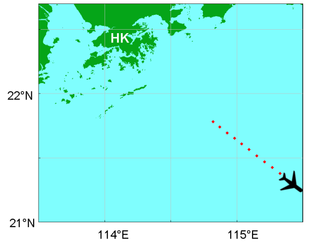
| Figure 7: | A B747 aircraft made automatic weather reports on its way to Manila on 26 March 2003. The red dots indicate the locations at which winds and temperatures were taken. |
Booklet for pilots now available in Chinese
In view of favourable response, the booklet on 'Windshear and Turbulence in Hong Kong', prepared by the Observatory in collaboration with the International Federation of Air Line Pilots' Associations (IFALPA), has also been prepared in Chinese. It is available for viewing at:
http://www.weather.gov.hk/aviat/articles/WS-turb-booklet-Chinese-web-ver.PDF
- Chinese version
http://www.weather.gov.hk/aviat/articles/WS-turb-booklet-web-ver.PDF
- English version
New windshear wording put on trial
Since airport opening in 1998, the methodology of alerting windshear at the Hong Kong International Airport has been based on the so-called ” first encounter, maximum intensity" principle, which was adopted for use after consultation with the local aviation community. The idea is that the microburst or windshear alerts passed by the air traffic controllers to the pilots should include the location (i.e. runway or 1, 2 or 3 nautical miles (NM) from runway threshold) of the first encounter of the microburst or windshear event (i.e. first encounter) and the maximum value of the computed wind speed difference (i.e. maximum intensity). This simplifies the alerting of windshear when more than one occurrence of microburst or windshear is detected over the same approach or departure corridor.
Despite the simplicity of alerts, some pilots have expressed concerns over possible confusion this may cause. As an example, under the windshear conditions depicted in the figure below where there is a windshear event of +15kt at 3 mile final and a microburst event of -30kt at 1 mile final, the consolidated windshear alert based on the ”first encounter, maximum intensity" principle will be:
”Caution. Microburst minus 30 knots 3 mile final".
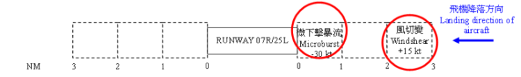 |
Pilots not familiar with this alerting principle may be caught by surprise when on approaching the airport they first experience a gain event (windshear of +15 kt) instead of a loss event (microburst of -30 kt) at the” first encounter (3 mile final)" location only to encounter a loss of -30 kt a couple of seconds later at 1 mile final. This issue was raised by the Civil Aviation Department and subsequently discussed by the International Federation of Air Line Pilots' Associations (IFALPA) in late 2002. The pilots generally felt that an indication of the maximum intensity and an indication of location in terms of approach or departure corridor (without further details on which section of the corridor) would suffice for their preparation for landing or take-off. A new phraseology has thus been drawn up, and under the new arrangement the alert in the above example will become:
”Caution. Microburst minus 30 knots on final approach".
A trial has started on 1 April 2003 and will last for 6 months. Users are encouraged to provide feedback to the Hong Kong Observatory (telephone: 2926 8434, fax: 2375 2645, email: stchan@hko.gov.hk).
Kind words from the aviation community
The number of products on the Observatory's on-line aviation weather information service, the AMIDS (Aviation Meteorological Information Dissemination System), now tops 200. The products range from runway winds, satellite cloud images to en-route and destination weather information. A newcomer is the computerized medium-level significant weather charts in colour.
Here is a snapshot of feedback from aviation users:
Figure 8: The new medium-level significant weather chart in colour
An 18-year Observatory-EMSD collaboration
The Hong Kong Observatory (HKO) and the Electrical and Mechanical Services Department (EMSD) jointly put a new electronics device into operation at the automatic weather station at Ngong Ping in May 2003. The work represents the effort of Ms. Cindy Man, an engineering graduate from EMSD and working at HKO. Since 1985, the Observatory has been collaborating with EMSD in providing attachment opportunities for engineering graduates.
Located at an exposed and remote hilltop of Lantau Island to the south of the Hong Kong International Airport, the station at Ngong Ping relies solely on wind power to operate its equipment. With the electricity generated, the station automatically measures the wind and temperature there and sends the data back to HKO by wireless transmission. ” Cindy has made a device which lets us know instantly whether the wind is producing enough electrical energy for the station", said Dr. C.M. Tam, Senior Scientific Officer of the HKO.
Cindy was pleased that her work could serve a scientific purpose. She said: ” It is one thing learning from books and quite another putting what you have learnt into practice. Colleagues at the Observatory helped me a lot in overcoming difficulties in the circuit design. Journeys to inspect the station at Ngong Ping and to figure out how to install the device there were exhausting because there was no road transport and we had to carry the equipment on foot. However, I find the experience very rewarding, especially now that my work can be used to explore the potential of such renewable energy as wind power in Hong Kong."
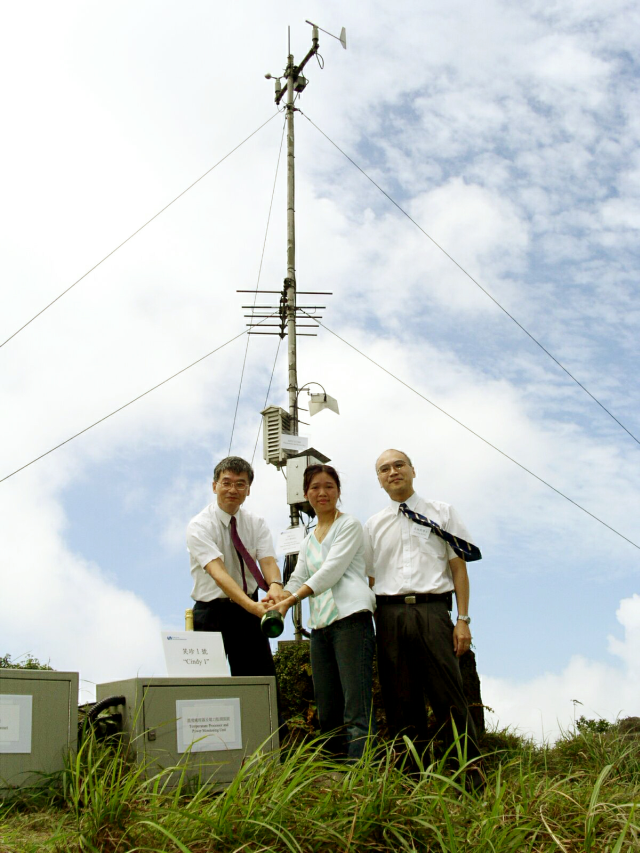
| Figure 9: | Cindy Man of EMSD (middle) celebrating the operation of her new device with EMSD's Dr. Arthur Wong (right) and HKO's Dr. C.M. Tam (left) at Ngong Ping. |
Weather observations at the airport
___________________________________________________
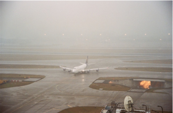
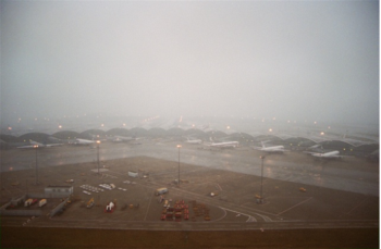
Misty rain
The passage of a cold front on 6 March 2003 brought rain and low visibility to the airport. The visibility dropped to below 1000 metres at one point.
 |
 |
|
(Photo: Courtesy of Mr. C.S.Yuen)
|
|
Halo over Chek Lap Kok
The picture shows a special optical phenomenon called halo, seen over Chek Lap Kok on 17 April 2003. Halos result from the refraction or reflection of light by ice crystals suspended in the atmosphere.
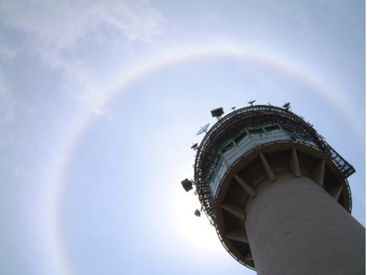
| Figure 10: | Halo in the form of ring over Chek Lap Kok on 17 April 2003 (Photo: Courtesy of Mr. C.S.Yuen) |
Quiz on aviation weather | ||||
| 1. |
Which of the following is always true for the atmosphere? a. The humidity decreases with height b. The temperature decreases with height c. The wind speed decreases with height d. The pressure decreases with height |
4. |
The process by which water vapour turns into water droplets to form clouds is called … a. transpiration b. sublimation c. condensation d. evaporation | |
| 2. |
Which of the following is highest in the sky?
a. stratus b. cirrus c. cumulus d. altocumulus |
5. |
What is usually associated with low pressure?
a. sunshine b. cumulus clouds c. windy weather d. rain | |
| 3. |
An area of low pressure with a circulation centre is called …
a. an anticyclone b. a cyclone c. a trough of low pressure d. a ridge of high pressure |
6. |
Which of the following on the Beaufort scale of wind force is equivalent to strong winds?
a. 4 b. 6 c. 8 d. 10 | |
Severe weather
_____________________________________
Windshear as high as 30 knots in sea breeze!
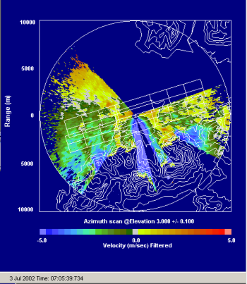
Sea breeze develops under fine and light wind conditions. At the Hong Kong International Airport, sea breeze usually sets in from the west. With the background wind from the east, the sea breeze converges with the background wind to produce windshear, i.e. a gain in the headwind to an aircraft (Figure 11). Yet sea breeze can also develop under stronger wind conditions. A case in point occurred on 20 April 2003, when against a background easterly wind of 15 knots (Figure 12) a 10-knot sea breeze developed west of the airport near midday. This produced a windshear of 25 knots on the airfield. Indeed, an aircraft reported a headwind gain of 25 to 30 knots while making a landing from the west around the time.
On the Observatory's LIDAR (LIght Detection And Ranging) system (Figure 13), a sea-breeze 'front' was clearly discernible over an area on the western part of the airport where outgoing winds (the background wind, warm colours) and incoming winds (sea breeze, cold colours) met. This new piece of equipment had enabled the Observatory to issue in advance a windshear alert for that occasion.
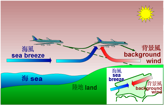
Figure 11: Windshear arising from sea breeze
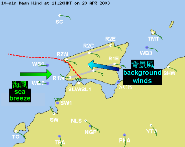
Figure 12: Winds around HKIA at 11:20 a.m., 20 April 2003
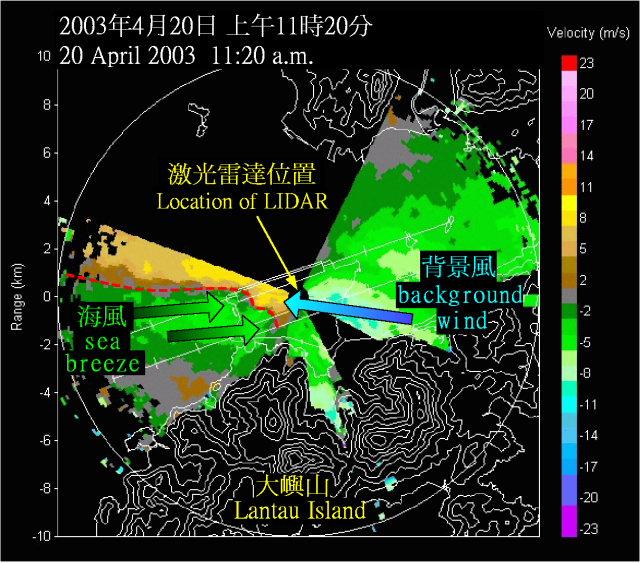
Figure 13: LIDAR picture at 11:20 a.m., 20 April 2003. The red dotted line indicates the sea breeze front.
Improved sea breeze monitoring with the third weather buoy
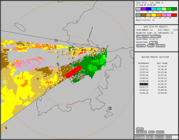
The Observatory is happy to announce the deployment of a new weather buoy since early 2003. This is the third buoy that the Observatory launched in the past two years to enhance weather monitoring at the airport.
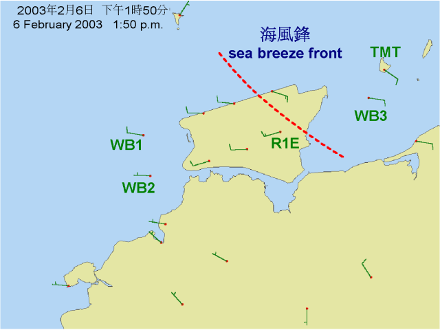
| Figure 14: | Winds around 1:50 p.m., 6 February 2003. (WB1: weather buoy 1, WB2: weather buoy 2 and WB3: weather buoy 3) |
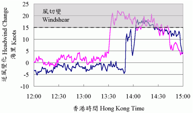
| Figure 15: | Headwind changes across the sea breeze front, as calculated based on the winds at the new weather buoy (pink line) and at Tai Mo To (deep blue line). |
Sea breeze causing headwind loss-are you joking?
While sea breeze usually causes a headwind gain to an aircraft, some aircraft did experience a headwind loss. Why was that?
To answer the question, let's look at the formation and structure of sea breeze. As the land surface warms up in a sunny day with light winds, the air rises and allows the cooler air over the sea to come in, thus setting up a sea breeze.
Figure 16 shows a vertical scan of the atmosphere taken by the LIDAR (LIght Detection And Ranging) on a fine, sunny day in April 2003. It shows sea breezes (green) against a background of easterly winds (yellow and brown). Interestingly, it reveals an undulating top for the sea breeze.
Figure 17 is a schematic diagram showing the sea breeze structure. Under normal circumstances, an aircraft that comes in with the sea breeze will experience a headwind gain when crossing the leading edge of the sea breeze. However, if within the sea breeze the tailwind is increasing (from point A to point B) instead of decreasing then it translates into a headwind loss for the aircraft.
Another situation that will lead to a headwind loss arises when the aircraft flies into the sea breeze, as shown in Figure 18. In this instance, the aircraft flying from point a to point b will experience a change from headwind to tailwind, resulting in a headwind loss. Indeed, an aircraft landing at the airport near midday that day reported encounter of a headwind loss followed by a headwind gain. This would be consistent with a flight path in which the aircraft flew from point a to b (loss) and then from b to c (gain).
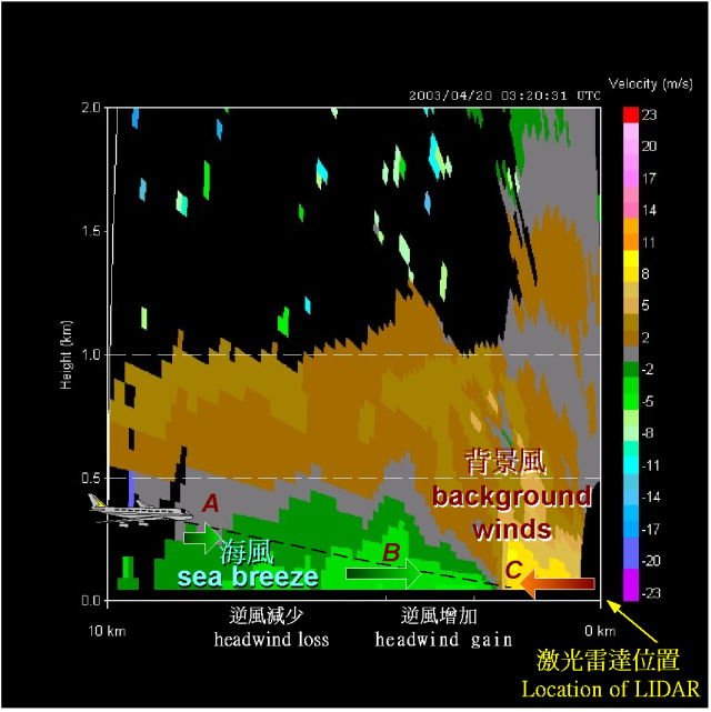
Figure 16: Vertical scan of LIDAR picture at 11:20 a.m. on 20 April 2003
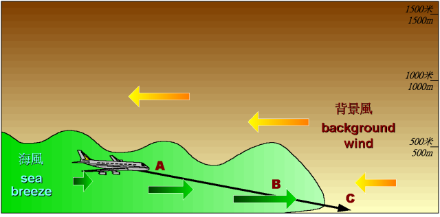
Figure 17: An aircraft traversing sea breezes
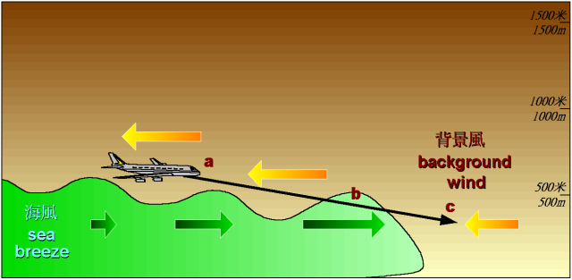
Figure 18: An aircraft moving on a track close to the upper boundary of sea breezes
Outreach
_____________________________________
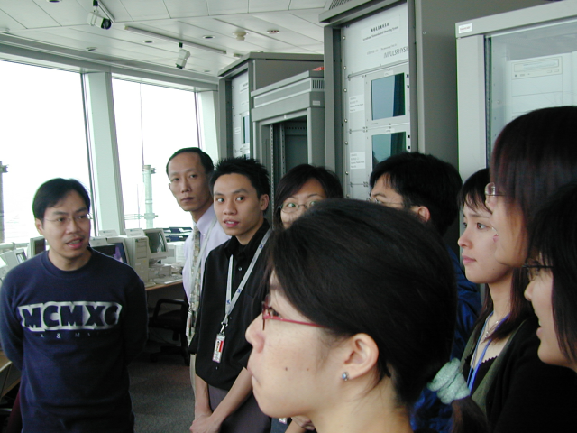
Briefings on windshear and turbulence
The Observatory delivered two briefings on windshear and turbulence alerting service on 12 March 2003, one to airline representatives and pilots and one to air traffic control (ATC) personnel. This year's briefings highlighted the usefulness of new weather sensors - LIDAR and weather buoys - in windshear detection, as well as the improved performance of the windshear and turbulence alerting service over the past years. With over 50 participants, both briefings were concluded with lively questions and answers. The presentation in electronic form is available on request.
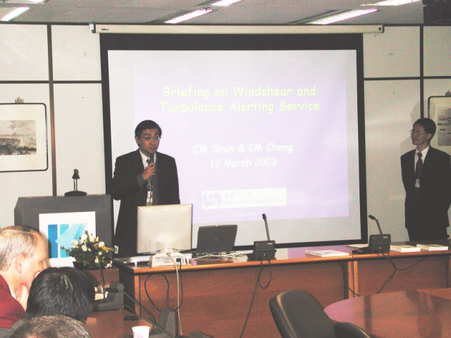
| Figure 19: | The Observatory's Mr. C.M. Shun (left) and Dr. C.M. Cheng (right) providing the briefing for airline representatives and pilots |
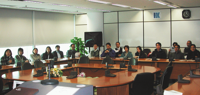
Figure 20: ATC personnel in active Q&As after the briefing
Observatory open day
March 2003 is celebration time for the Observatory. Following the 120-year Anniversary and Time Capsule Laying Ceremony on 2 March, pleasant weather continued to greet visitors to the Observatory Open Day during the weekend of 22-23 March. Despite concerns over SARS, over 4000 members of the public showed up.
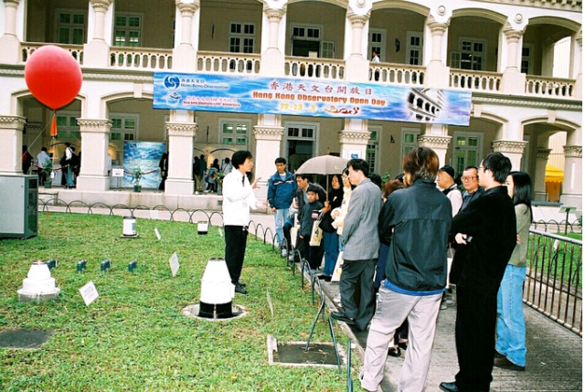
Figure 21: Curiosity satisfied-Observatory staff explaining to visitors how the various rain gauges work
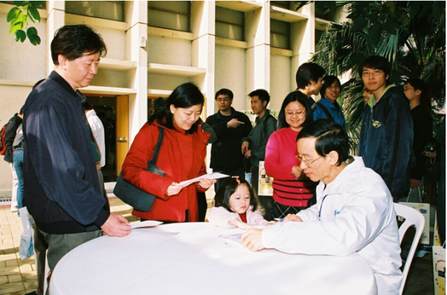
| Figure 22: | A family affair - A little girl alongside her parents seeking an autograph from the Director, Mr. C.Y. Lam |
Airport Meteorological Office
__________________________________________________________
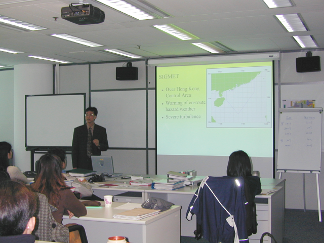
Meteorological briefing for ATC personnel
At the request of the Civil Aviation Department, the Observatory's L.O. Li gave a briefing to a group of ATC personnel on 25 March 2003. As part of a training course for ATC personnel, the briefing covered such topics as the climatology and significant weather within the Hong Kong airspace.
Eye in the sky
The Japan GMS-5 geostationary meteorological satellite has been serving this part of the world since the early 1990. Starting from 22 May 2003, it is backed up by GOES-9. Located above the equator at longitude 155°E, GOES-9 is operated by the joint effort of JMA and US NOAA NESDIS. The replacement of GMS-5, the MTSAT, is scheduled to launch in early 2004.
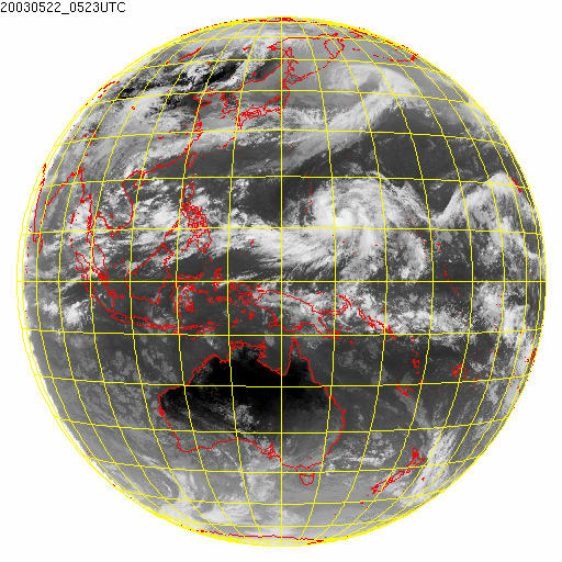
Figure 23: GOES-9 satellite image at 2 p.m., 22 May 2003
Note: JMA = Japan Meteorological Agency ; NOAA = National Oceanic and Atmospheric Administration ; NESDIS = National Environmental Satellite Data and Information Service
_____________________________
Air transport symposium
The Observatory participated in the 4th International Symposium on Electronics in the Air Transport Industry (SEATI) in Hong Kong on 8 January 2003, with a presentation of a paper 'Recent Developments to Enhance Windshear and Turbulence Alerting at the Hong Kong International Airport' by C.M. Shun, C.M. Cheng and H.G. Wai. The symposium offered a good opportunity for the Observatory to interact with the air transport industry.
| Figure 24: | The Observatory's C.M. Shun explaining the capability of the LIDAR in monitoring the weather under clear air conditions |
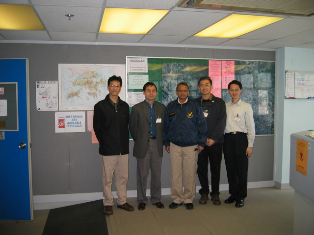
Collaboration with NOAA
Three scientists from the Environmental Technology Laboratory (ETL) of the U.S. National Oceanic and Atmospheric Administration (NOAA) visited the Observatory from 17 February to 1 March 2003. The purpose was to exchange knowledge and experience in the application of LIght Detection And Ranging (LIDAR) system to weather monitoring. The scientists shared with the Observatory their experience in using LIDAR for studying weather phenomena near mountainous terrain in the U.S. and Europe, while the Observatory presented LIDAR images of weather patterns never observed before in Hong Kong. There were useful discussions on optimizing and evaluating LIDAR performance, and potential areas for joint studies were identified.
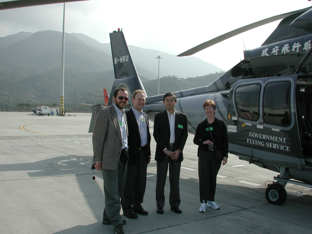
| Figure 25: | NOAA scientists, Dr. Robert Banta (2nd from left), Dr. Alan Brewer (1st from left) and Ms. Lisa Darby (1st from right), pictured here with the Observatory's C.M. Shun before a helicopter flight around the airport |
Visit by aerodrome control assistants
| Figure 26: | A group of aerodrome control assistants from the Civil Aviation Department visited the Airport Meteorological Office on 15 April 2003. Mr. W.C. Ho, Acting Senior Scientific Assistant, is seen here enlightening the CAD colleagues with facets of his weather observing work. |
Visit to Korea
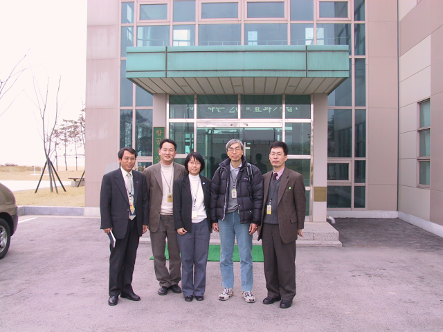
In mid-February 2003, the Observatory's Ms. Sharon Lau and Mr. Y.T. Wong visited the Korea Meteorological Administration (KMA) and its Airport Meteorological Office (AMO) at Inchon. The visit enabled a better understanding of the operation of the AMO and maintenance of meteorological facilities in support of the aviation weather services there.
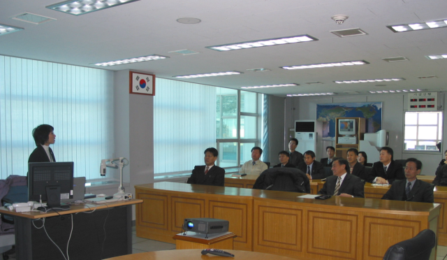
| Figure 27: | Ms. Sharon Lau explaining the work of the Observatory to colleagues of Korea Meteorological Administration |
| Figure 28: | Ms. S.Y. Lau (middle) and Mr. Y.T. Wong (2nd from the right) pictured here in front of the Airport Meteorological Office at Inchon with Mr. J.H. Park (1st from the left), Mr. D.Y. Shin (2nd from the left) and Mr. J.S. Park (1st from the right). |
Visit to Hong Kong Aviation Club at Shek Kong, 22 March 2003
| Figure 29: | HKO colleagues visited Captain S.K. Gupta (middle) of the Hong Kong Aviation Club to discuss the enhancement of weather service. |
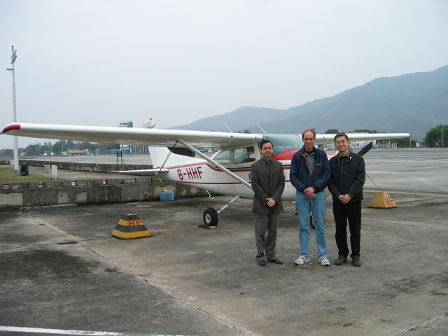
| Figure 30: | Dr. B.Y. Lee (left), Mr. C.M. Shun (right) pictured here with Mr. Nigel Evans, after a ride on the Cessna 182 |
Staff matters
______________________
Passing the baton
Mr. C.Y. Lam succeeded Dr. H.K. Lam as Director of the Observatory on 14 March 2003. Dr. Lam retired after 32 years of distinguished service at the Observatory. Mr. Lam, the new Director, has been in charge of the public weather services for over seven years and prior to that was responsible for the planning and development of meteorological facilities for the Chek Lap Kok airport.
”'Service based on Science' is the guiding philosophy of the Observatory", said Mr. Lam in a meeting with the press after taking up the Director post, ” the Observatory will proactively respond to the society's ever-changing needs, and will adopt the appropriate technologies and measures to meet these needs."
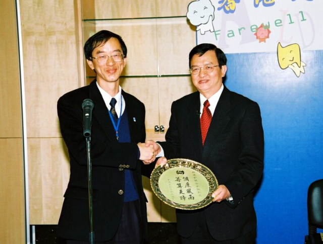
Figure 31: Mr. C.Y. Lam (left) presenting a souvenir to Dr. H.K. Lam (right)
Photogenic personalities
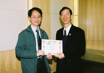
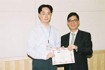
At the Observatory, C.M. Cheng works on high-impact weather, while S.T. Chan works on windshear and turbulence alerting. But do not expect to see them always immersed in scientific studies. As a matter of fact, they are winners of the best TV weather presenter for the past two quarters respectively. The panel of judges includes an expert from Radio Television Hong Kong. Our congratulations to both of them!
 |
 |
||||
|
|
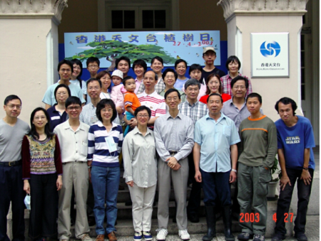
Tree planting day
 |
 |
|
Colleagues of the Observatory and their family pictured here on a tree planting day in April 2003, an annual event to make the Observatory headquarters greener and prettier. | |
| Telephone and Fax Numbers | |
| Enquiry on flight documents | (852) 2910 6922 |
| Officer-in-charge AMO | (852) 2910 6300 (852) 2922 5805 |
| Duty Forecaster AMO | (852) 2910 6920 (852) 2922 5806 |
| Fax | (852) 2910 0080 |
|
Dial-a-Weather |
(852) 187 8200 (Cantonese) (852) 187 8202 (Putonghua) (852) 187 8066 (English) |
|
Telephone Information Enquiry System |
(852) 2926 1133 |
http://www.weather.gov.hk
http://www.hko.gov.hk/
Web Page for Aviation Weather Services
http://www.weather.gov.hk/aviation
http://www.hko.gov.hk/aviation
Editor this issue C. W. Wu
Hong Kong Observatory:134A Nathan Road, Kowloon, Hong Kong
Email:
mailbox@hko.gov.hk