Weather On Wings
| Newsletter for the Aviation Community |
|
No. 17 - June 2002 |
New products and service development
______________________________________________
Putting heads together
P.W. Chan
For the first time, the Hong Kong Observatory deployed a weather buoy in Hong Kong. The buoy was
installed in late 2001 over the waters west of the Hong Kong International Airport (HKIA). The work received the full co-operation
of Marine Department colleagues who helped solve technical problems. Supported by solar power, the buoy transmits wind, pressure,
temperature and humidity data every 10 seconds, via radio.
The buoy helps fill in the information gap over the data-sparse area. Despite the short time period since commencement, it has demonstrated
its usefulness in providing advance windshear alerts to aircraft during sea breeze and frontal passages.
Mr. K.K. Lau of the Marine Department recalled the challenge they faced when designing the buoy, "Our buoys are mainly used for mounting
relatively small and light navigation signs. The Observatory's buoy posed a problem for us in that the weight of the equipment might make
the buoy very unstable."
The present design came about after careful design and trials with different conFig.urations. The Marine Department was very pleased that
"the implementation had been plain sailing."
Plan is in hand to deploy more buoys for weather monitoring in Hong Kong waters.
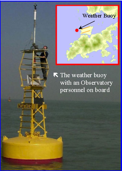
Fig. 1 The weather buoy and its location
Braving windshear
S.T. Chan
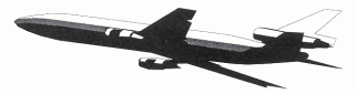
In collaboration with the Government Flying Service (GFS), investigation flights were conducted over the past two years to study the weather conditions conducive to windshear near the airport. On each flight, the GFS aircraft takes on two tracks. One is the "control" track which aimed at establishing the background airflow; the other is a "circling" track, the purpose being to study the weather pattern over Lantau and the airport.
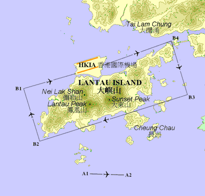
Fig. 2 Investigation Flight Tracks
Until recently, on-board weather data logging was done manually and the task of logging down the information was quite laborious. GFS engineers came up with innovative ideas to make data logging a much more efficient process in investigation flights scheduled this year. First, they instigated automatic retrieval of such information as aircraft position, wind direction and speed directly from the on-board Flight Management System (FMS). The next problem was trickier: how to synchronize FMS with another on-board system the Flight Deck Recorder (FDR or Black Box) which recorded essential air navigation data. And the engineers came up with the solution of using the smoke detector for time-marking. Incredible this may seem, they reasoned that when the pilot checked the smoke detector during the flight, the action of pressing the detector button was a simple yet elegant way to get the time-marking process started. Their suggestions were overwhelmingly accepted and results from the investigation flights in March and April this year greatly benefited from the introduction of such new practices.
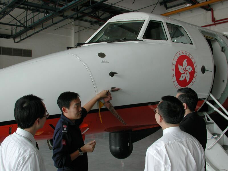
Fig. 3 Capt. Calvin Shum of GFS showing Observatory staff the aircraft for investigation flights
Two more pieces of Observatory software for WMO
H.G. Wai
| VHHH 0024 12012KT 9999 FEW015 SCT030 TEMPO 0309 27010KT TX30/06Z TN24/22Z= |
To most people, these cryptic words may mean no more than a riddle. But for pilots, they represent
the weather forecast for the Hong Kong International Airport in the coming 24 hours.
Like other aviation weather offices around the world, the Observatory provides airport weather reports and forecast at regular
intervals to support flight operations. These reports and forecast are issued in standard codes known as METAR
(aviation routine meteorological reports) and TAF (Terminal Aerodrome Forecast). The message above is an example of TAF.
To enhance their user friendliness, the Observatory has recently started to provide METAR and TAF in decoded forms on internet
(http://www.weather.gov.hk/aviat/amt_e/wxobsfc e.htm).
The response from users has been very positive.
We also received several requests for the decoding software
from meteorological services overseas. Noting the immense interest in the software, the Observatory contacted the
World Meteorological Organisation (WMO) and had the software (METAR decoding and TAF decoding) included in its registry of
meteorological software (http://www.wmo.ch/web/ddbs/cbssoftreg.html)
operated under the WMO's Commission for Basic Systems (CBS). Together with the two new pieces of software, Hong Kong, China now
has a total of eight entries in the international meteorological software registry.
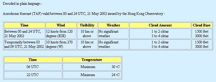
Fig.4 TAF(Terminal Aerodrome Forecast) in decoded forms
Charted waters and continents
L.O. Li
There are now more choices of wind and temperature charts on the web-based Aviation Meteorological Information Dissemination System (AMIDS) for aviation users. The figure 5 presents the available choices.
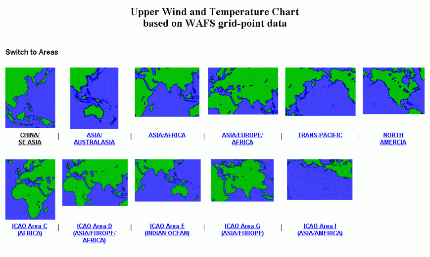
Fig.5
Weather observations at the airport
___________________________________________
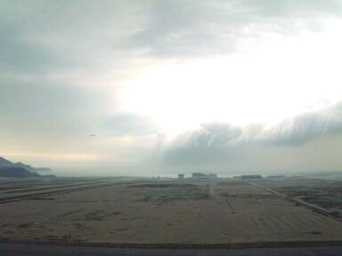
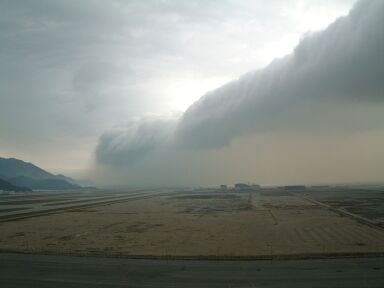
Passage of a cold front
C.S. Yuen
In the afternoon of 5 March 2002, a cold front swept through Hong Kong, turning the clear sky cloudy. As the cold front passed the airport, winds strengthened from the northwest. Aerodrome Warning and the Strong Monsoon Signal were issued. The temperature dropped from 25 degrees to 20 degrees Celsius in two hours.
|
|
|
|
Fig. 6 & Fig. 7 A band of cumulus clouds associated with a cold front, |
|
Airport in fog
S.W. Yeung
Late winter and early spring are the favourable seasons for fog in Hong Kong. Fog is formed when warm and moist air from the southeast moves over the cool waters near the South China coast. On 17 January 2002 dense fog affected the Hong Kong International Airport, with the local visibility going down to 200 m at one time that morning.
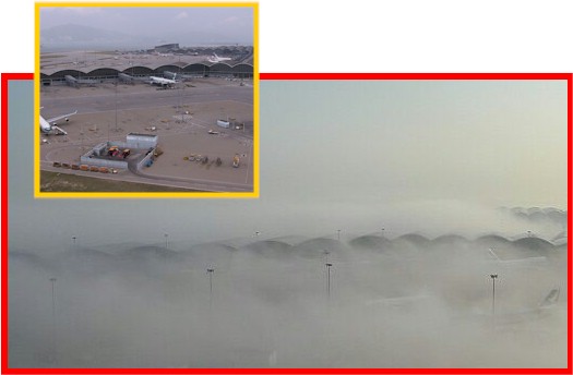
Fig. 8 Passenger Terminal Building (PTB) immersed in a layer of dense fog, with
its top barely visible (picture taken at 8:30 a.m.,
17 January 2002 by D.S. Lau).
Inset shows the PTB in a clear fine day.
Severe weather
_____________________________________
Tornado detected for the first time in Hong Kong
C.M. Cheng
The Hong Kong Observatory received from an airport personnel a report of very windy conditions resembling a
tornado on Chek Lap Kok Island in the evening of 20 May 2002. The event occurred at around 8:30 p.m. and dustbins were blown around
violently at Catering Road East, Chek Lap Kok.
Thunderstorms were affecting Hong Kong around that time. Warnings of strong monsoon and thunderstorms were in force. The Observatory
had also issued alerts of significant windshear in advance.
The event was well observed by the Observatory's Terminal Doppler Weather Radar. This is the first time the radar detected a tornado
since its operation in 1998. Located at Tai Lam Chung, this radar is specifically used for detecting weather phenomena
giving rise to windshear in severe weather at the airport. The radar picture taken at the time shows opposing winds
exceeding 90 kilometres per hour and affecting an area one kilometre across over the eastern part of Chek Lap Kok. This is
typical of tornadoes.
A tornado is a fast rotating column of air extending from thunder clouds to the ground. Locally, occurrences of tornado are mostly
associated with unstable weather during the rain season from May to September.
On record, there are a total of 6 cases of tornadoes in Hong Kong, including the above report.
The last reported tornado occurred in Fanling on 17 May 1994.
A tornado over waters is called a waterspout. Since 1959, there were a total of 36 cases of waterspout and waterspout-like funnel
cloud within 460 kilometres (250 nautical miles) of Hong Kong.
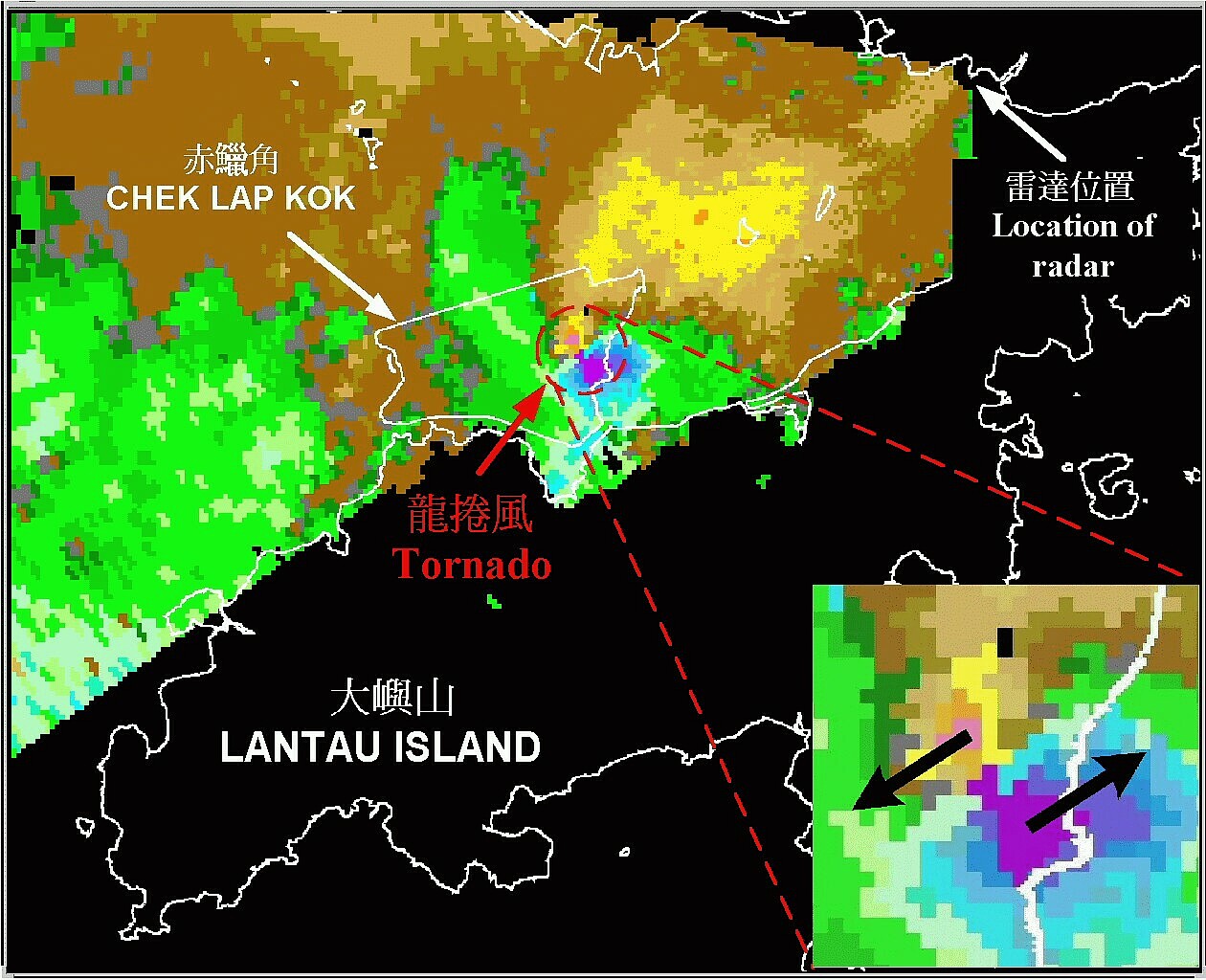
Fig. 9 Picture taken by the Terminal Doppler Weather Radar of the Hong Kong Observatory
at 8:31 p.m. on 20 May 2002. Purple/blue indicates winds blowing towards the northeast,
while orange/yellow indicates winds blowing towards the southwest.
Two patches of opposing winds closely packed together is the typical pattern of tornadoes.
Vortices downwind of Lantau
S.T. Chan
In the afternoon of 18 January 2002, four aircraft reported encountering windshear while landing at the Hong Kong International Airport on 07L runway (western end of the north runway). They reported windshear magnitudes of 15 to 20 knots during the period 3:00 to 4:15 p.m. Hong Kong Time (HKT).
The weather pattern that day (see the Weather Chart) was characterized by a ridge of high pressure ahead of a cold front over south China. The ridge brought easterlies to the surface, with winds veering to the south on hilltops of Lantau.
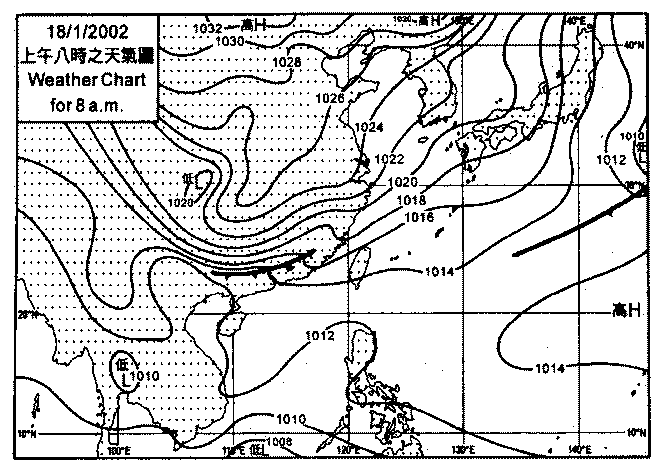
Fig.10 Weather Chart.
The time sequence of the wind observations shown below depicts the local wind disturbances near the airport during the period. While winds over the airport remained generally easterly, the newly-installed weather buoy saw winds changing from northeasterly to northwesterly, then southerly and finally northeasterly. This successive change in wind direction at the buoy, against rather steady winds in the background, suggests the existence of small vortices one by one, over the western part of the airport, and their subsequent movement to the northwest. These small vortices brought significant changes to the headwind locally, as amply demonstrated in the accompanying figure which shows the headwind changes between the weather buoy and the anemometer near the 07L touchdown zone. It is believed that the four aircraft encountered windshear associated with such headwind changes.
The windshear alert had been issued in advance. We were happy to have received the following compliment from one of the pilots:
"Thanks to the controller's advice we increased our bug speed accordingly and were ready to deal with the w/s (windshear) encounter".
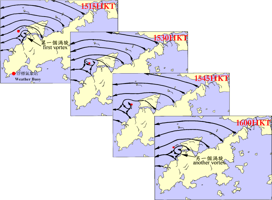
Fig. 11 Time sequence of the wind observations
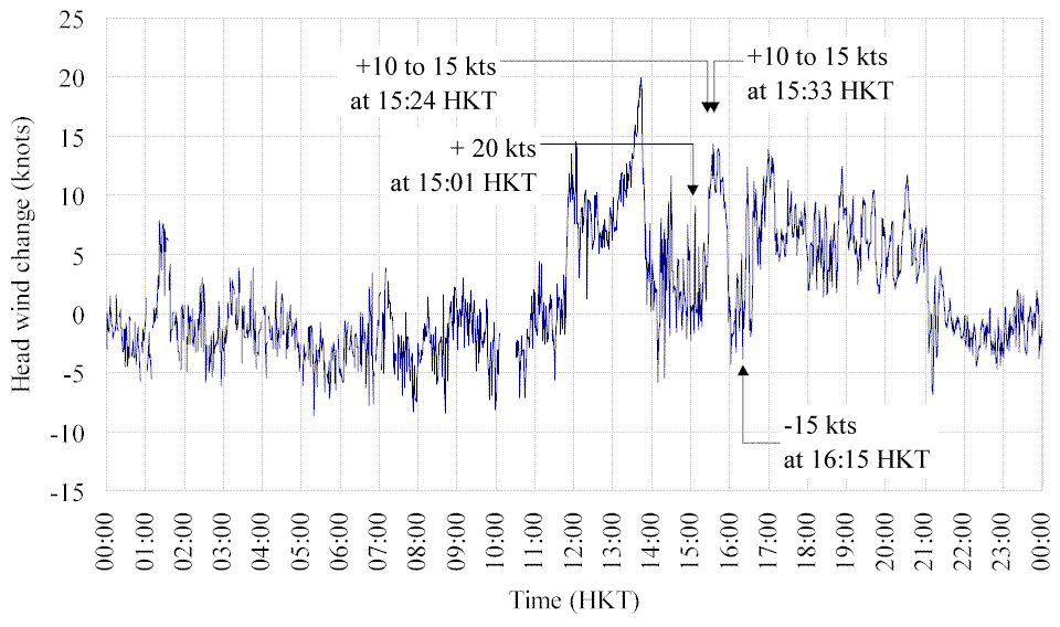
Fig.12 Time series of head wind change (relative to aircraft landing on runway 07L)
between the buoy and the anemometer at the western end of runway 07L.
Time and magnitude of the four windshear events are also indicated on the graph.
Duststorm over northeast China
Paul K L Ho
At 1:14 p.m. HKT on 8 April 2002, the Observatory captured a satellite picture (right) of widespread dust over northeast China. The dust was far from Hong Kong (more than 1,500 kilometres) and an extensive rainband over the East China Sea had the effect of washing out any dust moving south. Hong Kong was not affected by the duststorms.
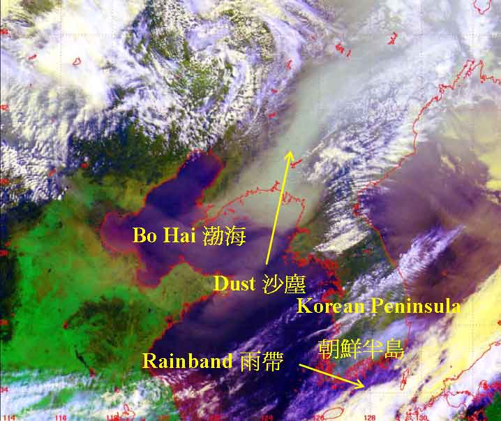
Fig.13 Satellite image captured by NOAA-16 at 1:14 p.m. (Hong Kong time) on 8 April 2002.
Meeting People
_____________________________________
Windshear and turbulence briefings
C.M. Shun
The Observatory delivered two briefings on windshear and turbulence alerting service on 14 March 2002, one to airline representatives and pilots and one to air traffic control (ATC) personnel. The objective of the briefings was to present the findings of a review on the windshear and turbulence alerting service for the airport, improvements achieved and the future plan. The total audience was over 60, and both briefings were followed by lively questions and discussions. A technical note on the subject "Windshear and turbulence alerting service at the Hong Kong International Airport a Review" is now available on the Observatory's website, under "Publication and Records".
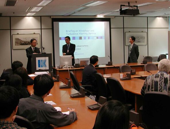
Fig.14 Mr. Benjamin Fong, Chief Air Traffic Control Officer of the Civil Aviation Department (left)
introducing the speakers Mr. C.M. Shun (middle) and Dr. C.M. Cheng (right) to ATC colleagues.
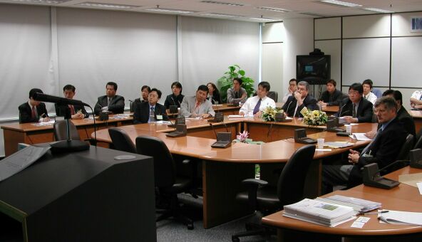
Fig. 15 Airline representatives and pilots having the floor in the discussion
Quiz on aviation weather
L.O. Li
(There can be more than one answer.)1. In which season do northerly winds blow most often in Hong Kong?
(A) spring (B) summer
(C) autumn (D) winter
2. Which of the following weather phenomena will reduce the visibility?
(A) strong wind (B) rain
(C) fog (D) haze
3. After taking off, aircraft usually navigate at a height of 10 km.
(i) The pressure aloft is usually
(A) lower (B) higher and
(ii) the temperature aloft is usually
(A) lower (B) higher
than that of the surface.
4. Which of the following conditions will favour fuel saving for flight in upper air?
(A) Tailwind, low air temperature
(B) Headwind, high air temperature
(C) Tailwind, high air temperature
(D) Headwind, low air temperature
5. A tropical cyclone in the northern hemisphere and one in the southern hemisphere differ in their directions of
rotation. A tropical cyclone in the northern hemisphere rotates:
(A) counter-clockwise (B) clockwise
Answers
Airport Meteorological Office
_____________________________________
We will strive to do better
S.Y. Lau
The annual survey on the aviation weather services provided by the Observatory was conducted in late March. We thank airlines for their returns. The survey covered products and service items and overall 98% of them were rated satisfactory or better. The airlines also provided valuable comments on areas regarding further improvement. We are working on the comments and will strive to do better.

Disaster preparedness
L.O. Li
To ensure our weather services for the airport go uninterrupted when Control Tower becomes inoperative, the Observatory has its backup facilities ready and running 24 hours a day. Drills are conducted regularly to ensure the competency of staff. Some of the drills also involve relevant government departments and the Airport Authority.
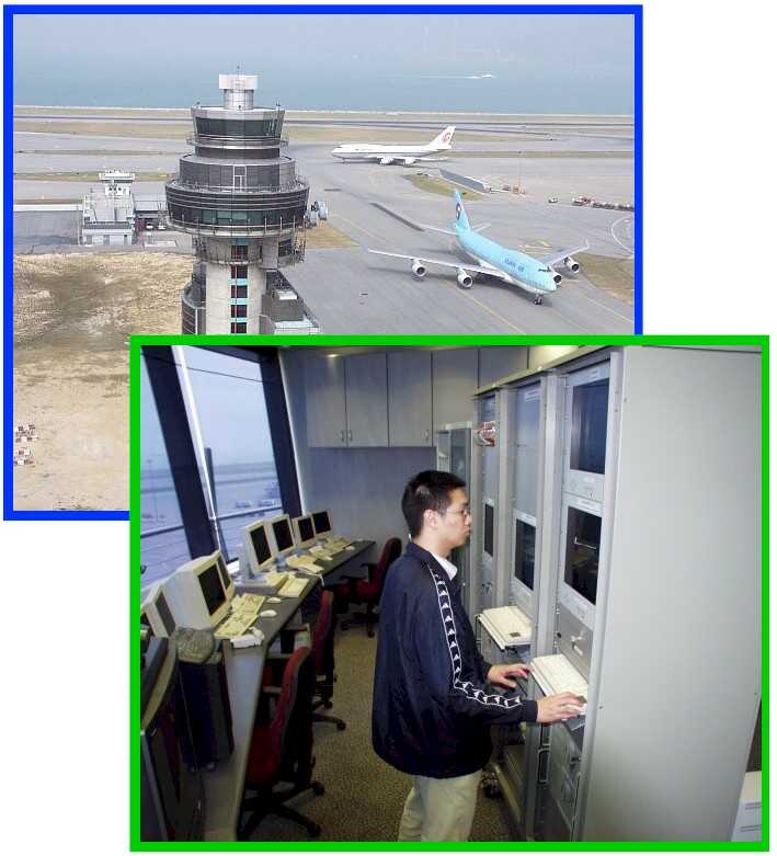
Fig.16 Ancillary Airport Meteorological Office
Cheung Chau Signal Station
calling it a day!
With rapid advancement in modern communication technology, nowadays the latest weather forecast and warning is readily available on various medias ranging from radio, TV, telephone to internet. To keep pace, the Observatory decommissioned Hong Kong's last signal station at Cheung Chau early this year. This marked the end of the tradition of hoisting visual signals for tropical cyclone and strong winds.
Back in the old days, Cheung Chau also served as an aeronautical weather station from 1953 till 1992, when it went automatic. Despite the decommissioning of the signal station, the automatic weather station there will continue to operate and provide weather observation round the clock.
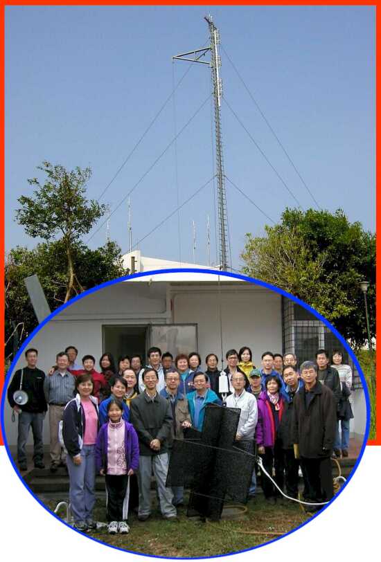
Fig.17 Observatory staff and their family members at Cheung Chau Station, pictured here with the decommissioned No.10 typhoon signal.
Meetings and visits
_____________________________________
Observatory Open Day (23-24.3.2002)
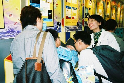
Fig. 18 Observatory staff explaining the exhibits to visitors
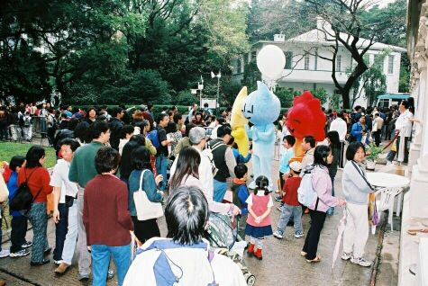
Fig. 19 Photograph session with cartoon figures of the Observatory Weather Family
Seminar on Aviation Meteorological Services and Information Exchange with CAAC
S.W. Yeung
A delegation from Air Traffic Management Bureau, Civil Aviation Administration of China (CAAC/ATMB) participated in a seminar on aviation meteorological services and information exchange at the Observatory during 15 - 18 January 2002. The visit was carried out under the Memorandum of Long Term Technical Co-operation between CAAC/ATMB and the Observatory. The delegation visited the Observatory's facilities, including those at the Airport Meteorological Office. Apart from technical exchanges, discussion was made on the enhancement of weather information exchanges including the provision of numerical model output, automatic weather station and radar data.
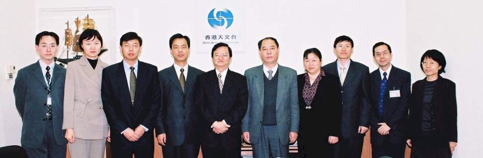
Fig.20 The delegation from CAAC/ATMB pictured here with the Director and staff of the Observatory
Visiting the Meteorological Center at Baiyun International Airport, Guangzhou
L.O. Li
For enhanced exchange of meteorological data, the Observatory's Messrs. L.O. Li and N.K. Cheng visited the Meteorological Center of CAAC's Central and South China Air Traffic Management Bureau (ATMB) in March 2002. During the visit, there were useful interactions on dissemination of weather data via the internet.
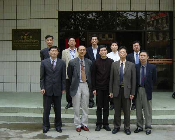
Fig.21 Colleagues of Meteorology Division of Central and South China ATMB pictured here with Observatory staff
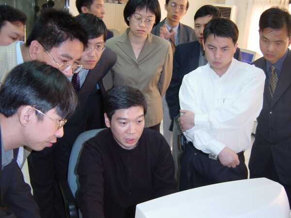
Fig.22 N.K. Cheng giving a demonstration to ATMB counterparts
Staff Matters
_____________________________________
Tree Planting Day at the Observatory
On 17 March, Observatory staff and their family members planted a
variety of trees in the compound. Apart from beautifying the grounds,
the event also conveyed the message of environment conservation.

Fig. 23 Tree Planting Day at the Observatory
Up a hill, down a mountain
S.W. Yeung
Throughout my career at the Observatory, I had been in various jobs and there was no lack of excitement in each of them. However, a recent task to select a site for a new weather station on Lantau Island was quite a challenge to me - I had to be winched down from a hovering helicopter!
To enhance monitoring of windshear affecting the airport and to further improve forecasting techniques, the Observatory is adding new anemometers on Lantau. When I was assigned the task, the first thing that came into my mind was the picture of myself descending smartly from a helicopter and landing gracefully on the ground, like an action movie star! To make this scene come true, I took the winching class seriously, where I learnt how to avoid sliding off the rope and to keep my body steady to prevent injuries.
It was fine the day when I flew to Sham Wat on Lantau. However, I did not have the mood to appreciate the beautiful scenery. I just kept on mentally rehearsing the safety procedures. Upon arriving at the landing point, I readied the rope and waited nervously with my legs dangling outside the helicopter and my heart beating twice as fast! Soon, I was winched up a little and then slowly down. The few seconds before landing seemed to last for hours. After landing safely on the ground, I waited till I calmed down and got my breath back before starting the site-selection work.
When I finished my task on Lantau, I had again to be winched up to the helicopter. Second time over, I was not so frightened and even managed to smile before the camera something to show off to my kids!
Thinking about it, although winching was a little scary, it saved both time and energy when compared to hill-climbing. I really have to thank colleagues from the Government Flying Service. Without them, I would not have completed the task so smoothly.
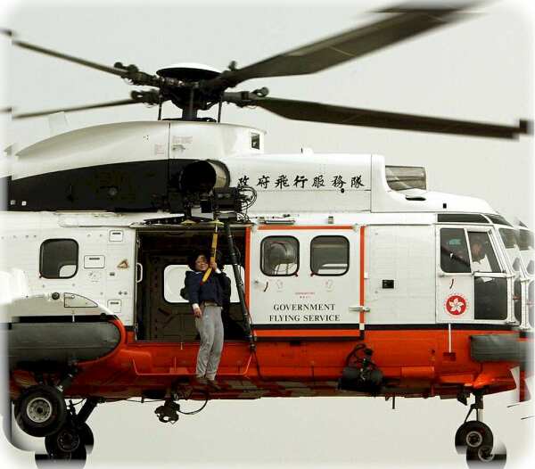
Fig.24 The writer had her share of excitement during site selection on Lantau!
In and out of the Office
Mr. K.S. Leung, officer-in-charge of the Airport Meteorological Office(AMO), retired from the civil service in January 2002 after working 30 years at the Observatory. We wish him a happy retirement. He is succeeded by Ms. Sharon Lau. Ms. Lau has earlier involved in the planning of the meteorological facilities at Chek Lap Kok as well as the development of its windshear and turbulence alerting service. She welcomes suggestions and comments on ways to improve services and can be reached by phone at 2922 5805 or email sylau@hko.gov.hk.
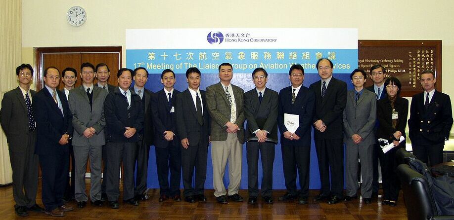
Fig.25 Participants of the 17th meeting of the Liaison Group on Aviation Weather Services bidding farewell to Mr. K.S. Leung (centre)
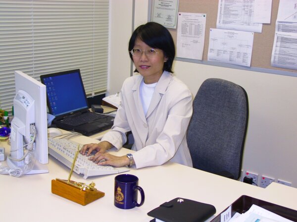
Fig.26 Ms. S.Y. Lau in her office
|
Telephone and Fax Numbers | |
|
Enquiry on flight documents |
(852) 2910 6922 |
|
|
|
|
|
|
|
|
|
|
|
|
|
Hong Kong Observatory Home Page | |
|
Web Page for Aviation Weather Services | |
|
http://www.weather.gov.hk/aviation | |
Editor this issue L.O. Li, M.T. Tsang | |
Email:mailbox@hko.gov.hk
Hong Kong Observatory : 134A Nathan Road, Kowloon, Hong Kong