Tropical Cyclones in 2018 > Figure 3.5.4b

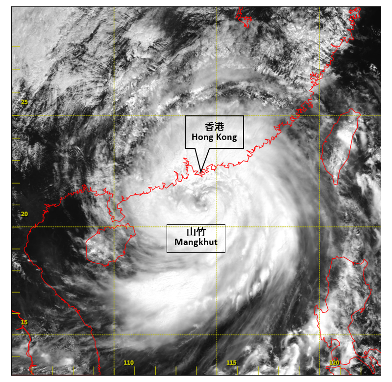
Figure 3.5.4b Visible satellite imagery around 11 a.m. on 16 September 2018. The
extensive circulation of Mangkhut covered the northern part of the South
China Sea and south China coastal areas. [The satellite imagery was originally captured by Himawari-8 Satellite (H-8) of Japan Meteorological Agency (JMA).] |
