Tropical Cyclones in 2017 > Figure 3.3.11

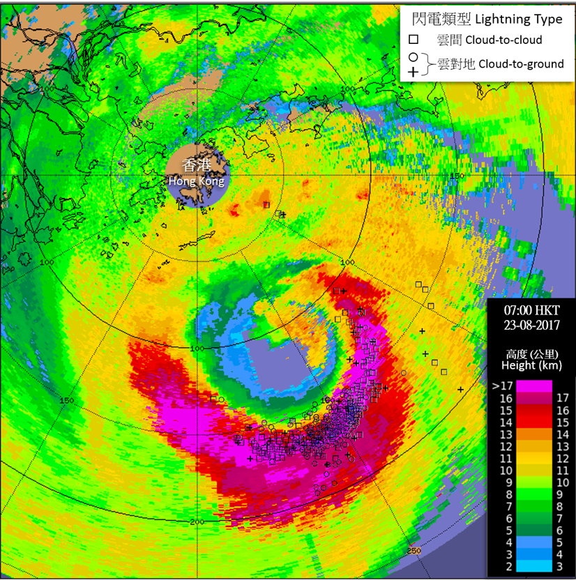
Figure 3.3.11 Image of cloud top height estimated using radar data at 7 a.m. on 23 August 2017, overlaid with lightning locations during the past 30 minutes. Very intense convection and frequent lightning appeared near the eyewall of Hato over the southeastern quadrant with the cloud top reaching over 16 km to the top of the troposphere.
|
