Tornado in the “eye” of LIDAR
Tornado in the “eye” of LIDAR
Jeffrey LEE Chi-wai
January 2021
“A tornado was spotted at Chek Lap Kok at around 4pm today (25/9) and sustained for around 20 minutes. The occurrence was captured by both the cameras installed in the airport and the LIDAR…” This was the Facebook post of the Observatory on 25 September 2020, but how does a LIDAR detects tornado?
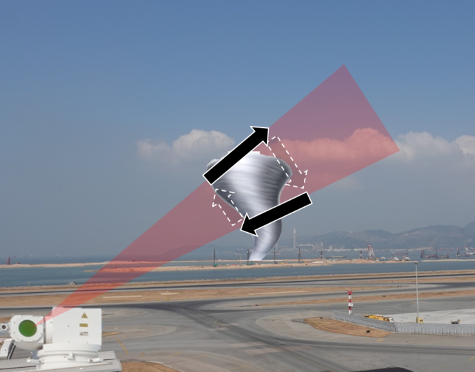
A LIDAR emits infrared light and receives the light reflected from suspended particulates in the air. It makes use of Doppler effect to measure the speed of movement of suspended particles to derive the wind speed. However, basing on Doppler effect, the LIDAR can only measure the radial velocity of a tornado, i.e. the component of wind “moving towards or away” from the LIDAR, but not the component moving sideways, as shown in Figure 1.
Compared with the Terminal Doppler Weather Radar, LIDAR has a higher spatial resolution and is able to provide more detailed observations on tornadoes that are smaller in size. In addition, LIDAR is able to detect in light rain as the measurement is based on the movement of suspended particles.
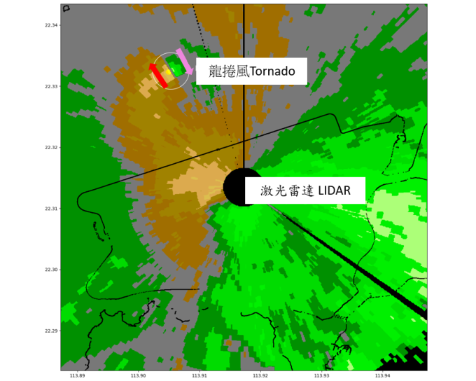
When compared with human observations, a LIDAR can more readily determine the direction of rotation of the tornado. Take the tornado on 25 September as an example. From the perspective of the LIDAR, the wind on the left hand side of the tornado is blowing outwards while it is blowing inward on the right hand side. Thus, it is clear that the tornado is rotating in a clockwise direction (Figure 2).

Figure 1: The LIDAR can only measure the inward and outward components of the wind (black arrows). (Illustration).

Figure 2: Brown areas are the areas where the wind is blowing outward from the radar. The green areas are the area where the wind is blowing inward towards the radar. As the wind on the left hand side of the tornado is moving outward (red arrow) while the wind on the right hand side of the tornado is moving inward (pink arrow), thus the tornado is rotating clockwise.