Application of Phased Array Weather Radar (PAWR) in monitoring inclement weather
Application of Phased Array Weather Radar (PAWR) in Monitoring Inclement Weather
JIN Jeffrey Tong and CHAN Ying-wa
January 2023
The Observatory installed a Phased Array Weather Radar (PAWR), the first of its kind in Hong Kong, at Sha Lo Wan (SLW) in 2021 (Figure 1). The PAWR comprises an array of small antenna units, each can be controlled independently for transmitting and receiving radar signal. By imposing phase shift to the antenna units, a radar beam can be generated for transmission in a designated direction. The merits of PAWR include its small size and simultaneous transmission of multiple radar beams. By utilising both mechanical and electronic scanning methods, a volume scan with a maximum of 68 layers can be completed in 1 minute. This is 5 to 6 times denser than the Tai Mo Shan and Tate’s Cairn weather radars which take around 6 minutes to complete a volume scan with only 12 layers. The PAWR can thus provide high spatial and temporal resolution radar images for monitoring the rapidly changing mesoscale weather systems such as localised rainstorms, hail, tornadoes, etc.
Since its trial operation in October 2021, the SLW PAWR performed well in monitoring several inclement weather events. One example was the occurrence of waterspout over the waters to the west of Cheung Chau in the morning of 8 June 2022 which was captured by the Observatory’s network camera (Figure 2a). The SLW PAWR captured clearly the development and dissipation process of the waterspout. In particular, the Doppler velocity overlayed with 3-D radar reflectivity image at around 10:18 a.m. showed the dipole pattern associated with the waterspout, suggesting the presence of a rotating air column. It was estimated that the maximum wind speed associated with this cyclonic vortex at a height of about 2 km exceeded 20 m/s (Figure 2b).
As the Observatory collects more PAWR data, weather forecasters will have a better understanding of the characteristics and evolution of mesoscale weather systems which will also pose a positive impact on nowcasting operation.
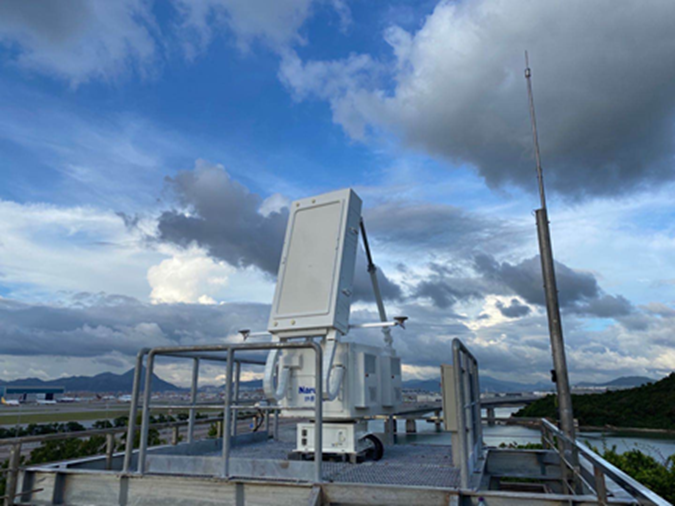
Figure 1 The Phased Array Weather Radar installed at Sha Lo Wan.
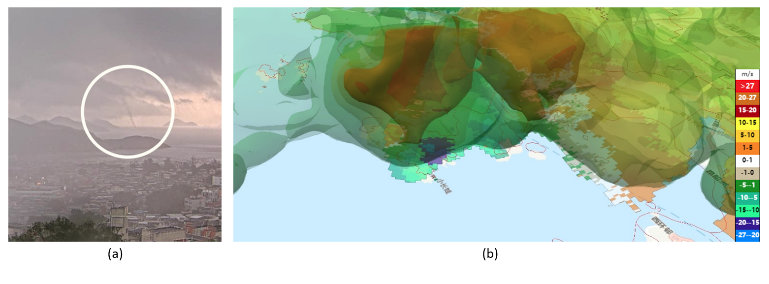
Figure 2 Waterspout observed by the Observatory’s network camera at Cheung Chau in the morning of 8 June 2022 (Figure 2a) and the PAWR’s Doppler wind field overlayed with 3-D radar reflectivity image showing the dipole pattern (blue: towards the radar; orange: away from the radar).