A Virtual Tour to The World's First LIDAR at The Airport
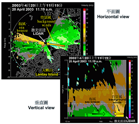
Now, let us take a look at some LIDAR images. The following example shows how the LIDAR information can be used to monitor windshear.
The LIDAR images on the right were captured in the morning of one fine day in April 2003. Sea breeze is quite common with fine weather at the airport. Usually blowing from the west, it converges with the background winds which typically blow from the east. The convergence of these opposing winds sometimes produces windshear for landing aircraft ...... |
|
 |
 |
 |
 |

