Numerical Weather Prediction Models
|
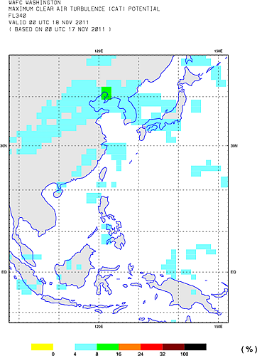
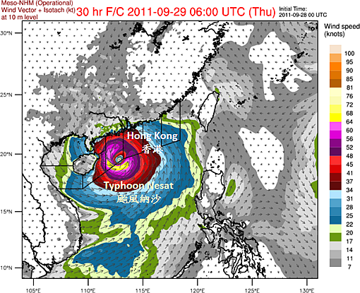
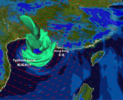
Aviation forecasters make use of products and data from the numerical weather prediction (NWP) models to formulate various aviation weather forecasts and alerts. The global model data are transmitted to the Observatory via the Global Telecommunication System and Internet from the European Centre for Medium-Range Weather Forecasts (ECMWF), the United Kingdom Meteorological Office (UKMO), the Japan Meteorological Agency (JMA), and the National Center for Environmental Prediction (NCEP) in the United States (Figure 1). For forecasting large-scale weather systems such as monsoon, cold surge and typhoon, these model data are generally adequate. However, in resolving regional variation of meteorological elements and smaller scale features associated with convective weather system, the spatial and time resolution of global NWP model data may not be fine enough. To enhance the support for the aviation forecasters in these aspects, the Observatory started to run the Non-hydrostatic Model system in June 2010, at horizontal resolutions of 2 km (inner domain) and 10 km (outer domain) to provide model forecast data and products up to 15 hours and 72 hours ahead respectively (Figure 2 and Figure 3). |
|
Figure 1 : Clear air turbulence potential forecast from the NCEP global NWP model.
Figure 2 : Forecasts of surface wind speed and direction from the Observatory's
Figure 3 : Forecasts of upper-level wind vector (red arrows), 3-dimensional isotach of wind speed (green) and relative humidity (filled contours in blue) from NHM.
|