The Observatory Enhances Services on Tropical Cyclones
29 June 2022
The Hong Kong Observatory enhanced its services on tropical cyclones today (29 June) including the monitoring and forecasting of the combined effect due to tropical cyclone and prolonged rainstorm. When significant wind-rain combined effect is expected, the Observatory will make announcement to the public through Tropical Cyclone Warning bulletins and media briefings. This is to ensure that members of the public can take early protective measures against personal security and family safety. For details, please refer to the Educational Resources article “Beware of Multi-Hazard Combined Effect” and the Cool Met Stuff video “Combined Effect of Inclement Weather".With the gradual improvements achieved by the Observatory in tropical cyclone track forecasting over the past few years, the errors of tropical cyclone forecast track were found to be reduced in general. With effect today, the “Potential Track Area” on the tropical cyclone track diagram will be made narrower. For the latest weather forecast and tropical cyclone news, please visit the "My Observatory" mobile app or the following webpages:
Weather Forecast: https://www.hko.gov.hk/en/wxinfo/currwx/flw.htm
Nine-day weather forecast: https://www.hko.gov.hk/en/wxinfo/currwx/fnd.htm
Tropical Cyclone Warning: https://www.hko.gov.hk/en/wxinfo/currwx/tc.htm
Tropical Cyclone Track Information: https://www.hko.gov.hk/en/wxinfo/currwx/tc_gis.htm
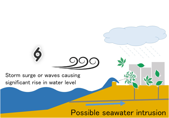
Tropical cyclones can bring about multiple hazards including high winds, heavy rain, storm surge, pounding waves, etc., adding up to significant combined effect.
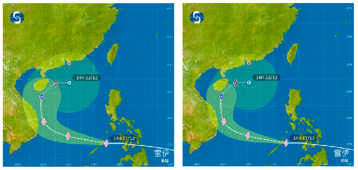
The “Potential Track Area”, represented by the yellowish shading, for Tropical Cyclone Rai of December 2021: (left) the original versus (right) the revised versions.