Cumulonimbus clouds -- their development and dissipation (14 July 2004)
Notable Weather Events
Cumulonimbus clouds -- their development and dissipation (14 July 2004)
Cumulonimbus clouds are characterized by strong vertical motion of very moist air, developing to a great height. The upper part of a cumulonimbus cloud has a fibrous texture and often spreads out in the shape of an anvil.
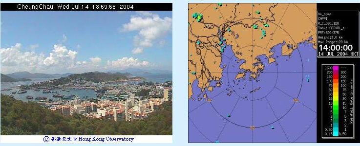
The afternoon of 14 July 2004 saw the development of cumulonimbus clouds about 50 to 100 km north of Hong Kong. The sequence of weather radar pictures (right) shows that the clouds followed a southerly flow, moving towards the north. The photo sequence (left) shows an anvil spreading from left to right, a result of westerly winds aloft.
Cumulonimbus clouds generally produce showers. When fully developed, they may bring thunderstorms and even hail.
The weather radar pictures also show development to the west of Hong Kong. However, this was not captured by the camera which pointed north.
| Photo taken at Cheung Chau Automatic Weather Station, looking to the north. | Weather Radar Picture |
 | |
    | |