Monthly and Seasonal Backward Trajectory Maps
|
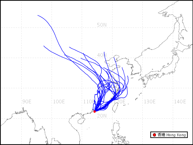
The Hong Kong Observatory has enhanced on 12 January 2010 its Backward Trajectory Map webpage to include the monthly and seasonal backward trajectory maps. A backward trajectory traces the possible path over 3 preceding days of an air parcel arriving in Hong Kong. In additional to the existing daily backward trajectory map, monthly and seasonal trajectory maps are now accessible through a user-friendly interface. This is useful for tracing the origin of the air mass reaching Hong Kong from a monthly or seasonal perspective. |
|
Monthly Backward Trajectory Map |
|
|
|
Example : The backward trajectory map in January 2009 shows that the air masses reaching Hong Kong in the month mainly came from the north or northeast. Such trajectories sometimes bring relatively low visibilities to Hong Kong. |
