Radar Image Gallery - Tropical Cyclones
Tropical Cyclones
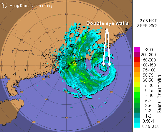 |
The image indicates Typhoon Dujuan exhibiting a double eye-wall structure while approaching the eastern coast of Guangdong in early September 2003. The diameters of the inner and outer eyes were about 20km and 100km respectively. The double eye-wall structure in tropical cyclones was not rare in the west Pacific. It had been observed recently in Typhoon Kujira (2003), in Typhoon Kirogi and Typhoon Kai-Tak (2000). Associated with strong typhoons, double eye walls were also observed by the Observatory's weather radar during the passage of Typhoon Elsie in 1975 and Typhoon Hope in 1979. |

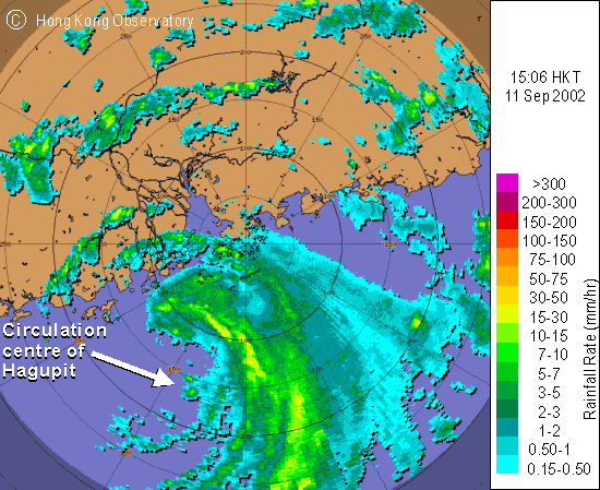 |
The image depicts Hagupit's asymmetric distribution of rain bands, which were mainly located on the eastern and northern sides of the storm. Hagupit came rather close to Hong Kong, with its centre only about 150 km to the south-southwest of Hong Kong. Despite such a close distance, the weather in various parts of Hong Kong was quite different. Hagupit brought squalls and heavy rain to Lantau and Hong Kong Island while most parts of the New Territories were relatively rain-free. |
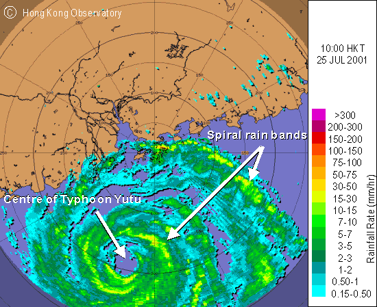 |
The circular eye of Typhoon Yutu was clearly seen in the image at about 200 km to the south-southwest of Hong Kong in the morning of 25 July 2001. The outermost rain band of Yutu was affecting Hong Kong then. Spiral rain bands, a typical characteristic of a tropical cyclone, can clearly be seen. |