The erratic Pabuk
The erratic Pabuk
(10 August 2007)
|
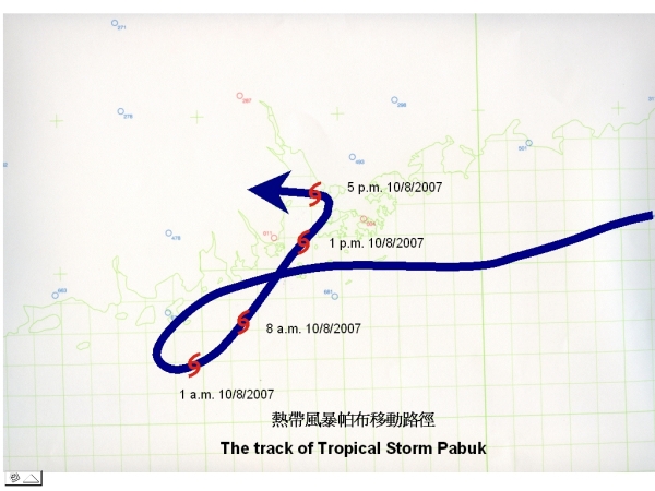
Tropical cyclone signals for Pabuk were cancelled yesterday (9 August) and re-issued today (10 August). This has happened before, roughly twice in 10 years. The return of Pabuk this morning can be attributed to the influence of the remnant of tropical depression Wutip which crossed Taiwan yesterday. Today, signals were changed in relatively rapid succession. Within 7 hours, the number 1 signal was replaced by the number 3 and then the number 8 signal. This was because of the proximity of Pubak to Hong Kong, and the fact that it accelerated and strengthened at the same time on approaching Hong Kong. Pubuk took an abrupt turn of 90 degrees to the west in the afternoon today. It was because the air current steering the movement of Pabuk was weak. In such a situation, the movement of a tropical cyclone tends to be erratic. It is difficult to forecast such erratic movement with the current state of science. With the abrupt 90-degree turn away from Hong Kong, the impact from the gales of Pabuk was confined to the western part of the territory, less than initially expected. In spite of this, gales prevailed over the waters south of Hong Kong for most of the afternoon and early evening.
|
