Lightning location map enhanced with geographical reference overlays
Lightning location map enhanced with geographical reference overlays
(6 July 2006)
|
Starting from today (July 6), the Hong Kong Observatory will add a number of geographical reference overlays to the lightning location map. This enables members of the public to identify more easily the location of lightning and better prepare or plan their activities.
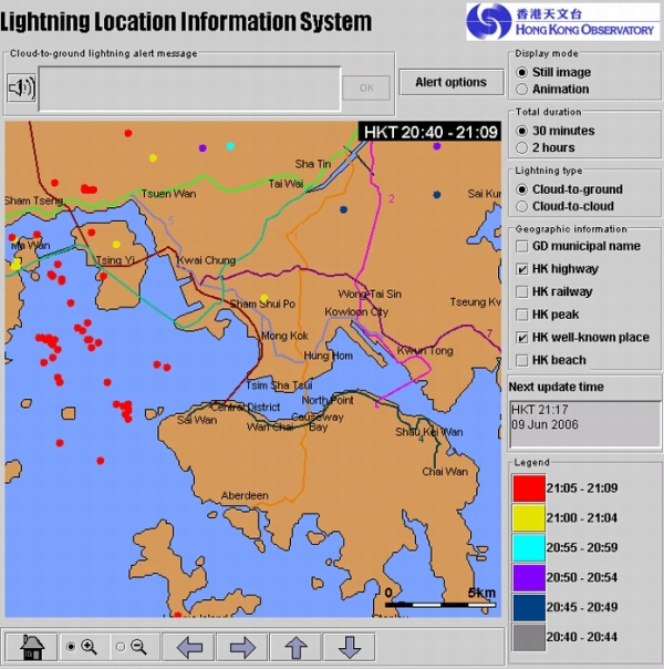
Since its launch in June last year, the lightning location information service has been well received by the public. Visits to the webpage were in excess of 1.6 million. To further improve the service, the Observatory has added a number of geographical reference overlays to the lightning location map (http://www.weather.gov.hk/wxinfo/llis/index.htm). The features include highways, railways, peaks, well-known places, Hong Kong beaches, and municipal names for Guangdong province. The Observatory has also added a new webpage showing rain areas detected by the radar overlaid with lightning locations. From the distribution of lightning detected near the rain areas, the public will be able to gain a comprehensive appreciation of the weather situation.
Mr Lee Chun-wai, Chairman of the Hong Kong Federation of Countryside Activities, said, "We welcome this new service provided by the Hong Kong Observatory. Hikers can now select one or more of the geographical reference overlays on the lightning location map. This would enable them to decide on a hiking trail away from thunderstorms."
Lightning location map enhanced with geographical reference overlays
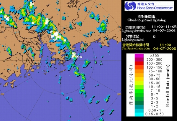
Radar images with lightning locations added (lightning locations denoted by white squares)
|