HKO announces findings on long-term sea level change in HK
HKO announces findings on long-term sea level change in HK (14 June 2004)
|
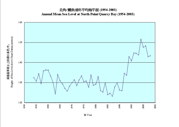
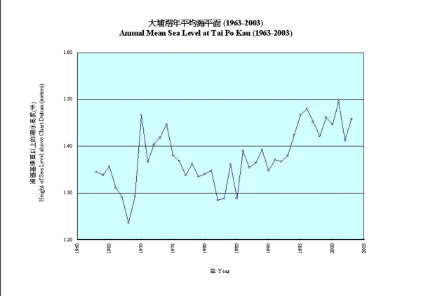
The Hong Kong Observatory announced today (June 14) the result of a study on long-term sea level change in Hong Kong. During the past 50 years, the mean sea level in the Victoria Harbour has risen by 0.12 metre, at an average rate of 2.3 millimetres per year. The mean sea level at Tolo Harbour has also risen by 0.12 metre in the last 40 years, at an average rate of 3 millimetres per year.
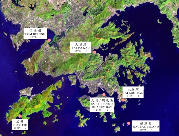
The Hong Kong Observatory operates a number of tide gauge stations in Hong Kong to monitor the sea level heights. Among these tide gauge stations, the station at North Point measured the sea level of Victoria Harbour from 1954 to 1985. The station continued collecting sea level data after relocation to Quarry Bay in 1986. To date, more than 50 years of data have been collected which is the longest and most complete tidal record in Hong Kong. Another tide gauge station at Tai Po Kau has recorded the sea levels in the Tolo Harbour for 41 years, since 1963.
Due to tides and meteorological effects, the sea level is in a continuously changing state. Ocean currents of the South China Sea, fresh water discharge and sedimentation from the Pearl River, as well as changes in coastline due to large scale reclamation affect the sea currents and sea levels at various parts of Hong Kong waters.
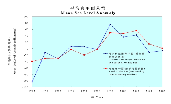
The Assistant Director of the Hong Kong Observatory, Mr Yeung Kai-hing, said, "While the sea levels and their inter-annual variations at various parts of Hong Kong waters are not all the same, the long-term sea level change at the Victoria Harbour agrees well with that in the South China Sea. The observed sea level change of Victoria Harbour in the past 50 years is similar to that of the South China Sea measured by the State Oceanic Administration of China, and is consistent with the change of the South China Sea in the past decade measured by the remote sensing satellites jointly operated by the USA and France."
Situated at the coast of the South China Sea, Hong Kong is affected by typhoons every year. The highest sea levels in Hong Kong have been caused by storm surges associated with typhoons. Near the centre of a typhoon, the sea surface bulges upward as the atmospheric pressure is lower than that of the exterior. The strong winds associated with a typhoon will also drag and pile water up towards the coast. A storm surge is the anomalous rise in sea water brought about by the combined effects of pressure and wind stress. In Hong Kong, most storm surges would have a height of 0.5 to 1.0 metre. In extreme conditions, the water level could exceed the tide level by more than three metres, bringing sea flooding to coastal low lying areas.
Sea flooding due to storm surges is not common in Hong Kong. In history, storm surges associated with a typhoon in 1937 and Typhoon Wanda in 1962 caused severe flooding to widespread areas in the New Territories. The latest sea flooding due to storm surge occurred during the passage of Typhoon Utor in 2001, when flooding was reported in the northwestern part of the New Territories and Tai O of Lantau.
After the mean sea level has risen, similar storm surges could cause higher sea levels, increasing the chance of coastal sea flooding. Mr Yeung said, "The mean sea level at Victoria Harbour has risen 0.12 metre in 50 years. Such a rise shortens the return period of high water level by half, that is, a high water level with a return period of 50 years would have a return period of about 25 years after the rise in the mean sea level." Nevertheless, as the effects of storm surges and long term sea level rise have been taken into consideration in the design of coastal projects, it is unlikely that the sea level will pose a threat to Hong Kong in the near future.
The Hong Kong Observatory's study also reveals that the inter-annual change in the sea level in Victoria Harbour was particularly prominent in the past 15 years, with steep rise of the annual mean sea level from 1987 to 1999 and rapid fall after that. This period coincides with the most rapid rise in the global average temperatures since instrumental measurement of air temperatures began in the 1860s. This suggests that global warming might be an important factor in the sea level change in Hong Kong.
According to an assessment report published by the Inter-governmental Panel on Climate Change (IPCC) in 2001, one of the consequences of global warming was the rise in sea level due to thermal expansion of the upper layer of the ocean and melting of polar ice caps and mountain glaciers, and it was estimated that the global mean sea level had risen by one to two millimetres per year in the 20th century. There are, however, considerable regional variation in the sea level change as global warming would affect atmospheric and oceanic circulations and hence the regional climate and sea level. Mr Yeung said, "Regional climate change study is a key area of work of the Hong Kong Observatory." Besides, as crustal movement would affect sea level measurement, the Hong Kong Observatory in co-operation with the Lands Department and Hong Kong Polytechnic University has started to make measurement of the vertical ground movement at tide gauge stations, using satellite-based Global Positioning System techniques, since 2004. The data will support long term sea level change studies in future.
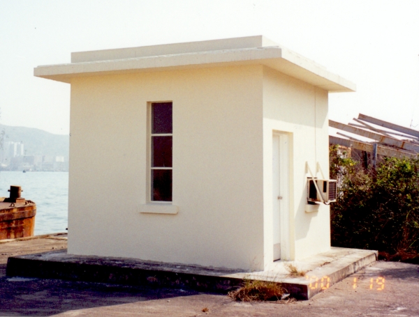
Figure 2: Quarry Bay Tide Gauge Station
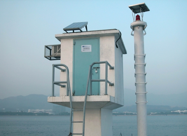
Figure 3: Tai Po Kau Tide Gauge Station
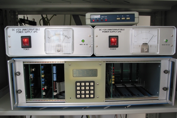
Figure 4: Tide Data Recording Equipment
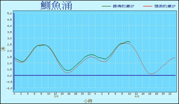
Figure 5: Tide Chart for Quarry Bay Tide Gauge Station
Figure 6: Annual Mean Sea Level at North Point/Quarry Bay (1954-2003)
Figure 7: Annual Mean Sea Level at Tai Po Kau (1963-2003)
Figure 8: Mean Sea Level Anomaly
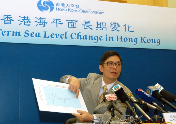
Figure 9: Assistant Director of the Hong Kong Observatory, Mr. YEUNG Kai-hing describing the Long Term Sea Level Change in Hong Kong Table 2: Annual Mean Sea Level at North Point/Quarry Bay (1954-2003) |