HKO launches radar image website
HKO launches radar image website (9 January 2004)
|
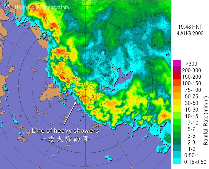
The Hong Kong Observatory will launch a new radar image gallery website at www.weather.gov.hk/wxinfo/radars/radar_gallery/index_e.htm today (January 9). This is a further step following the launch of radar pictures with rainfall information on the observatory's website in August 2003, and aims to promote public awareness towards disaster preparedness. The gallery features severe weather phenomena captured by the observatory's weather radar such as tropical cyclones and rainstorms, as well as typical seasonal weather phenomena in Hong Kong like isolated showers and winter rain. There are also pictures that may prompt memories of the days when the Hurricane Signal No 10 was hoisted under the attack of Wanda, Ellen and other typhoons. Images created by the observatory are also included to help readers interpret the radar pictures. "Radar pictures are very informative, but users need certain skills for interpreting the pictures properly. One of the purposes of setting up the gallery is to help the public to interpret radar images using real examples," said Mr HG Wai, Acting Assistant Director of the Hong Kong Observatory. You are welcome to visit the gallery at www.weather.gov.hk/wxinfo/radars/radar_gallery/index_e.htm. Live radar pictures captured by the observatory's radar can be viewed at www.weather.gov.hk/wxinfo/radars/radar.htm. To further help the public to interpret the radar information on the web, a training course will be organised by the observatory in mid-February. Those interested in the course can browse the following webpage for details: www.weather.gov.hk/education/coursec_0402.htm.
Radar image captured on 4 August 2003 depicting a line of heavy showers. |
