The Observatory uploads radar pictures on website
The Observatory uploads radar pictures on website (9 August 2003)
|
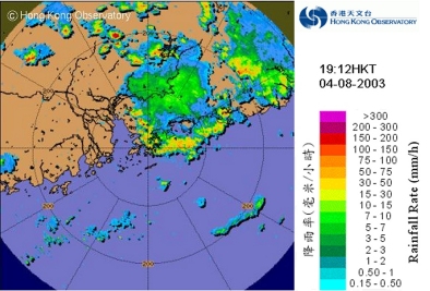
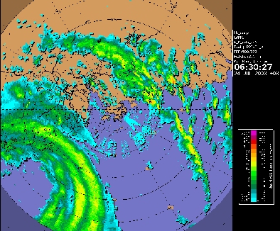
The Hong Kong Observatory announces the availability of radar pictures with rain intensity information in its website today (August 9). To enable the public to interpret correctly the radar and satellite information in its website, the Observatory has started running courses for the public. The first course was held in early August. Those interested may now apply to attend the second course to be held on August 30 and September 6. The radar picture is located at: http://www.weather.gov.hk/wxinfo/radars/radar.htm. The rain intensity is represented by different colours. The picture is normally updated every 12 minutes. Its coverage extends out horizontally to a distance of 250 kilometres from Hong Kong, encompassing most of Guangdong and a portion of the northern part of the South China Sea. The new radar picture has been put on trial since July. It has received very good feedback from the public. Here are some examples:- "The new images show more clearly the intensity and movement of rain echoes near Hong Kong which are useful in the monitoring of heavy rain and tropical cyclones. Please keep up the good work." - Mr Clarence Fong of the Weather Underground of Hong Kong. "We, a group of weather enthusiasts, thank the Observatory very much for the release of 256-km radar [information], which enables us to know more clearly the latest weather conditions around Hong Kong" - Mr Alan Chui of the Storm-Chaser Electronic Monthly. "It's a good attempt to put radar pictures on the Internet. It enables people to know the whereabouts of rain areas and how fast they move out to more than 200 kilometres from Hong Kong." - Mr Choy, a participant of the first training course held in early August. Dr B Y Lee, Assistant Director of the Hong Kong Observatory, points out that the radar pictures on the Observatory website will enable people to make weather-sensitive decisions to suit their own circumstances. For example, they can decide whether to proceed with or suspend outdoor activities in the light of the intensity and distribution of rain appearing on the radar picture. However, he also remarks that the interpretation of radar pictures is not straightforward. They might be misinterpreted if the viewer is not aware of such factors as the atmospheric conditions and the way the radar is operated, all of which might cause unwanted effects on the radar picture. Members of the public seeking to make good use of radar and satellite pictures are encouraged to sign up for the coming training course. For details regarding registration, please check out: http://www.weather.gov.hk/education/seminarc.htm.
|


