|
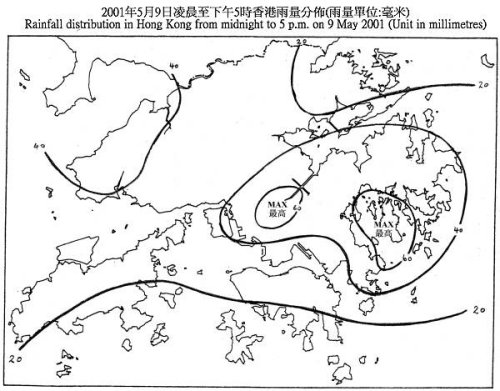
A trough of low pressure brought unsettled weather to the south China coast in the past couple of days (7 to 9 May 2001). Heavy rain and thunderstorms associated with this trough of low pressure started to affect Hong Kong last night (8 May 2001) and brought more than 50 millimetres of rain to Sai Kung area.
With the passage of the trough of low pressure, another area of heavy rain and thunderstorms swept across the territory this afternoon (9 May 2001), necessitating the hoisting of the following warnings:
Thunderstorm Warning : 2:30 p.m. to 5:30 p.m.
Amber Rainstorm Warning : 3:35 p.m. to 5:30 p.m.
Up to 5 p.m. today (9 May 2001), many parts of the territory received more than 40 mm of rain. The rain was heaviest over northern Kowloon, Sha Tin and the eastern part of the New Territories where over 60 mm of rain were recorded.
Below is the rainfall distribution map for Hong Kong up to 5 p.m. today (9 May 2001):

For the latest weather forecast, please refer to the following webpages:
http://www.weather.gov.hk/wxinfo/currwx/flw.htm (local weather forecast) &
http://www.weather.gov.hk/wxinfo/currwx/f5d.htm (5 day forecast).
| 