Fog
|
Fog | |
|
6 March 2006 | |
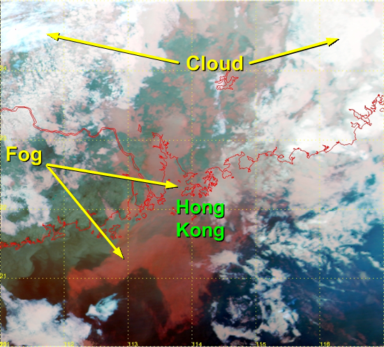 |
Under a moist maritime airstream, fog shrouded the Pearl River Delta and the neighbouring sea on 6 March 2006. In that night, winds in Hong Kong were generally light and the visibility at Chek Lap Kok fell to a low of 200 m. The satellite image showed that fog (in red colour) appeared over Hong Kong and neighboring area. |
|
Image time - 10:52 p.m., 6 March 2006 The satellite image, which was captured by EOS TERRA satellite. This was generated by combining the satellite data from channels 20, 31 and 32. Major features appearing on the image include fog/mist (red - smooth in texture) and clouds (white). To know more about weather satellites, please refer to the Notes. | |
|
Fog | |
|
15 February 2006 | |
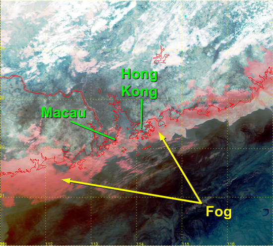 |
In the evening of 15 February 2006, winds were generally light over Guangdong. The coastal region was shrouded in fog patches, causing low visibility in the area. In Hong Kong, the visibility was only around 200 m at Waglan Island. The visibility at Macau was about 6 km at the time, but dropped to 500 m in two hours. The satellite image shows the fog (in red colour) hovering over the coast of Guangdong. |
|
Image time - 10:21 p.m., 15 February 2006 The satellite image, which was captured by EOS TERRA satellite. This was generated by combining the satellite data from channels 20, 31 and 32. Major features appearing on the image include fog/mist (red - smooth in texture) and clouds (white). To know more about weather satellites, please refer to the Notes. | |
|
Fog | |
|
12-13 January 2006 | |
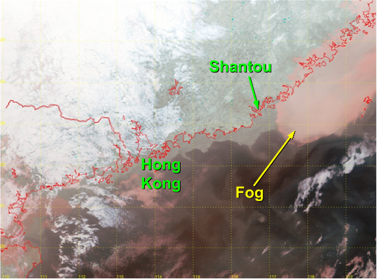 |
This case illustrates how fog is observed on satellite during the day and at night. In the evening of 12 January 2006, widespread fog affected the southeastern coast of China and the adjacent waters. Nighttime satellite image is specially processed to highlight the location of fog. On the satellite image, fog is depicted in red colour, making it easy to distinguish fog from other clouds (which appear in white colour). The area of fog spread west to affect Shantou that night and the following day, causing visibility there to drop to a low of 400 m. |
|
Image time - 10:33 p.m., 12 January 2006 The satellite image, which was captured by EOS TERRA satellite. This was generated by combining the satellite data from channels 20, 31 and 32. Major features appearing on the image include fog/mist (red - smooth in texture) and clouds (white). To know more about weather satellites, please refer to the Notes. | |
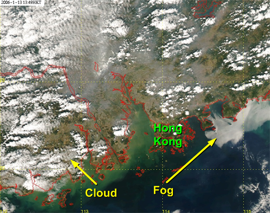 |
In the early afternoon on the next day (13 January 2006), the area of fog reached the coastal waters just to the east of Hong Kong. The daytime true colour image ( which likens the view as seen by the naked eyes from space) shows that the area of fog appears in white colour with smooth texture. |
|
Image time - 01:49 p.m., 13 January 2006 The satellite image, which was captured by EOS AQUA satellite. This was generated by combining the satellite data from channels 1, 3 and 4. Fog/mist appears in white colour with smooth texture. To know more about weather satellites, please refer to the Notes. | |
|
Fog | |
|
17 January 2002 | |
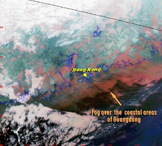 |
In the early morning of 17 January 2002, the coast of Guangdong was affected by widespread fog, causing the visibility in Hong Kong to drop below 500 m. The fog appears as hazy red patches on the satellite image. |
|
Image time - 3:10 a.m., 17 January 2002 The satellite image, which was captured by NOAA-16, was specially processed using channels 3B, 4 and 5, with assignment of colours to bring out features of special interest. Major features appearing on the image include fog/mist (red - smooth in texture) and clouds (white). To know more about weather satellites, please refer to the Notes. | |
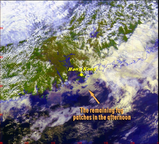 |
The fog dissipated gradually during the day. However, some fog patches still remained in the afternoon and were discernible on the satellite image (in pale yellow colour). |
|
Image time - 2:27 p.m., 17 January 2002 The satellite image, which was captured by NOAA-16, was specially processed using channels 1, 2 and 4, with assignment of colours to bring out features of special interest. Major features appearing on the image include low clouds/fog (pale yellow) and clouds (white). To know more about weather satellites, please refer to the Notes. | |