Weather Services for Aviation
Overview of the services:
Within the framework of the International Civil Aviation Organization (ICAO), the Hong Kong Observatory (HKO) is the designated meteorological authority in Hong Kong to provide weather services for international air navigation. The provision of aviation weather services is to contribute towards the safety, regularity and efficiency of international aircraft operations. This is achieved by supplying the necessary meteorological information to Air Traffic Services (ATS) units, airline operators, flight crew members, airport management and others associated with international air navigation.
History:
The HKO's long association with aviation began in 1920 when proposals for an aviation weather service were first discussed. Aviation forecasting service began in 1937 and a forecaster was stationed at Kai Tak Aerodrome on a part-time basis. The Airport Meteorological Office (AMO) at the Kai Tak Terminal Building came into operation in 1939. After the Second World War, the HKO resumed the provision of aviation weather services in August 1947. In response to the rapid growth of air traffic in the post-war years, a team of aviation forecasters was recruited in 1957 to man the AMO. Since then the AMO witnessed the continuous growth in air traffic volume at Kai Tak.
With the opening of the new Hong Kong International Airport (HKIA) at Chek Lap Kok in July 1998, the AMO carries on with its operations at the Air Traffic Control Tower. New meteorological systems based on state-of-the-art technologies were implemented to enable the AMO to cope with the increasing demand.
Weather Observation and Forecasting:
Weather observers and aviation forecasters work round-the-clock at the AMO to take routine and special weather observations and to provide enroute forecasts as well as aerodrome forecasts for the HKIA.
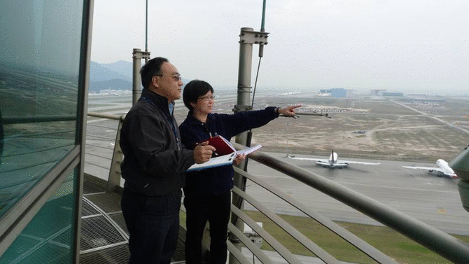
Fig. 1 Making weather observations
In support of air traffic flow management, the Aviation Forecaster provides routine daily briefings to Air Traffic Control Centre (ATCC) of the Civil Aviation Department on significant convection forecast for key areas over the Hong Kong Flight Information Region (HKFIR).
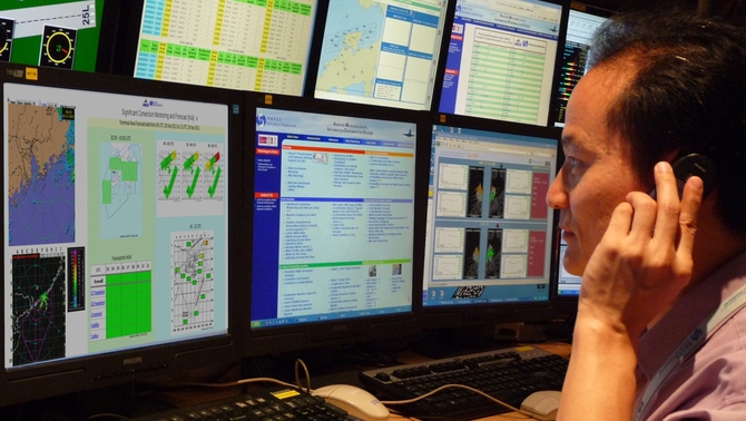
Fig. 2 Aviation Forecaster conducting a weather briefing for ATCC
Six sets of anemometers are installed in the middle and at both ends of the Northern and Southern Runways to measure the wind direction and speed an aircraft will encounter during take-off and landing. There are also six sets of Runway Visual Range (RVR) transmissometers to measure visibility conditions along the two runways.
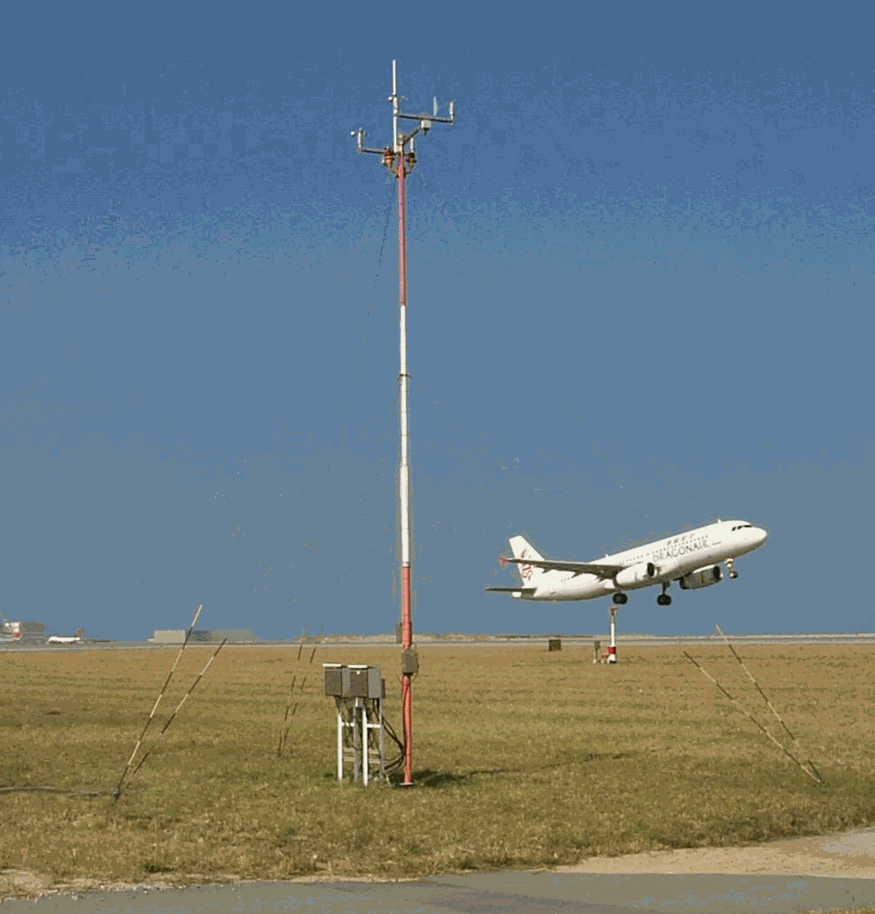
Fig. 3 An anemometer near the runway
Thermometers, barometers, raingauges and a ceilometer are set up in a meteorological enclosure near the Air Traffic Control Tower to provide temperature, pressure, rainfall and cloud base information for the aerodrome.
Additional ceilometers are installed at Siu Mo To and Tai O to assist the observation of cloud base over the approach and departure areas.
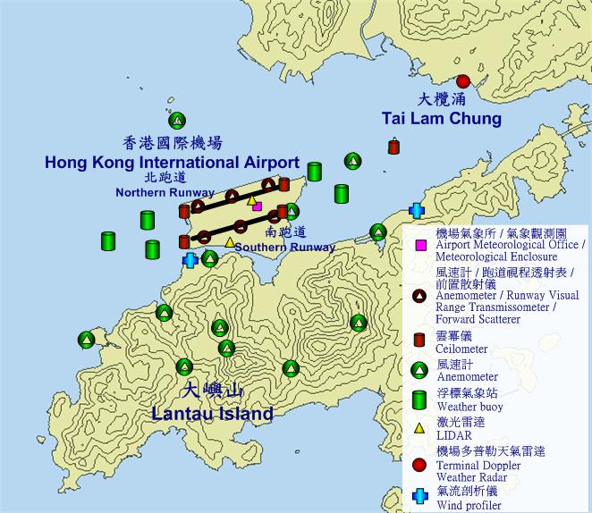
Fig. 4 Locations of meteorological equipment around the airport
The observations and forecasts are disseminated to ATS units for onward transmission to aircraft pilots, to airline operators for pre-flight planning and to local users operating helicopters and light aircraft. Such information as well as weather reports from neighbouring aerodromes are included in the regular broadcasts for aircraft in flight and for aircraft preparing for landing at or taking off from the HKIA.
Aircraft observations of winds, air temperatures and special phenomena are compiled by the AMO and disseminated as aircraft reports.
Warning Services:
The AMO is responsible for issuing warnings on hazardous weather which may affect the safety of aircraft operations within a designated airspace over the northern part of the South China Sea. It also issues aerodrome warnings on adverse weather for protection of aerodrome facilities and aircraft on the ground.
To enhance the safety of aircraft landing at and taking off from the HKIA, the AMO issues alerts of low-level windshear and turbulence. The dual LIght Detection And Ranging (LIDAR) system (each LIDAR located separately near the northern runway and the southern runway), a Terminal Doppler Weather Radar (TDWR), a network of over 20 anemometers and two wind profilers are used to assist in the detection and alerting of windshear and turbulence.
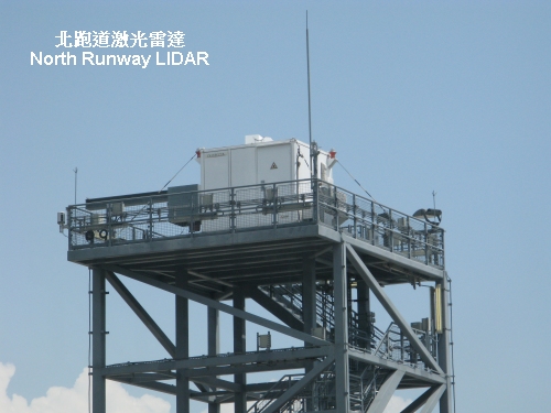
Fig. 5 The Northern Runway LIDAR
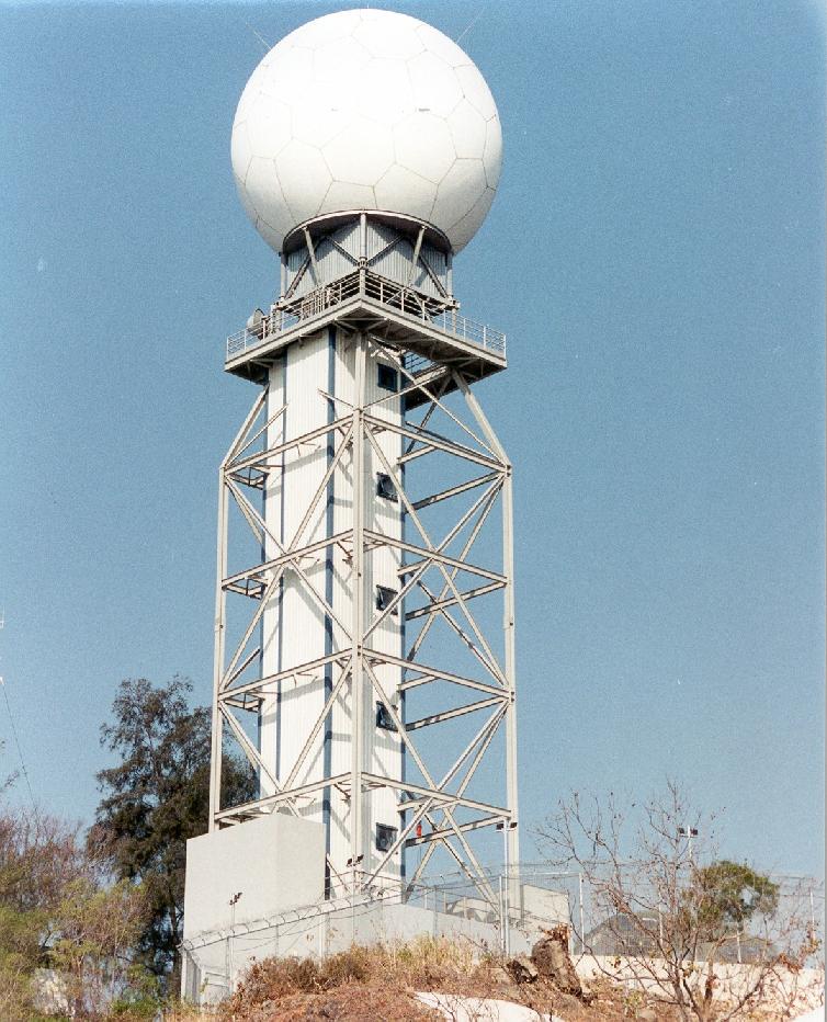
Fig. 6 Terminal Doppler Weather Radar at Tai Lam Chung
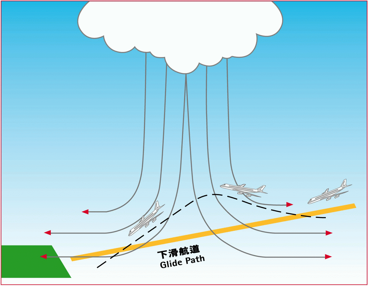
Fig. 7 Schematic diagram of windshear caused by a microburst
Low-level windshear and turbulence alerts for the approach and departure areas within 3 nautical miles of the runway thresholds are issued by the AMO for relay by air traffic controllers to approaching and departing aircraft.
Service Delivery:
A meteorological data processing system acquires, processes and disseminates meteorological information to support the operation of the HKIA. This system is connected with the systems of the Civil Aviation Department (CAD) for exchange of operational weather data with airports around the world, and for display of meteorological information to air traffic services units. This system also includes an on-line information service through which airline companies can retrieve flight documentation including forecast charts of en-route significant weather and wind/temperature data issued by the World Area Forecast Centres at London and Washington, weather forecasts for departure, destination and alternate aerodromes, as well as the latest meteorological information of weather radar and satellite images, aerodrome warnings, tropical cyclone information, etc. Weather briefings are provided via telephone or video conferencing equipment to flight crew members on request.
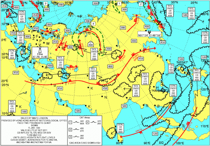
Fig. 8 A sample significant weather chart
New Development:
HKO will constantly use the latest technology to ensure efficient service delivery. Improvement of various warning services including windshear warnings will continue with a view to further increasing accuracy and reducing false alarms. Following international trend, plan is in hand to develop capabilities for real-time downlink of weather data obtained by aircraft and uplink of weather information required in the cockpit.
For more information, please visit the Aviation Weather Services web page