Enhanced tropical cyclone track webpage
14 July 2010
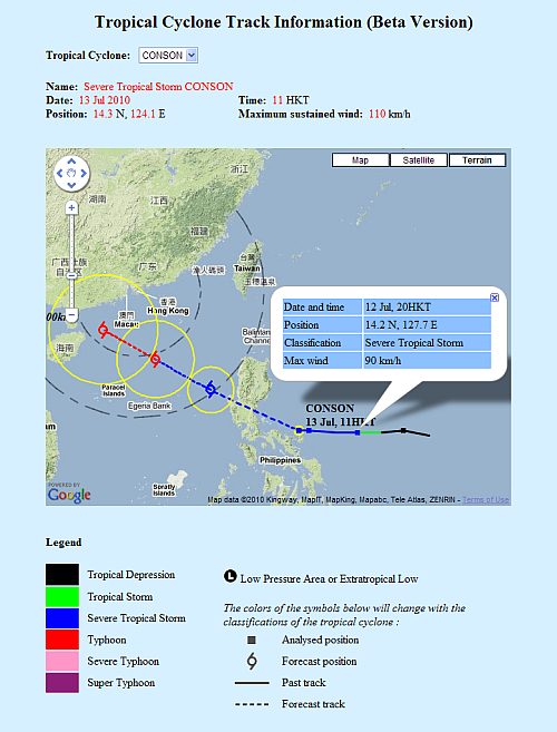
Whenever there is a tropical cyclone approaching Hong Kong, the tropical cyclone track webpage usually becomes one of the most popular pages in the Observatory website. To enable the public to identify more easily the areas which may be affected by tropical cyclones, the Observatory launched a new tropical cyclone track information webpagebased on a geographic information platform today (14 July) on top of the existing fixed-area map version. Users can display tropical cyclone positions and tracks over a detailed map, an aerial imagery or a terrain map. They can also zoom in or out the map and pan to their area of interest. In addition, detailed information of the tropical cyclone, including its latitude, longitude, classification and maximum sustained wind, can be displayed simply by placing the mouse cursor over its analysed or forecast positions. Multiple tropical cyclones can also be displayed on the same map.
|