Satellite Imagery of Interest : Monsoon & TC
14 October 2016
A new Satellite Imagery of Interest is now available on the Observatory's website. The imagery shows the co-existence of the northeast monsoon and Tropical Storm Aere in the vicinity of the coastal areas of Guangdong.
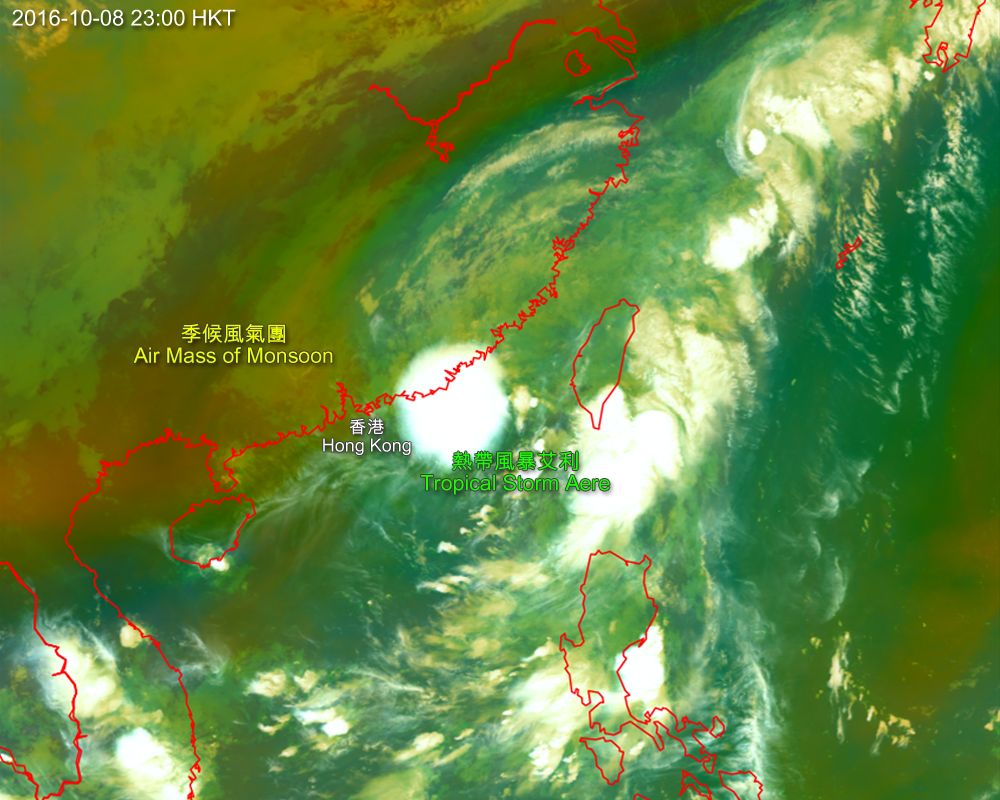
On 8 October 2016, Tropical Storm Aere lingered over the northern part of the South China Sea. During the overnight period, a replenishment of the northeast monsoon, which spread southwards from the north, reached the coastal areas of Guangdong. Multi-channel composite satellite imagery shows the extent of the air mass (brownish yellow) associated with the monsoon. (The imagery was captured by Himawari-8 satellite of Japan Meteorological Agency)
You are welcome to visit the Observatory's Weather Satellite Imagery webpage for details.
http://www.weather.gov.hk/wxinfo/intersat/satellite/sate.htm