Satellite Imagery of Interest: Intertropical Convergence Zone
21 June 2016
A new Satellite Imagery of Interest is now available on the Observatory's website. The imagery shows the Intertropical Convergence Zone (ITCZ).
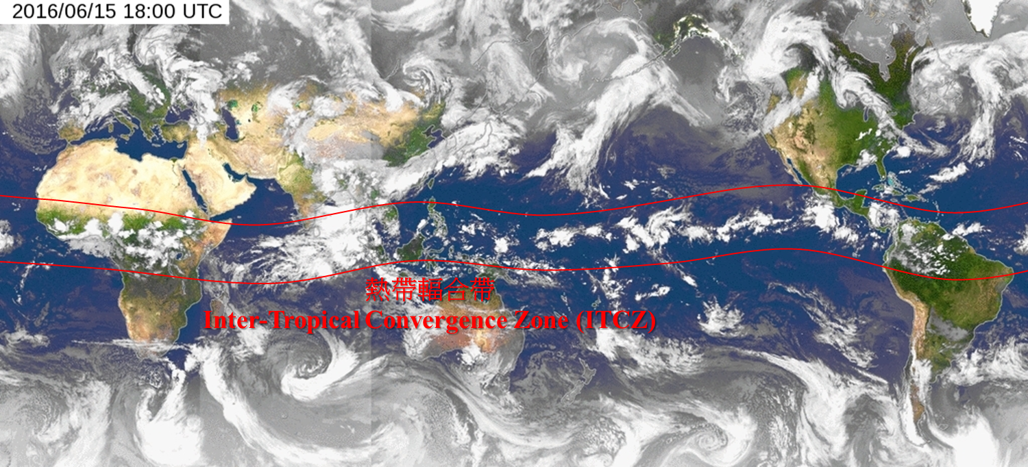
The Intertropical Convergence Zone (ITCZ) is a belt of low pressure between subtropical highs of the Northern and Southern Hemispheres. It moves back and forth near the equator periodically once every year. Air streams converge over ITCZ which fuels development of convective activities and formation of most tropical cyclones. On 16 June 2016, global mosaic satellite imagery showed convective developments over ITCZ. ITCZ will move northwards in the next couple of months, and more tropical cyclones will be formed by a stronger Coriolis force.
You are welcome to visit the Observatory's Weather Satellite Imagery webpage for details.
http://www.weather.gov.hk/wxinfo/intersat/satellite/sate.htm