The Observatory enhances satellite imagery services
15 March 2016
The Observatory enhances its Internet satellite imagery services on 15 March 2016, providing more diversified, detailed and timely regional and global satellite imageries for the general public. Update frequency of satellite imageries covering eastern Asia increases from once every 30 minutes to once every 10 minutes. Visible satellite imageries currently in black and white are also upgraded to true colour. Furthermore, the satellite webpage is enhanced with a new high resolution satellite imagery covering southern China and the South China Sea to show the weather condition over Hong Kong and its vicinity more clearly. The Observatory also integrates the geostationary meteorological satellite data covering other parts of the world to produce a global mosaic of satellite imagery which could help users appreciate the weather worldwide.
Apart from the Observatory's satellite imagery webpage, various types of satellite imageries are introduced on the Geographic Information System (GIS)-powered "Met on Map" webpage, useful for users to get hold of the latest weather development when combining with other weather information.
URL of webpages:
Satellite Imagery webpage:
http://www.hko.gov.hk/wxinfo/intersat/satellite/sate.htm
“Met on Map” webpage:
http://maps.weather.gov.hk/gis-portal/web/index_e.html
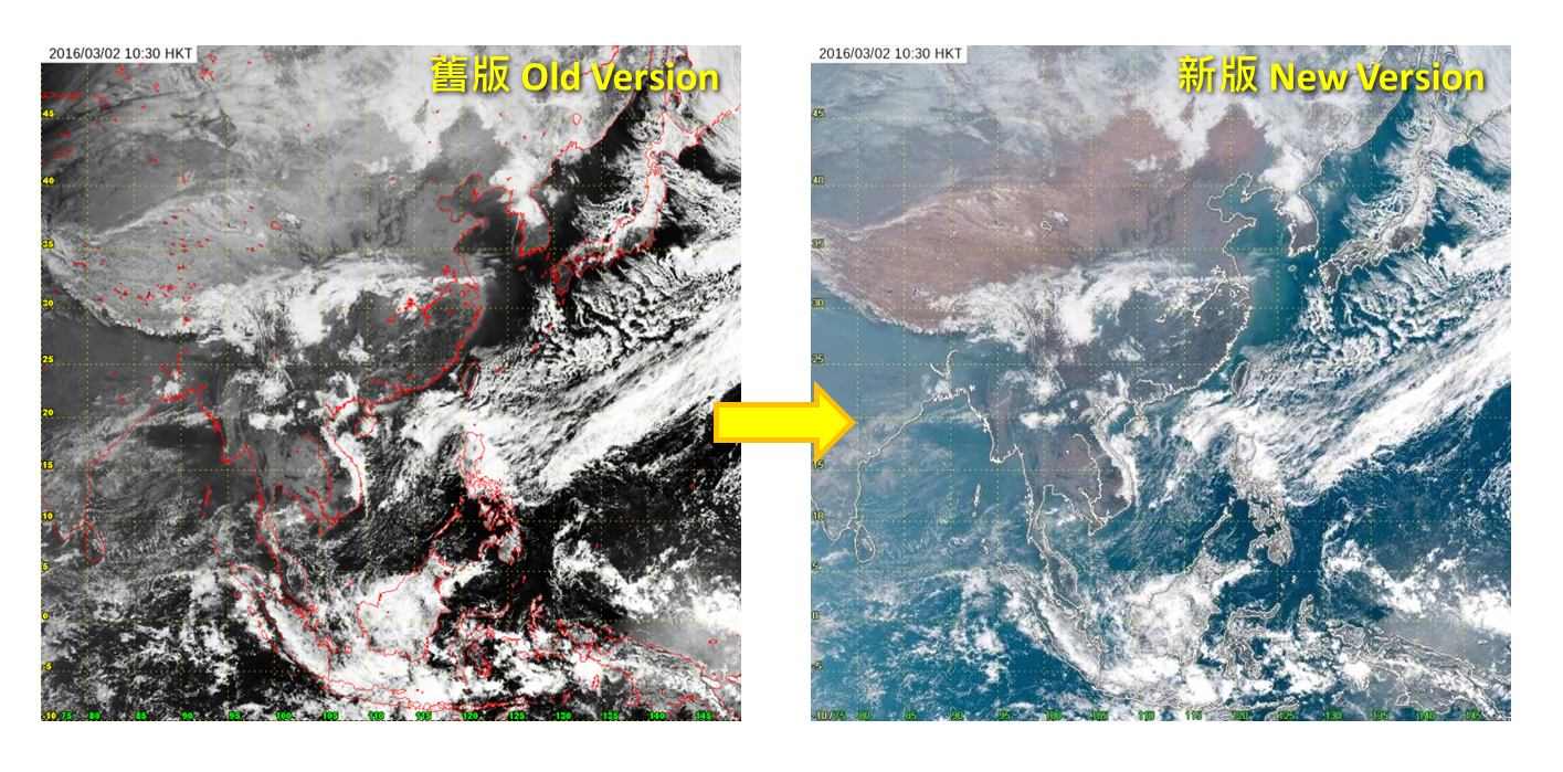
Figure 1 Upgrade of black and white visible satellite imagery to true colour

Figure 2 Addition of satellite imagery covering southern China and the South China Sea

Figure 3 Global mosaic of satellite imagery