The Observatory launches new version of satellite webpage
23 March 2015
The Observatory launches a new version of satellite webpage on 23 March 2015 which aims at providing better regional and global coverages for the public, especially the travellers who would like to appreciate the weather conditions of their destinations, through the extended satellite imageries and large-area satellite imageries covering regions around the world. On the front page, the coverage of the satellite imageries is extended by over 300% to cover a large part of Asia. The animation period of the satellite imageries is also extended from 24 hours to 48 hours. The new frontpage also provides the additional function of presenting the satellite imageries on a Geographic Information System (GIS) platform.
To heighten public interest of weather phenomena and awareness of hazardous weather, the new satellite webpage also includes a regularly-updated gallery which displays past satellite images of interest. For example, the fallstreak hole widely reported by members of the public on 19 January 2015 as seen by the satellite is included in the gallery.
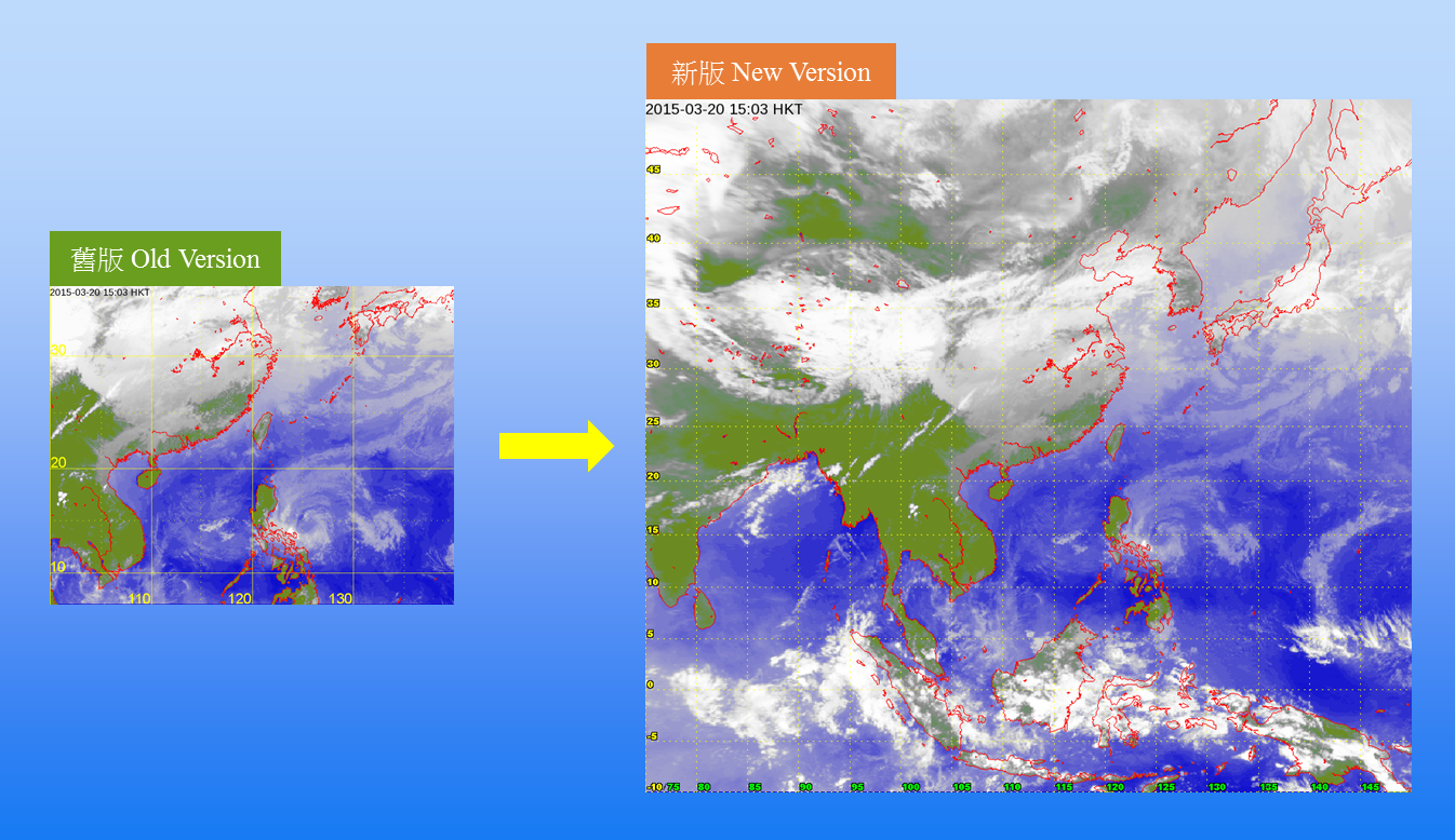
Figure 1 Coverage of the satellite imagery on the front page is extended by over 300%
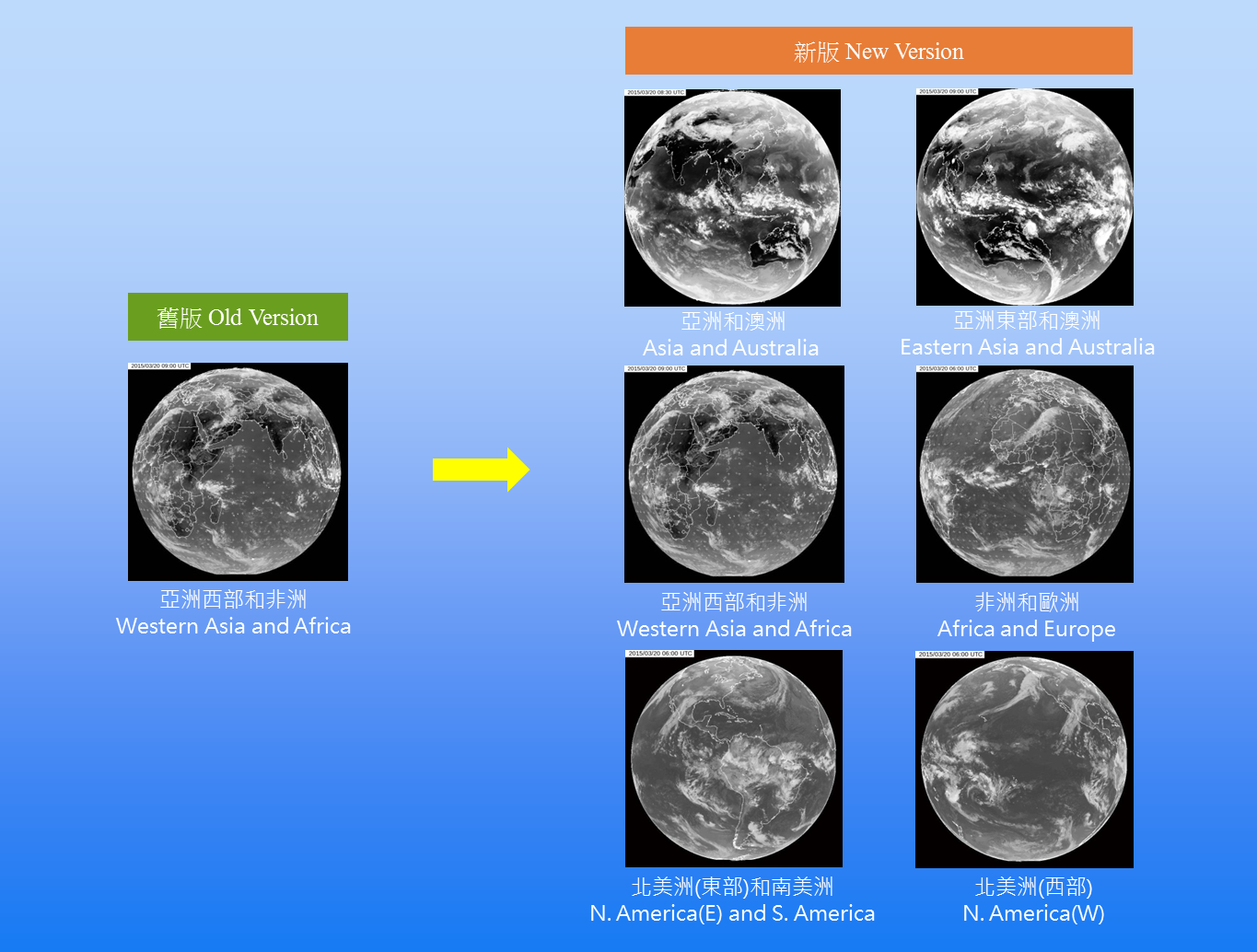
Figure 2 More Global Satellite Imageries
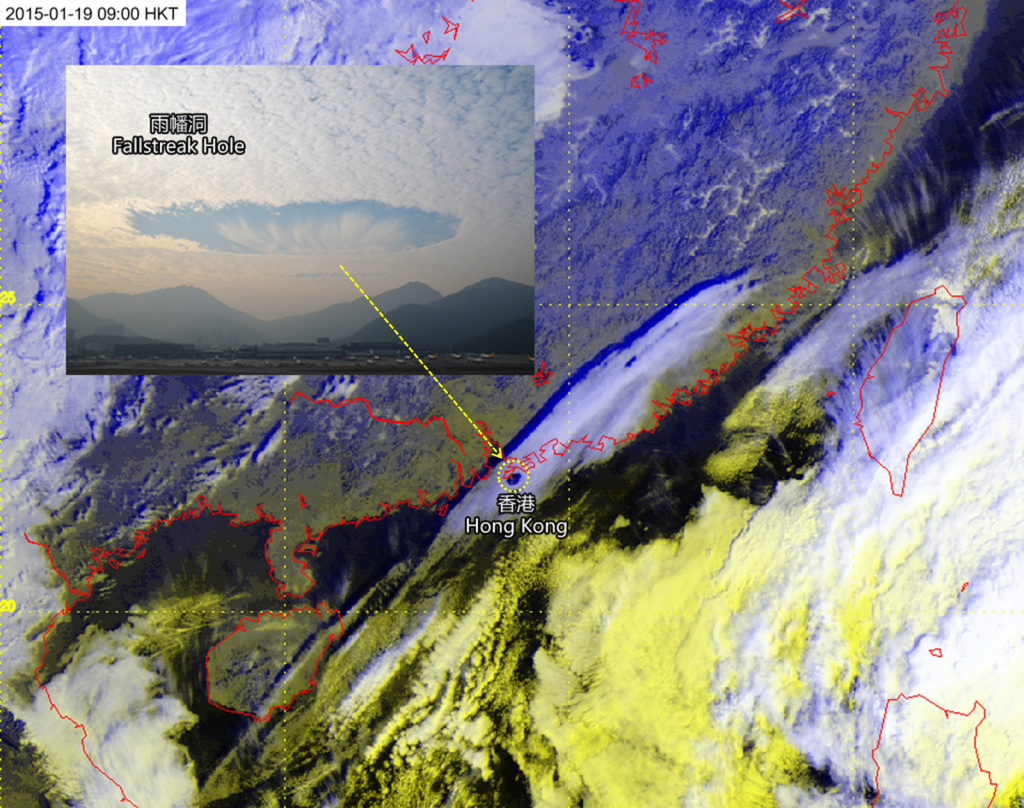
Figure 3 Satellite Imagery of Interest: A rarely-seen fallstreak hole over Hong Kong
URL of webpages:
English version:
http://www.hko.gov.hk/wxinfo/intersat/satellite/sate.htm
Chinese version:
http://www.hko.gov.hk/wxinfo/intersat/satellite/satc_uc.htm