Weather On Wings
 |

|
| Newsletter for the Aviation Community |
 |
Issue No. 20 - November 2003 |
'Aviation Sports' webpage - another Observatory initiative
B.L. Choy
The Observatory has recently developed a new webpage to provide enthusiasts with the latest weather indices for soaring. Local aviation sports societies welcome the initiative. "We are glad that the Hong Kong Observatory provides weather information useful to the soaring communities", said a radio-control soaring society in Hong Kong.
Aviation sports activities, including paragliding and model sailplane soaring, are becoming more popular in Hong Kong in recent years. Before flying, glider and sailplane pilots may be interested to know if there is adequate lift due to upward air currents. The Observatory routinely calculates two commonly used weather indices which are useful for estimating the soaring conditions, namely the Thermal Index and the Soaring Index. The calculations are based on the latest weather observations made aloft from a balloon released at the King's Park Meteorological Station. For further details on how the indices are defined or how they are to be used, the reader may like to visit:
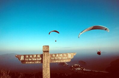
Figure 1: Local aviation sport enthusiasts enjoying the fine soaring weather
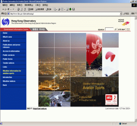
Figure 2: The newly launched "Aviation Sports" Webpage
Further international recognition
Mr. C.M. Shun, Senior Scientific Officer of the Hong Kong Observatory was elected Vice Chairman of a Sub-group of the International Civil Aviation Organization (ICAO) at its meeting held in Bangkok in July 2003. This followed an earlier appointment of Ms. Sharon Lau, Senior Scientific Officer, to serve on the Management Group of the Commission on Aeronautical Meteorology of the World Meteorological Organization (WMO).
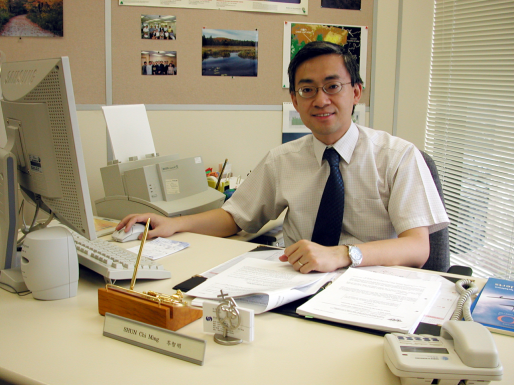
Figure 3: C.M. Shun, Senior Scientific Officer
The establishment of a Vice Chairman post followed the growing importance of weather information in civil aviation. As Vice Chairman, Mr. Shun was responsible for all matters associated with aeronautical meteorology in the region.
It was the first time an HKO officer presided at meetings of the ICAO. Since 2001, Mr. Shun has been the chairman of a technical task force under the Sub-group. "I am honoured to be elected Vice Chairman. The recognition given to me by ICAO is a result of Observatory colleagues working tirelessly in recent years. I would like to take this opportunity to further the development in aeronautical meteorology for the region," said Mr. Shun.
Mr. Shun started to work in aeronautical meteorology at the Observatory in 1993. He was responsible for the installation of the Terminal Doppler Weather Radar, introduction of the LIght Detection And Ranging (LIDAR) system to the airport, as well as research into the windshear causes and improvement to the alerting methodology at the airport. In early 2003, he contributed an article on Hong Kong International Airport's windshear and turbulence alerting service to the ICAO Journal, establishing the Observatory's forerunner position in international aviation weather service.
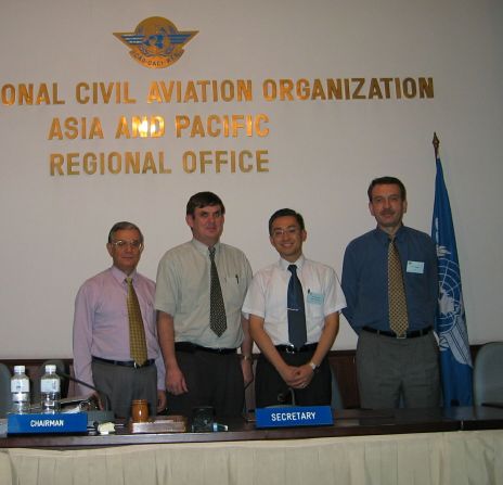
| figure 4: | At the meeting (from left to right) : Mr. K.P. Rimal (ICAO Regional Officer, CNS), Mr. Jeffrey Bollard (Chairman of CNS/MET Sub-Group), C.M. Shun, Mr. Dimitar Ivanov (ICAO Regional Officer, MET) |
International Accolade
Mr. C.Y. Lam, Director of the Hong Kong Observatory, has recently been elected Vice President of Regional Association II (Asia) of the World Meteorological Organization (WMO). He will hold the position until the next session to be held in Hong Kong at the end of 2004. The position was previously held by Dr. H.K. Lam, the Observatory's ex-Director.
Mr. Lam felt honoured to be elected. He said "This represents recognition of the Observatory's work by Asian countries and reflects the Observatory's image in the international meteorological community, and is a result of years of hard work by colleagues."
The main responsibility of Regional Association II is to coordinate meteorological and related activities within Asia and to ensure that these go hand in hand with other regions of the world.
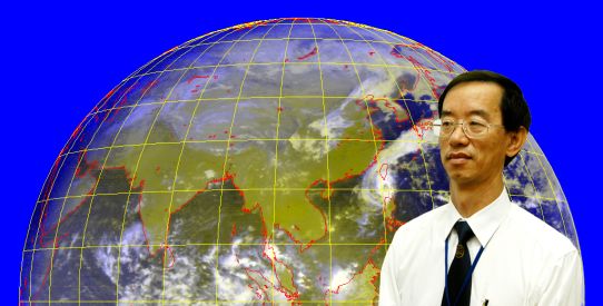
Figure 5
Outreach
__________
Why Pilots Carry Extra Fuel
Captain Brian Greeves (Hong Kong Airline Pilots Association)
I remember having a very pleasant lunch with the previous director of the Hong Kong Observatory, just after he took up his post. He asked me what the HKO could do to help the pilots. I answered very simply, "Please give us accurate forecast". I was not trying to be facetious or even rude, but to emphasise how important it is to the pilot to know what the weather will really be like. I have subsequently made a presentation called the "Anatomy of a Flight" to some of the forecasters and HKO staff.
Take-off
Payload may be reduced. The aircraft may be adversely affected by crosswinds, tailwinds and windshear and turbulence. Maximum engine ratings may be required. Aircraft may not be able to take-off. There may be delays resulting from Low Weather Minima Operations (LWMO)
Planning Stage
More fuel required for destination, alternate and en-route airports
May not be able to do local training at Macau and Shenzhen
May not be able to fly Extended Range Twin-Engine Operations (ETOPS)
May require re-routing of the flight
En-route
Weather avoidance, strong winds and turbulence may result in extra track miles or in descending to a lower level causing a higher fuel burn and additional flight time. Ultimately, this may cause the aircraft to be unable to make its original destination. These conditions can also prevent the cabin crew from carrying out the in flight service and, more importantly may cause injury to the passengers or crew.
Destination
Adverse weather (rainstorms, strong winds and wind shear, low visibility etc.), may cause holding and there may be LWMO in progress with further delays. These conditions might also result in go-arounds and diversions to other airports. There will be an affect on all aircraft movements with subsequent delays. Some of these conditions can also be potentially hazardous.
Travel to and from airport
The issuing of typhoon signals and the associated weather can cause delays for crew, passengers and freight resulting from the difficulty of getting to and from the airport.
In summary, the actual and forecast weather affects pilots at every stage of the flight. This is why the International Federation of Airline Pilots Associations (IFALPA) and the local pilot associations value the chance to participate in the various meteorological forums in Hong Kong and internationally. It also has been a privilege to collaborate on a number of projects, the most recent being the publication of the HKO/IFALPA booklet on "Windshear and Turbulence in Hong Kong". Let me just end by thanking the director, C.Y. Lam, and all of you in the HKO, on behalf of the pilots, for your efforts in helping to make our job safer and more efficient.

Figure 6: Captain Greeves is excited about the uplinking of more weather information to the cockpit
Kind words from aviation users
We are happy to hear further favourable comments from users:
"I find this newsletter an excellent resource. I would like to extend my thanks and congratulations on the great service you provide to the aviation safety community ... Specifically, your work on wind shear which was summarized in the June issue is excellent information ..." - from an airline.
"[The Observatory's on-line weather information system, (AMIDS)] is an excellent weather web site ... The data provided is very accurate and updated ..." - from another airline.
Electronic outreach
S.T. Chan
The Hong Kong Observatory recently launched an electronic news bulletin on its web site for aviation users. The aim is to enhance communication of the latest news on aviation weather services to the international community. Topics covered include new products and services, equipment development, special weather phenomena observed at the Hong Kong International Airport, coming meetings, latest publications and research results.
Those interested in receiving the bulletin are welcomed to register at:
http://www.weather.gov.hk/en/aviat/outreach/register.htm
Registered users will be provided with news updates via email. For a favour of the bulletin, please visit:
http://www.weather.gov.hk/aviat/outreach/index.htm
Figure 7: Wind barb display for winds around HKIA
New products and service development
____________________________________
Webpage on common weather instruments
T.L. Cheng
Do you know how the Observatory measures wind, rain, clouds and other weather elements?
Following the release of a webpage on different cloud types last year, we have launched a new webpage this year to introduce common
weather instruments. Besides the measurement of wind, temperature, humidity, pressure and rain, this webpage covers instruments
for determining the visibility and cloud-base height. There is also a quiz to test how much you know about the subject. Please visit:
http://www.weather.gov.hk/en/aviat/edu_inst/clfcmi.htm
Webpage on different types of cloud in Hong Kong:
https://kids.weather.gov.hk/V2/eBook/ebook_cloud/ebook_shelf_e.htm
Enhancement on AMIDS for the aviation community
W.H. Lui
The Observatory's AMIDS (Aviation Meteorological Information Dissemination System) has been given a
face-lift since mid-July 2003. It incorporates user-friendly features to ease surfing.
The radar images are now updated more frequently than before. Also, the radar image display has been enhanced with overlays of air-route
and check-point maps. This enables airline users to better visualize the location and movement of rain areas in relation to their reference
points.
Figure 8: AMIDS' new look
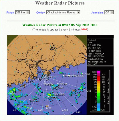
Figure 9: Radar image overlaid with air-route/check-point maps
Radar pictures on the Observatory website
Paul K.L. Ho
The Observatory presents radar pictures with rain intensity information on its website since mid-2003.
The site address is:
http://www.weather.gov.hk/wxinfo/radars/radar.htm
The picture is updated every 12 minutes and covers a range of 250 kilometres from Hong Kong, encompassing the south China coastal areas
and the northern part of the South China Sea. The rain intensity is represented by different colours as shown in the inset.
Since its launch, the service has received over 2 million visits as well as favourable comments from the public. Here are some feedback:
"The new images show more clearly the intensity and movement of rain echoes near Hong Kong which are useful for the monitoring of heavy rain
and tropical cyclones. Please keep up the good work", from Mr. Clarence Fong of the Weather Underground of Hong Kong.
"...When Imbudo entered within 256 kilometres of the Observatory's radar [coverage], we could clearly see the true face of Imbudo..."
from Mr. Alan Chui of the Storm-Chaser Electronic Monthly.
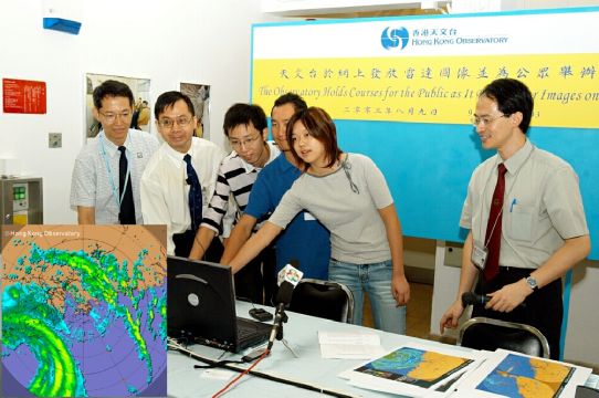
| figure 10: | The Observatory's B.Y. Lee (2nd from the left), C.C. Chan (1st from the left) and C.M. Cheng (1st from the right) launching the radar picture website with participants of the radar and satellite picture interpretation class in August 2003. Inset shows the radar picture taken in the morning of 24 July 2003, with the centre of Typhoon Imbudo at about 250 km southwest of Hong Kong |
Weather observations at the airport
___________________________________
Waterspout!
S.Y. Lau
Apart from lightning, perhaps no manifestation of weather is as frightening as the sight of a tornado or waterspout, a slender twisting funnel cloud that snakes its way to the ground or sea surface. July 2003 broke the Observatory's record with 4 waterspouts sightings in a month. On two occasions, the observers at the Airport Meteorological Office observed waterspouts over the waters separately to the west and north of the airport. The photo below was taken by the Observer on 31 July 2003, showing a waterspout just behind the Hong Kong Aircraft Engineering Company Limited (HAECO) building. Another funnel cloud was visible to the left.
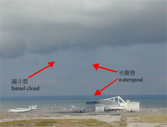
Figure 11
Lenticular cloud over Lantau
C.M Shun
Mountain wave cloud (also known as lenticular cloud, i.e. lens shaped) was observed on the hilltop
of Lantau on 12 August 2003. The picture was taken at around 2:20 p.m. that afternoon at the Hong Kong International Airport looking
south-southeast towards Lantau with a setting of 1/160s, F8.0 and ISO-100 speed. At the time winds were light to moderate southerly,
with showers just passing over Lantau an hour earlier.
Lenticular clouds are evident of wave motions in the airflow over and to the lee of mountains, where moisture in
the air condenses into water droplets as a result of the upward motions. They are more often observed in the cool season
when the air is more stable. However, in this case, it was a little unusual that lenticular clouds were observed on a summer day.
It is believed that a weak stable layer (an 'inversion' in weathermen's terminology) at around the hilltop level might have
contributed to the cloud formation.
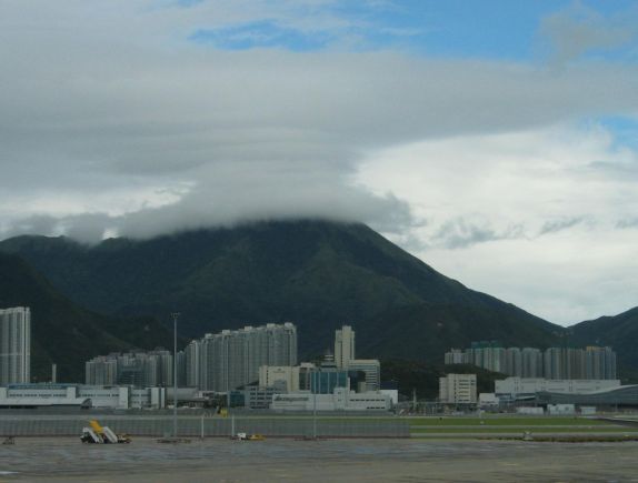
Figure 12
Over the rainbow
L.O. Li
A beautiful double rainbow was observed at the airport in the morning of 26 July 2003. How did it come about? A rainbow is produced when sunlight coming from behind the observer is refracted and then reflected by raindrops in the air. Sometimes the sunlight is reflected twice in the raindrops, forming a secondary rainbow outside the primary rainbow. The second reflection also reverses the order of the colours in the rainbow, with violet now appearing on the outside and red on the inside. Moreover, compared with the inside it is noticeably dimmer on the outside of the primary rainbow.
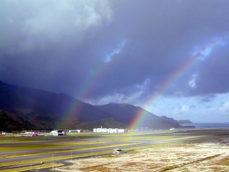
Figure 13 Double rainbow over Chek Lap Kok on 26 July 2003
(Photo: Courtesy of Mr. S.T. Chow)
Severe weather
________________
Gust-front windshear observed by LIDAR
B.L. Choy
In the evening of 4 August 2003, a gust front crossed the Hong Kong International Airport,
bringing windshear of 40 knots (74 km/h) as reported by a landing aircraft. However, wind measurements on the airfield only indicated a
20-25 knots (37-46 km/h) windshear. Why was that?
Before finding a reason, let's first look at what a gust front is and the weather that day.
A gust front is the leading edge of cooler air which rushes down and then spreads out from a thunderstorm.
An aircraft flying through it may encounter increased headwind and lift, resulting in windshear (Figure 14).
Shortly before 8 p.m., a gust front swept across the airport from the east and reached the waters
to the west, bringing with it strong northeasterly winds. Convergence of the northeasterlies with the background southwesterlies resulted
in a headwind change of only 20-25 knots as estimated from airfield winds (Figure 15).
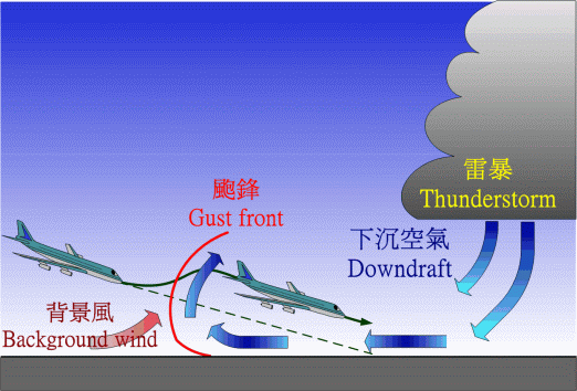
Figure 14: Schematic diagram of a gust front
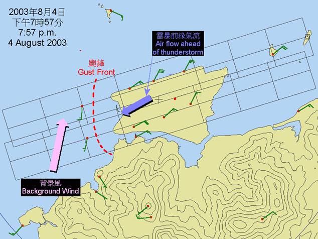
Figure 15: Winds around the airport at 7:57 p.m., 4 August 2003
As the fust front carried little rain, the Observatory's LIDAR (LIght Detection And Ranging) system was
very suitable for elucidating the wind pattern aloft, i.e. the winds as experienced by an approaching aircraft.
A near-horizontal LIDAR scan showed some windshear across the gust front (Figure 16). However, the significant windshear
was not revealed until we take a look at LIDAR data aligned closely to the flight path, which indicated a windshear of some 37 knots
(69 km/h) between 900 ft (270 m) and 600 ft (180 m) (Figure 17). This was very close to what the aircraft pilot observed.
LIDAR data is currently used by the aviation forecaster in day-to-day windshear alerting. In this gust front case, the forecaster was
able to issue a windshear alert giving 20 minutes of forewarning prior to the first aircraft reporting encounter of windshear.
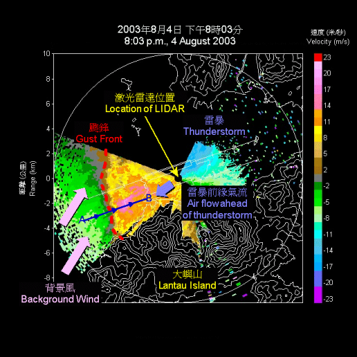
Figure 16: LIDAR image taken at 8:03 p.m. on 4 August 2003
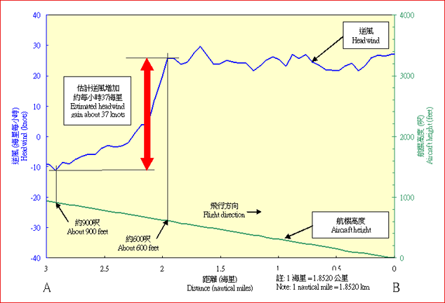
| figure 17: | Headwind along the scheduled flight path from points A to B (see Figure 3), as estimated from LIDAR data |
Typhoon Dujuan - a typhoon with double eye-wall
Edwin W.L. Ginn
Typhoon Dujuan exhibited a double eye-wall structure when crossing the northern part of the South China Sea on 2 September 2003.
The eye-wall is the innermost ring of intense convection near the centre of a typhoon, containing devastating winds and fierce rain.
While most typhoons have a single eye wall, some mature and strong typhoons develop a double eye-wall structure.
In the western North Pacific, the development of typhoons with double eye walls is not uncommon. It was observed in Typhoon Kujira (2003),
in Typhoon Kirogi and Typhoon Kai-tak (2000), in Typhoon Winnie (1997), in Typhoon Dinah (1987), in Typhoon Hope (1979) and in Typhoon Elsie
(1975).
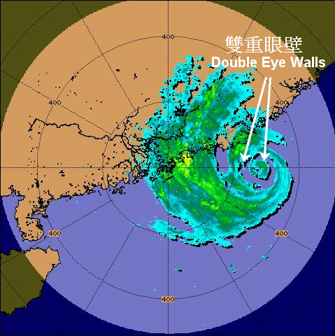
| figure 18: | Figure 18: Radar echoes captured at 1:05 p.m., 2 September 2003, showing the double eye walls of Typhoon Dujuan |
LIDAR scans low to capture windshear near ground
Olivia Lee
In the previous article on page 8, we have discussed the usefulness of LIDAR in gauging the winds aloft.
What happens if the weather phenomenon is shallow, i.e. occurring only near the ground?
A case in point is very shallow winds bringing windshear close to the ground. This was what happened in the early afternoon of 17 August 2003.
At around 2 p.m. that day, a convergence line (put simply, a line demarcating opposing winds) was observed to the west of the airport (Figure 19).
An aircraft approaching from the west reported experiencing a 15-knot windshear while landing on the northern runway.
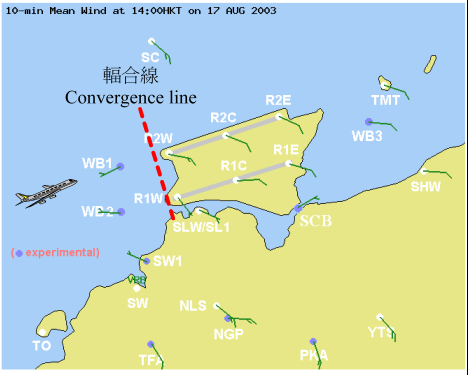
Figure 19: A convergence line was observed to the west of the airport
At the time it was relatively rain free. This made the LIDAR suitable for determining the wind pattern over
the airport. Indeed, the convergence line was well captured by a low scan of the LIDAR, i.e. a horizontal scan at zero degree elevation
(Figure 20), which shows westerlies meeting southeasterlies over the western part of the airport. If we look at a vertical profile across
the line AB in Figure 21, the change in the wind speed with height is evident (Figure 21). In particular, relatively strong westerlies were
shallow and confined near the ground, while winds aloft were lighter. As determined from LIDAR data, this resulted in a headwind gain
(i.e. windshear) of around 16 knots as the aircraft descended towards the airfield. The LIDAR had enabled the Observatory forecaster to issue
a windshear alert well in advance that afternoon.
The forecaster at the airport now makes use of wind information from both vertical and horizontal scans of LIDAR. Work is in progress
to further automate the windshear alerting using data from the LIDAR.
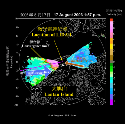
Figure 20 : The convergence line was well captured by a low scan of the LIDAR
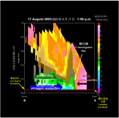
| figure 21: | A vertical profile across the line AB in Figure 2 shows the change in the wind speed with height |
Airport Meteorological Office
___________________________
Facing a storm
S.Y. Lau
Luzon, Philippines - 22 July 2003: Typhoon Imbudo swept through Luzon, leaving 22 dead and hundreds injured in its trail.
At the international airport in Hong Kong, Airport Authority (AA) called up the Hong Kong Observatory (HKO) for an emergency
coordination meeting with aviation users to ensure that everybody was geared up for the fast-moving storm. The arrangement
to brief users whenever Tropical Cyclone Warning Signal No. 8 is in effect was started in 2001. However, because of Imbudo's exceptional
speed, this was the first time ever that HKO provided a briefing even ahead of the Standby Signal No. 1.
Hong Kong International Airport, Chek Lap Kok - 23 July: Imbudo continued to head towards the coast of Guangdong. The Standby Signal No. 1
was issued on the previous night. After another briefing in the morning, HKO maintained close liaison with users throughout the day and
into the night. With the Tropical Cyclone Warning Signal No. 8 issued at 10:40 p.m., AA's Airport Emergency Center (AEC) went into full
gear as Imbudo started to unleash its full fury.
Hong Kong International Airport, Chek Lap Kok - 24 July: Despite cancellation of the Tropical Cyclone Warning Signal No. 8 at 8:15 a.m.,
Imbudo brought increasing crosswinds to the airport. Unfazed, HKO continued to provide weather updates to users well into midday and
attended a joint media briefing with AA to cover the delays experienced by airliners.
Typhoon Imbudo, an intense storm, passed without wrecking much havoc at the airport. From the weather point of view, there are two
factors that count. First of all, the increasing crosswinds at the airport after Imbudo's passage over Hong Kong were well anticipated.
More importantly, despite a fairly accurate forecast this time weather forecasting remains an inexact science, and it would be in the best
interest of aviation users to closely monitor the weather situation. To this end, the Observatory's online Aviation Meteorological Information
Dissemination System (AMIDS), which presents the latest weather information (including that for tropical cyclones) from the Observatory and
from overseas weather centers and sources, is a very handy tool.
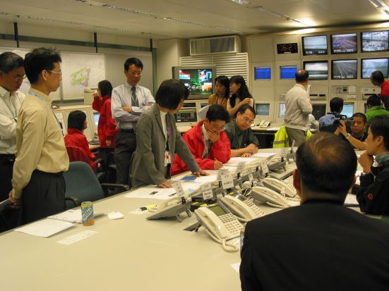
| figure 22: | Ms. S.Y. Lau (middle) briefing users at the Airport Emergency Centre on 23 July 2003 as Typhoon Imbudo approached |
"Glory"
B.Y. Lee
The photo, taken in the morning of 13 September 2003 during a flight from Kunming to Lijiang, China, shows the shadow of an airplane on the clouds. The shadow was surrounded by alternating reddish and bluish rings. This is an optical phenomenon known as "glory" and results from sunlight being reflected ("diffracted" in the physicist's term) back by water droplets in a cloud. It may also be seen from an elevated position on the ground, for example on a hill, when the sun casts the shadow of an observer onto an underlying layer of low cloud, mist or fog.
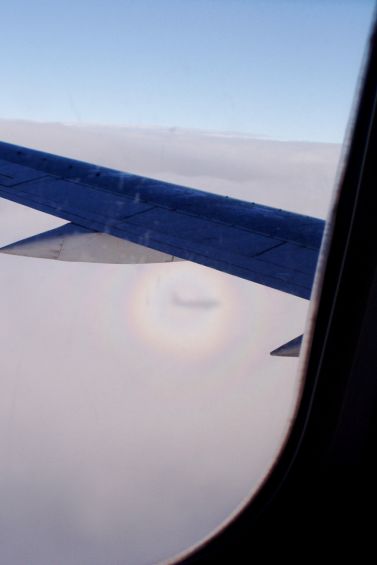
Figure 23
Observatory gets Community Chest award
Do not think of the Observatory staff as just a bunch of professionals doing meteorology. They also have a very strong social mind. The Observatory is very pleased to have won the 2002/2003 "Highest Per Capita Contribution Award", out of all government departments competing in the Community Chest "Community Assistance Raised by Employees (CARE)" Scheme.
Figure 24
Blackout? No panic!
Steve K.K. Chan (Electrical and Mechanical Services Department)
In mid 2003, electrical blackouts occurred in a number of major cities and affected communities there.
If a similar blackout happened in Hong Kong, would it affect the power supply to the Observatory's Airport Meteorological Office (AMO)?
AMO is situated in the Airport Traffic Control Complex (ATCX). Three 1,200-kilowatt diesel generators are installed there to provide sufficient
backup power to ATCX. When a power interruption occurs, the generators will automatically start up within fifteen seconds and provide full
emergency power to the facilities in ATCX including AMO.
Mr. K.F. Yeung, the Engineering Services Manager (Civil Aviation)
of the Electrical and Mechanical Services Department (EMSD) said, "The generators are tested regularly to ensure they are ready
for production. Besides, there are facilities in ATCX for connection to mobile generators. We run drills with the power company
to ensure that their mobile generators can be connected to our power distribution system quickly." "For AMO," Mr. Yeung added,
"a spare power distribution system is also installed. If the main distribution system failed, our staff would switch over to using the backup
system within a short time to maintain the power supply."
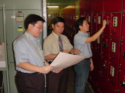
| figure 25: | Mr. Steve Chan (first left) and Mr. K.F. Yeung (middle) conducting a load test of the power distribution system |
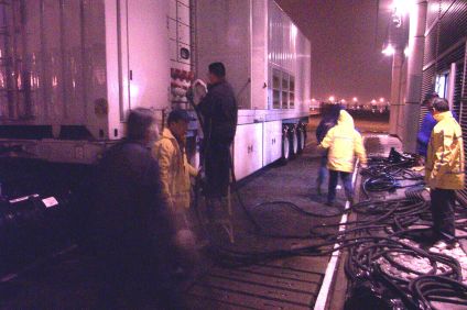
| figure 26: | EMSD staff conducting a drill to connect the mobile generator to the power distribution system of ATCX |
Meetings and visits
______________________________________
Visiting Guangzhou
Sharon Lau
Ms. Sharon Lau (Senior Scientific Officer, middle) pictured here with representatives from Air Traffic Management Bureau of Middle and Southern Region of China on the grounds of the new Guangzhou Baiyun International Airport in mid-July 2003. During her visit, Sharon presented the Observatory's work and shared experience on the transition of the Observatory's Airport Meteorological Office to Chek Lap Kok in 1998.
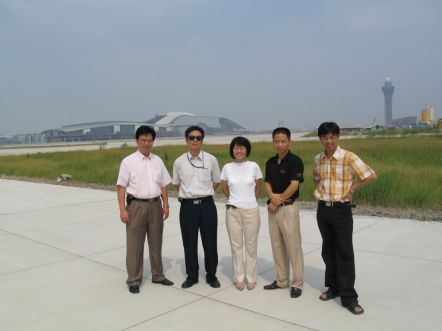
Figure 27
Course on Interpretation of Radar and Satellite Images
K.C. Tsui
To coincide with the release of radar images on the Internet, the Observatory conducted a basic course on weather radar and satellite images several times in August and September 2003. The purpose is to introduce the operating principles of these instruments and the interpretation of their images. Conducted separately for the general public and Government departments, the course was very well received, with more than a hundred citizens and 160 colleagues from 27 departments attending.
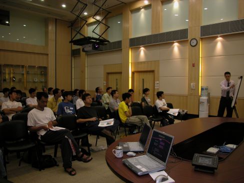
Figure 28 :Participants listened with their eyes open to the operating principles of a weather radar
Visit by the mainland radar experts
A delegation of radar experts from China Meteorological Administration, pictured here at Tai Mo Shan radar station with Observatory staff, visited the Observatory in early September. There was active sharing of experience on the maintenance and application of weather radars, and further strengthening of co-operation on technical matters.
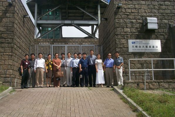
Figure 29
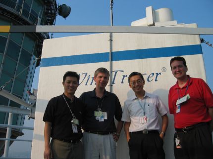
Visit by United Parcel Service (UPS)
UPS visited the Airport Meteorological Office on 30 September 2003 to know more about the Observatory's work on windshear and other services provided by the Observatory at the Airport.
| figure 30: |
Left to right: UPS's Messrs Jack Wong, James Mayer, the Observatory's C.M. Shun and UPS's Timothy Crook |
Weather on a special day
Would you like to find out the weather information of a special day in the past, such as your son's birthday,
or your daughter's wedding day? Please visit the following webpage of the Observatory:
http://www.weather.gov.hk/wxinfo/climat/specialday/html/select_e.shtml
Simply input the date. The weather information such as the temperature range, duration of sunshine, the amount of rainfall and any
tropical cyclone warning/rainstorm warning issued, will be displayed. You can also create a special greeting card using the webpage
and put in words appropriate for the occasion. The data period spans more than 100 years from 1885 to 2002, apart from a break
from 1940 to 1946 due to World War II.
Quiz on aviation weather
|
1. |
Which type of cloud is associated with thunderstorms? a. cirrus |
4. |
What is a Doppler radar being used for?
a. to measure the speed of aircraft | |
|
2. |
What is the use of a ceilometer? a. to detect whether the cloud is rain bearing |
5. |
What is the minimum wind speed of a typhoon? a. 62 km per hour or below (33 knots or below)
| |
|
3. |
We call it 'fog' when the visibility falls below - a. 7000 m |
6. |
Which of the following is not a "greenhouse" gas? a. Nitrogen | |
Staff matters
__________________________
Practice makes perfect
Y.T. Wong
Our electronic maintenance team has successfully assembled a wind profiler and installed it at
the Cheung Chau Meteorological Station in May 2003.
The wind profiler monitors wind conditions of the lower atmosphere using the
"Doppler effect". It sends out pulses of radio waves and measures the frequency of waves reflected by small eddies in the atmosphere.
The shift in frequency in the reflected waves gives the velocity of these eddies, thus producing a measurement of the wind.
Using the profiler, the Observatory keeps a close and continuous watch of wind conditions above the airport.
With the experience accumulated in three other set-ups at Sham Shui Po, Sha Lo Wan and Siu Ho Wan, we completed the assembly
and installation of this profiler with relative ease, not requiring external assistance. The profiler components weighing over 100 kilograms were
first transported to Mui Wo Pier to board a boat to Cheung Chau. They were then loaded onto 2 tri-wheel lorries to the station which is on top
of a small hill. The wind profiler was installed, and switched on the following day. Testing of the equipment was very smooth, and several days
of toil and fatigue were not for nothing.
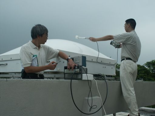
Figure 31:Y.T. Wong (left) and colleague S.T. Chan testing the wind profiler antenna at Cheung Chau
A fulfilling summer vacation
Jeff Yung
I am Jeff, a second-year student majoring in Computer Science and Information System at the University of Hong Kong. During this year's summer vacation, I was lucky to find employment at the Hong Kong Observatory as an intern. My work involved the development of software for aviation meteorological systems. It was the first time that I worked in a Government department and to apply my know-how in computers. I used Java language to prepare programs for the archival and processing of data from the Observatory's wind profilers and ceilometers. The products were displayed graphically so that forecasters could monitor more easily the vertical wind field and cloud-base height in real-time.
Although the work lasted for just six weeks, I truly felt the importance of "putting theory into practice". Apart from gaining valuable work experience, I also made friends with Observatory staff and other interns. Furthermore, the knowledge I gained in meteorology had stimulated my interest in science.

Figure 32: Mr. Jeff Yung tackling a myriad of weather information at the Observatory
ISO certification - 1st Anniversary
Observatory staff at the Airport Meteorological Office shouted "hurray" one year after ISO certification of its aviation weather service in 2002. The Observatory is the world's first weather service to have obtained the ISO award after the implementation of the relevant ICAO (International Civil Aviation Organization) recommendation in 2001.
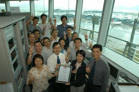
Figure 33
New accommodation
Mr. C.Y. Lam, Director of the Hong Kong Observatory (third from the left), inaugurated the opening of the annex building to the TDWR (Terminal Doppler Weather Radar) station at Tai Lam Chung on 1 November 2003. Dr. B.Y. Lee, Assistant Director (Aviation Weather Services) of the Observatory (fourth from the left) was also transferred to a new post on that day. His job is taken up by Mr. H.G. Wai (second from the left.
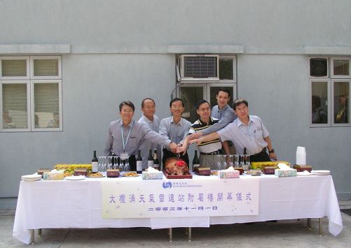
Figure 34
|
Telephone and Fax Numbers | |
|
Enquiry on flight documents |
(852) 2910 6922 |
|
|
|
|
|
|
|
|
|
|
|
|
|
Hong Kong Observatory Home Page | |
|
Web Page for Aviation Weather Services | |
|
http://www.weather.gov.hk/aviation | |
Editor this issue K. H. Cheung | |