Weather On Wings
 |
| Newsletter for the Aviation Community |
 |
No. 18 - December 2002 |
New products and service development
_________________________________________
The Observatory achieves a world first

Sharon Lau
The Hong Kong Observatory (HKO) becomes one of the first weather services in the world to be awarded an ISO 9001 certification in recognition
of its service for international aviation.
The ISO certification follows a recommendation of ICAO (International Civil Aviation Organization) adopted in 2001. The process started with
a consultant, N. Law & Associates, providing the necessary training in late 2001, followed by the establishment of quality documentation
and implementation of a quality management system in early 2002. Thereafter the Bureau Veritas Quality International (BVQI) was commissioned
as the certification body. With the conduct of internal audit by Observatory staff after mid-year, the entire process was concluded with a
successful certification audit in October 2002.
Dr H.K. Lam, Director of the HKO, said that "The Hong Kong Observatory is proud to be one of the first weather services in the world to be
awarded an ISO certification. This could not have been possible without the co-operation and dedication of the staff, as well as constructive
feedback from users of the aviation community".
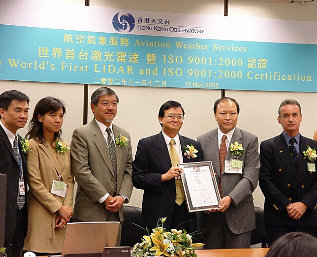
| Figure 1: | Director of the HKO, Dr. H.K. Lam (third from the right) receiving the ISO certificatefrom BVQI's Mr. J.F. Wang, in the presence of representatives from the aviation community |
The first LIDAR in the world
Olivia Lee
A LIght Detection And Ranging (LIDAR) system was successfully installed on the roof-top of the Air Traffic Control Complex one night in late June 2002. This represents the first installation of its kind for airport weather alerting in the world.
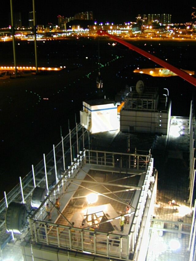
Figure 2 : Lifting of the LIDAR equipment shelter to the roof-top of the Air Traffic Control Complex
In the past, the Observatory made use of the Terminal Doppler Weather Radar (TDWR) to detect windshear in the vicinity of the Hong Kong International Airport (HKIA). Using microwave to measure the movement of rain drops in the atmosphere, the TDWR is capable of detecting windshear in rainy conditions. The newly-installed LIDAR, on the other hand, employs infrared radiation to detect the movement of dust particles or aerosols in the atmosphere. As such, LIDAR operates best in rain-free conditions, unveiling weather phenomena hitherto invisible to the human eye. The combination of the LIDAR and the TDWR will enable more comprehensive detection of windshear at the airport.
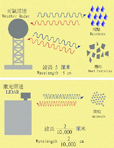
Figure 3: Difference in operating principles of weather radar and LIDAR
The LIDAR is located between the two parallel runways in the HKIA. This facilitates continuous scanning of the airport departure/approach corridors and detection of airstream that may affect the aircraft within 3 nautical miles (5.6 km) of the respective runway touchdown zones. Although still on operational trial, the LIDAR has already captured some interesting cases, such as windshear brought about by sea breezes and tropical cyclones. The Observatory will collect data over a period of time for analysis with a view to optimizing the function of the software. It is expected that the LIDAR would become operational in 2005.
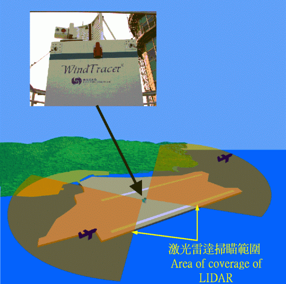
Figure 4: Sketch of the area of coverage of the LIDAR
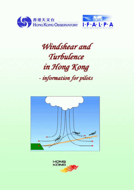
Booklet for pilots
C.M. Cheng
The Hong Kong Observatory, in collaboration with the International Federation of Air Line Pilots' Associations, has prepared a booklet on windshear and turbulence. As reference material for pilots, the booklet covers information on windshear and turbulence, their causes, and the windshear and turbulence alerting service in Hong Kong. To enable wide promulgation of the booklet among pilots and other interested readers, the booklet is available on the Internet for download.
More weather products
L. O. Li
For airline users, there are now more choices of weather related products on the Aviation Meteorological Information Dissemination System (AMIDS). These include:
 |
Wind barb display for winds around HKIA |
|
Winds at a number of places in Hong Kong |
|
Weather reports and forecasts for airports in Asia and Pacific region, Europe and Africa |
|
Satellite images from Meteosat-5 geostationary satellite of the European Organization for the Exploitation of Meteorological Satellite and NOAA (U.S. National Oceanic and Atmospheric Administration) series of polar-orbiting meteorological satellites (NOAA-12,14,15 and 16) |
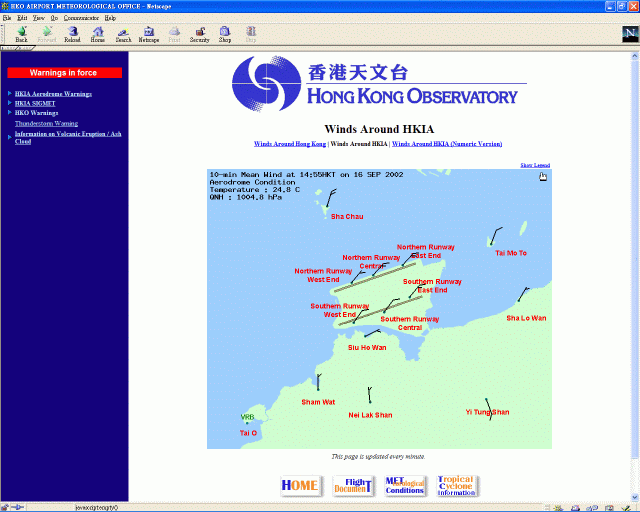
Figure 5: Wind barb display for winds around HKIA
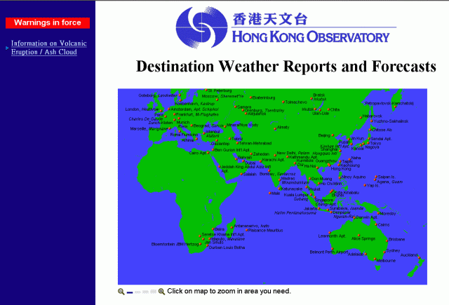
Figure 6: Weather reports and forecasts for airports in the Asia and Pacific region, Europe and Africa
The LIDAR is coming!
Captain Brian Greeves
(Hong Kong Airline Pilots Association)
(This article is reproduced from Flyleaf - Issue 42 with the permission from HKAOA/ HKALPA and Captain Brain Greeves)
Flyleaf is a magazine published by the Hong Kong Aircrew Officers Association (HKAOA) and the Hong Kong Airline Pilots Association (HKALPA).
In the following article published in August 2002, shortly after installation of the LIDAR, Captain Greeves gives us an introduction of the LIDAR and his perception of the equipment from a pilot's perspective.
In my last article (Flyleaf - Issue 41) on the Windshear and Turbulence Warning System, I promised to write something about the LIDAR. I hoped that everyone had forgotten that, but unfortunately I received a note from the editor demanding a piece, so here goes!
First of all, LIDAR is not a new type of lie detection equipment. It stands for LIght Detection and Ranging and is a type of infrared Doppler radar. It works in a similar way as a Doppler weather radar such as the TDWR, but uses an invisible (and safe) laser beam instead of microwaves. Its range of detection is limited by both the line of sight and by the visibility, so whilst the TDWR works best with particles, particularly raindrops, the LIDAR works best in clear skies with very small particles (aerosols).
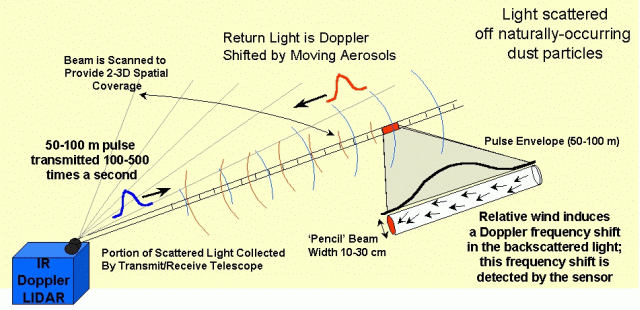
Figure 7 : Infrared Doppler radar (LIDAR) principle of operation
The wavelength of the LIDAR beam is 2 microns compared with 5 cm for the TDWR. This is not a limitation, because it has been bought to assist with the detection of windshear and turbulence in clear air conditions.
It will be sited on top of the ATC Complex and will have a range of about 4.5 nm. It will be able to observe the approach/departure track of all the runways i.e. out to 3nm beyond each runway threshold. This is one of the first installations of an operational LIDAR. Although the LIDAR has been around for sometime, it has previously only been used for research projects/purposes, including determining the wind characteristics around Chek Lap Kok prior to the opening of the Hong Kong International Airport. The problem with these research LIDARs was the scan rate was very slow (about once per 30 minutes) so they were no good for giving real-time information. This LIDAR will not have that limitation. It is still too early to know what its exact performance will be, but if it works, as planned, it will prove to be an excellent enhancement to the WTWS.
The LIDAR will be installed this summer and should be providing data towards the end of the year. Initially, the performance of the LIDAR will be assessed by the Hong Kong Observatory (HKO). It will then be gradually integrated (in 2003), first to assist the forecaster, with the eventual aim of it generating automatic alerts (2005 provisionally).
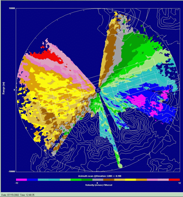
Figure 8: LIDAR wind velocities
The LIDAR is already producing some good data, including the above radar picture showing turbulence with around 5-10 knots loss on the approach to Runway 07. The TDWR (see display below) was taken slightly earlier, when an alert was being generated with a 10-15 knots loss. I know the LIDAR was correct, because I flew the approach at that time.
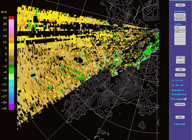
Figure 9: TDWR wind velocities
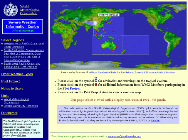
World-wide weather
W.M. Ma
The World Meteorological Organization (WMO) has entrusted the Observatory with developing and hosting two experimental websites for global weather information. The aim is to encourage the media and the public all over the world to make use of official weather information from national weather services.
The "World Weather Information Service" website provides weather information for cities in the world. In the first phase launched in last December, the website mainly provides climatological information for cities. In the second phase, weather forecasts for cities have been added to the website starting from December 2002. The website now provides weather forecasts for over 600 citie
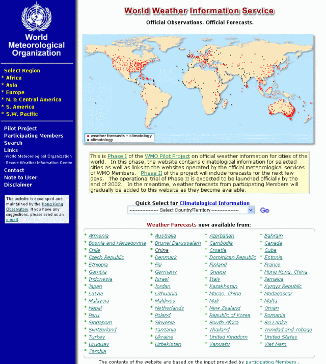
Figure 10: The "World Weather Information Services" website
The other website, the "Severe Weather Information Centre", is dedicated to severe weather information around the world. The website initially provided tropical cyclone forecasts and warnings issued by the national weather services over the northwest Pacific region. Recently, the website has been expanded to cover the southwest Pacific region (e.g. Australia, New Zealand, Fuji, etc). During the passage of Severe Tropical Storm Hagupit over the South China Sea on 11 September, the number of visits to the website exceeded 40 000.
Weather observations at the airport
_________________________________________________________
Haze at Chek Lap Kok
W.H. Hui
Recently there has been a lot of talk in town about the haze in Hong Kong, with visibility reduced in places like Tung Chung over Lantau.
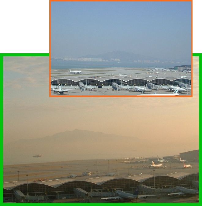
Figure 12: View of CLK, looking towards Castle Peak to the north,on a hazy day in January 2001.
Inset shows what it looks like on a clear fine day.
Haze refers to the reduction of visibility due to the suspension in the air of fine dust or aerosols. The above photographs compare what it looks like on a typical hazy day with that on a clear fine day at Chek Lap Kok (CLK), Lantau.
Let's look at the weather conditions associated with haze at CLK. Weather observations are made by the Observatory's weather observer every hour. From the wind distribution at CLK, as shown in Figure 13, winds blow predominantly from the east.
While winds from the west and northwest are relatively infrequent, the occurrence of haze when winds blow from these directions is anomalously high in comparison with other wind directions. This is clearly shown by Figure 14, which presents the percentage of time haze occurs when winds blow from a particular direction. There is a 1 in 10 chance for haze whenever winds blow from the west or northwest.
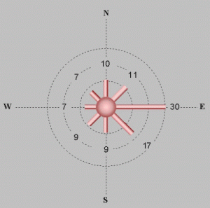 Figure 13:Percentage of time winds blow from a particular direction at CLK during April 1997 & March 2002 |
 Figure 14: Percentage of time with haze at CLK when winds blow from a particular direction in the same period. |
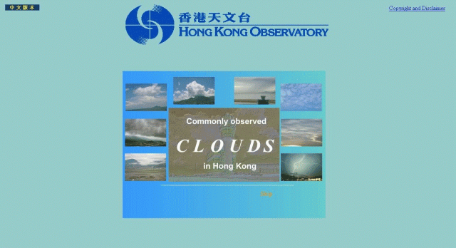
Cloud web page
Sharon Lau and Dickson Lau
Have you noticed that clouds in the sky can take on many shapes? To pilots, clouds provide hints on the weather to come. To help identification, clouds are grouped into families according to their height and shape. If you wish to know more about the clouds commonly observed in Hong Kong, please check out a new Observatory web page on clouds at http://www.weather.gov.hk/education/cloud/index_e.htm.
Mammatus
C.S. Yuen
The picture below shows a special type of cloud called the mammatus. Mammatus clouds consist of bulges or pouches on the underside of the clouds. They occasionally form in the presence of storm clouds - the cumulonimbus.
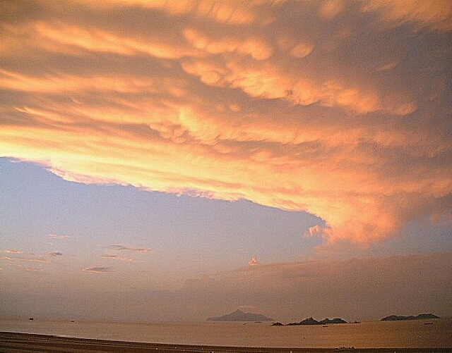
Figure 15: Photograph taken at the Airport Meteorological Office on 18 October 2002
|
Quiz on aviation weather
| |||
| 1. |
Which of the following is easier for aircraft to take off ? (A) Cold weather (B) Warm weather (C) It makes no difference |
4. |
What is the highest number in the Beaufort scale of wind force? (A) 8 (B) 10 (C) 12 |
| 2. |
What effect, if any, does high humidity have on aircraft performance ? (A) It decreases aircraft performance (B) It increases aircraft performance (C) No effect |
5. |
Which of the following covers the largest area? (A) Tornado (B) Severe thunderstorm (C) Typhoon |
| 3. |
Downburst is usually caused by? (A) Thunderstorm (B) Sea breeze (C) Aircraft exhaust |
Answer | |
Severe weather
___________________________
Hagupit playing havoe with the airport
S.T. Chan
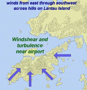
On windy occasions such as the passage of tropical cyclones, strong winds blowing across the hills on Lantau can severely disturb the airflow over the airport.
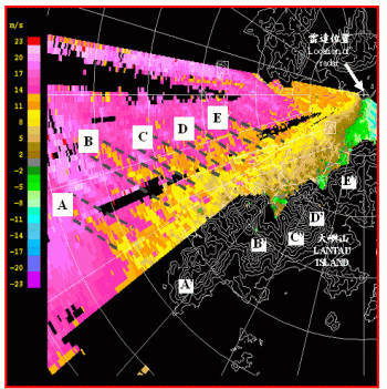
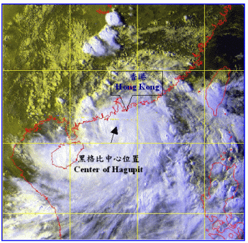
The figure on the left below shows the wind pattern captured by the Terminal Doppler Weather Radar (TDWR) in the afternoon of 11 September 2002 during the passage of Severe Tropical Storm (S.T.S.) Hagupit. Hagupit was located at about 150 km south-southwest of Hong Kong and was on its way towards western Guangdong (Figure 17). Amid the gale-force southeasterlies (represented by the pink pixels in Figure 16), there were streaks of lower wind speeds (orange pixels in regions A to E, bounded by dotted lines). The positions of these streaks corresponded well with the individual peaks on Lantau, marked A' to E'.
Aircraft flying through such regions of alternating strong and weak winds would experience headwind changes reaching as much as 30 knots (56 km/h). More than 20 aircraft were unable to land in the first attempt and had to go around that day. Most of these reported having encountered low-level windshear.
|
|
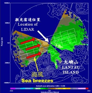
Imagingsea breeze-induced windshear for the first time
S.T. Chan
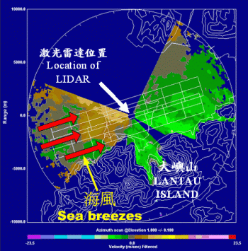
Sea breeze is one of the causes of windshear. Detection of sea breeze is now easier with the installation of a LIght Detection And Ranging (LIDAR) system at the airport.
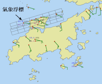
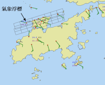
Figure 18 shows the initial development of the sea breeze as observed by the LIDAR near noon time on 21 August 2002. Approaching from the west, the sea breeze could be identified by greenish-colosoutheasterly near noon time. By noon, the wind at the weather buoy to the west of the airport had changed to west-northwesterly (Figure 21), indicating the passage of the sea breeze front edge. It was at this moment that the pilot of an aircraft flying in from Bangkok reported encountering significant windshear just before touchdown, at a point near the front edge of the sea breeze. The Observatory had issued windshear alert before the sea breeze set in that day.
 |
 | ||||
|
|
||||
 |
 | ||||
|
|
Microburst and windshear in Hong Kong
Captain Chris Kempis
(Hong Kong Airline Pilots Association)
(This article is reproduced from Flyleaf - Issue 42 with the permission from HKAOA/ HKALPA and Captain Chris Kempis)
This discussion has been written in the wake of articles on the subject published in two Cathay Pacific magazines, namely Crews News and Kai Talk. Both articles contain useful, pertinent information and are worth taking the time to read. Kai Talk also carries an article on the Virgin Atlantic windshear incident at Chek Lap Kok (CLK) last summer. The following discussion is intended to supplement these publications.
Windshear and, more specifically, microbursts were the aviation safety buzzwords of the 1980s. The period saw several microburst related accidents, with the Delta Airlines Flight191 L1011 crash on approach to Dallas Fort Worth in August 1985 being arguably the final catalyst to change. Windshear (in the same manner as Controlled Flight Into Terrain [CFIT] is considered today) was declared aviation's no 1 accident cause and what followed was a concerted effort by regulators, research agencies, the airlines and the International Federation of Air Line Pilots Associations (IFALPA) to develop procedures and training in: a) windshear and microburst avoidance, and b) maximizing the chances of a successful recovery from these hazards.
As a result we now have in place procedures (mostly memory items) and, more recently, on-board equipment. As professional aviators we know these to be essential tools of our trade.
Microbursts are typically associated with extra-tropical or temperate climates, particularly where these occur over large land masses. What is less expected is the presence of microburst type conditions in the tropical, maritime air mass that is typical in Hong Kong. Yet, these do occur and considerable effort has been expended in achieving a better understanding of these phenomena. The Hong Kong Observatory (HKO) and IFALPA have compiled a booklet titled "Windshear and Turbulence in Hong Kong," intended as guide for pilots operating into CLK. The following is an excerpt explaining "terrain-induced windshear":
What is 'terrain-induced windshear'?
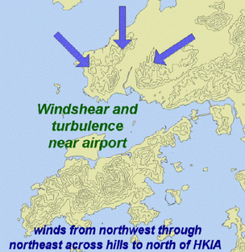
Hills disrupt the flow of air across them and hence may induce windshear and turbulence. The Hong Kong International Airport (HKIA) is located to the north of the mountainous Lantau Island, the highest peak on which is above 900 m. When winds of 15 knots or higher blow across the hills on Lantau from the east, southeast, south and southwest, windshear and turbulence may occur near the airport. Larger magnitude of windshear and turbulence is possible when the wind speed is over 30 knots.
|
|
While winds of 20 knots or higher come from the northwest through northeast sectors across the hills to the north of HKIA, windshear and turbulence may also occur near the airport, although much less frequently.
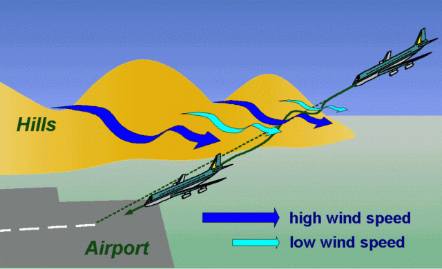
On windy occasions such as the approach of a tropical cyclone, air streams of high wind speed may emerge from mountain gaps. Lying between these high-speed air streams are air streams of lower wind speed. Aircraft traversing through alternating high-speed and low-speed air streams may encounter headwind losses and gains at different locations along the approach and departure corridors.
In particular, if an aircraft flies from a low-speed air stream to a high-speed air stream, it may experience a large headwind gain leading to a lift of the aircraft. If the aircraft moves from a high-speed air stream to a low-speed air stream, it may experience a large headwind loss resulting in a sinking motion. This sinking occurs irrespective of whether there is accompanying precipitation or not.
Apart from windy situations, windshear may also occur over the airport in lighter wind conditions when the atmosphere is stable (e.g. presence of a low-level temperature inversion). In fact, windshear has been known to occur when winds of less than 15 knots blow across the hills on Lantau Island in the spring months.
|
|
Due to the sporadic and transient characteristics of windshear, a wind speed loss/gain may not necessarily be followed/preceded by a wind speed gain/loss. Some aircraft may experience windshear and/or turbulence, while others do not, although the weather conditions are broadly the same. |
|
|
Windshear and turbulence are, on average, more significant on the southern runway because of the closeness to the hills of Lantau Island. |
|
|
Terrain-induced windshear does not necessarily occur in rain. As a matter of fact, many of the terrain-induced windshear reports received from aircraft flying into or out of HKIA are not associated with precipitation. |
|
|
While terrain-induced windshear is not caused by a "conventional microburst", the headwind loss and the sink that it brings to an aircraft may be comparable to that of a "conventional" microburst. |
A major tool used in researching the above mentioned phenomena is the Terminal Doppler Weather Radar (TDWR). The primary role of this instrument is to detect local wind conditions that lead to windshear and microbursts and, as such, it forms an essential part of the Windshear and Turbulence Warning System (WTWS). (See Spring 2002 issue of The Flyleaf for detail on the WTWS). The Kai Talk article by meteorologists from the HKO explains some of the operations of the TDWR as well as mountain wave flow and windshear. Below is a typical TDWR display showing the "spokes" or high speed airstreams (blue) that flow out from gaps on Lantau during southerly wind conditions. Notice the lower speed airstreams (green/dark green) that are interspersed between them:
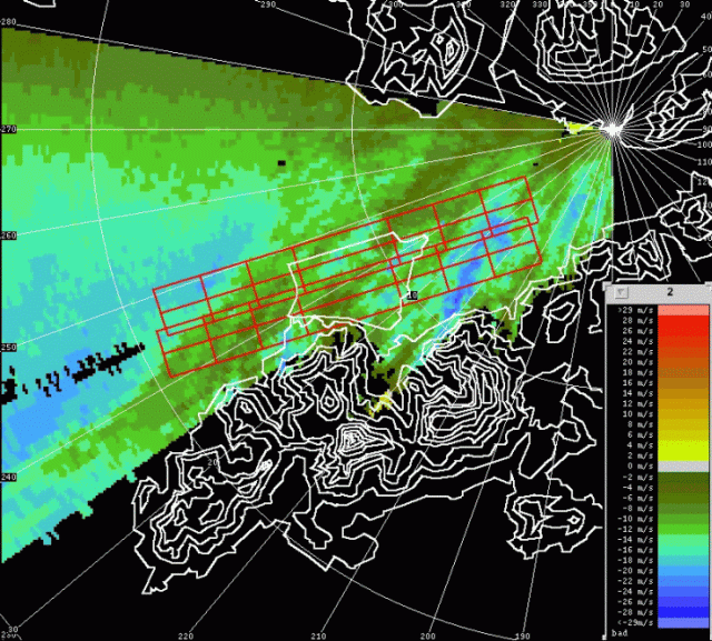
Figure 22: 10:24 hrs UTC TDWR wind velocities
Note: Blue to green indicates varying wind speeds towards radar and colors yellow to red away from radar.
So, what have we learned from the past four years of operations at CLK? Crew and ATC awareness of the potential
hazards have increased with operational exposure. The HKO is refining the calibration and algorithms for the TDWR. More importantly
though, knowledge and training are the most effective tools and they tell us that avoidance is by far the best strategy. In fact,
Flight Operations management has come out in print in both newsletters and NTCs with the clear message: Avoid! Do not take off
or make/continue an approach if a microburst alert is in force (as broadcast on ATIS or transmitted by ATC). Should an un-forecast
microburst be encountered, it will present itself as severe windshear. Follow SOPs and carry out the manoeuvre without hesitation and to
the best of your ability. On board detection systems may or may not recognize the conditions as the systems generally only operate
below 1500ft RA. (The FMGEC's did not detect windshear on the 2nd approach in the Virgin Atlantic incident). Finally, do not
limit your awareness of this phenomenon to Hong Kong. Narita 16/34 is another example of an approach in our network that is affected by windshear.
Pay close attention to METARs, ATIS, SIGMETs, Port Pages, ATC and PIREPs and form as accurate a mental picture as possible when planning
your approach or departure. Then, as stated previously, follow SOPs and training.
For more information on microbursts as well as the windshear and turbulence detection equipment in use in Hong Kong, log on to the HKO Website at:
http://www.weather.gov.hk/.
Meeting people
____________________________
Tropical cyclone briefings
Sharon Lau
To help air traffic control (ATC) and Airport Authority Hong Kong (HKAA) personnel warm up for the tropical cyclone season, a series of five refresher briefing sessions were conducted in May 2002 by the Observatory. The briefings focussed on the weather and windshear associated with the passage of tropical cyclones. The briefings attracted a total audience of nearly 180.
Figure 23: Sharon Lau giving a briefing to ATC and HKAA personnel
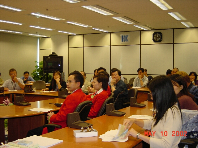
Figure 24: ATC and HKAA personnel having the floor in the discussion
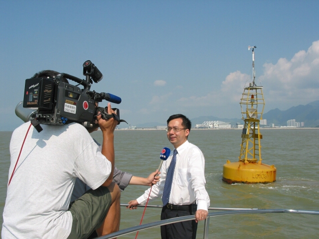
Floating the buoy
The Observatory's B.Y. Lee gave press interviews on 22 August 2002 on the first weather buoy deployed in Hong Kong to monitor weather conditions west of the airport (photo below). The occasion was attended by journalists from over 10 media organizations.
Airport Meteorological Office
__________________________________________________
Ready for response
Steve Chan
(Electrical and Mechanical Services Department)
On a fine morning in early July 2002, the E&MSD duty officer at the airport suddenly received a report from the Observatory saying that an anemometer mast had been severely damaged and required replacement at once. The duty officer immediately deployed the necessary manpower, vehicle and tools so that a spare mast was transported within an hour and erected at the site jointly with HKO personnel. Weather observations quickly resumed thereafter.
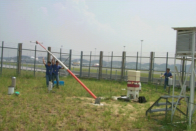
E&MSD staff erecting the spare anemometer mast in earnest
The above was anything but real. It was actually an exercise carried out regularly by E&MSD and HKO. The aim is to ensure that staff of both departments are well versed in replacing the anemometer mast, so that in the event of damage it can be restored in the shortest time possible. On the exercise day, a registered E&MSD safety officer was at hand to assess the work so that staff safety was assured.
Since the opening of the airport at Chek Lap Kok, E&MSD has been providing one-stop-shop maintenance and operation of the mechanical part, power supplies and air-conditioning systems to support the Observatory's aviation weather facilities. The staff of the two departments work closely, hand in glove, to make sure the airport equipment operates smoothly.
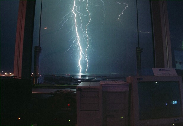
Forked Lightning
The airfield was directly hit by lightning strike on 2 August 2002. Thundery showers associated with an area of low pressure over the northern part of the South China Sea affected Hong Kong that evening. The area of low pressure developed into a tropical depression named Kammuri the next day. The photograph was taken by Mr. C.S. Yuen at the Airport Meteorological Office with ISO-100 negative film using long exposure and a F16 aperture.
Meetings and visits
________________________________
Greater participation in the international arena
B.Y. Lee
With increasing recognition for its work on aviation meteorology, HKO has been given a more significant role in the international arena in 2002. The following two colleagues have recently become chairpersons for working groups under the World Meteorological Organization (WMO) and the International Civil Aviation Organization (ICAO):-
| a) | Ms. Sharon Lau, Senior Scientific Officer, as co-chair of the TREND (Training, the Environment and New Developments) Working Group under WMO's Commission for Aeronautical Meteorology; |
| b) | Mr. C.M. Shun, Senior Scientific Officer, as chairman of ICAO's Asia/Pacific WAFS (World Area Forecast System) Transition Task Force. |
Sharon and CM have been in the respective Working Group/Task Force for several years. With their new responsibilities, they pledge to continue to convey requirements of the local aviation users to the international community and to contribute to further development of aviation meteorology. Our congratulations to both of them.
Civil Aviation Department visiting the Observatory
| Figure 26: Mr. Norman Lo, Acting Director-General of Civil Aviation (fourth from the right) and colleagues visited the Observatory on 6 November 2002 and were warmly welcomed by Dr. H.K. Lam, Director of the Hong Kong Observatory (fifth from the right in the front row) |
Visiting CAD and Cathay Pacific Airways
Trainees of the Observatory's "Applied Meteorology Course for Forecasters" visited the Civil Aviation Department (CAD) and Cathay Pacific Airways (CPA) on 4 July 2002 and were given briefings on their operations.
 |
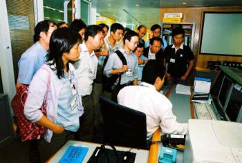 |
| Figure 27: A CAD colleague giving a briefing to HKO trainees on the operations of the Air Traffic Control Tower | Figure 28: A CPA personnel introducing their flight operations to HKO trainees |
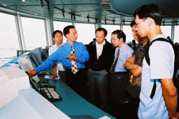
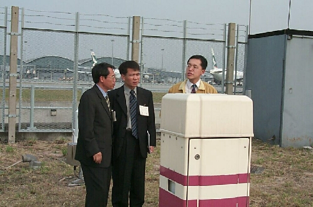
Visits by China Meteorological Administration and Korea Meteorological Administration
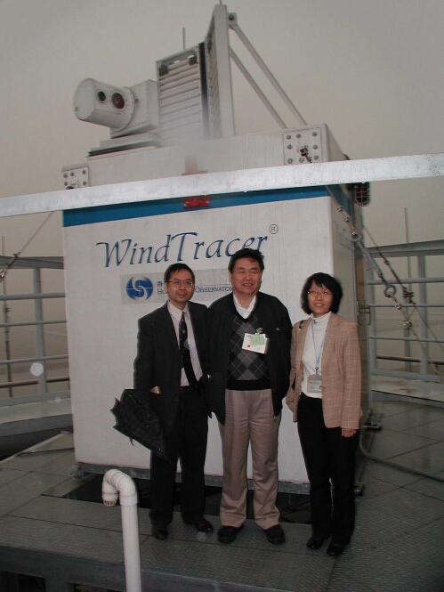
Figure 29: Delegation from China Meteorological Administration (CMA)visited HKO in December 2002. Mr. Li Huang, Deputy Administratorof CMA, is pictured here in front of the LIDARwith the Observatory's B.Y. Lee and Sharon Lau
| Figure 30: Korea Meteorological Administration's Messrs. Park Jun-hwan and Kim Dong-su (first and second from the left) discussing with HKO's Mr. P.W. Chan at the airport weather station in November 2002. KMA visited HKO for technical exchanges on aviation weather services, including verification of forecast and the application of LIDAR |
Visit by CAAC/ATMB
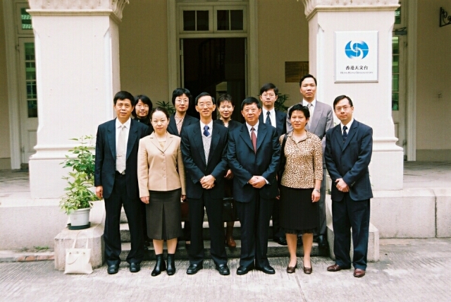
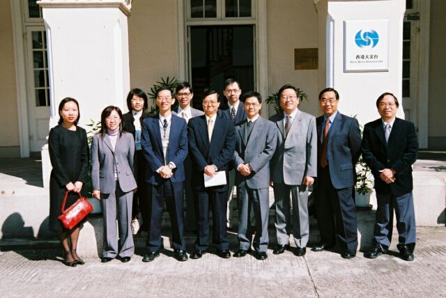
| Figure 31: A delegation from Air Traffic Management Bureau (ATMB), Civil Aviation Administration of China (CAAC), led by the Director General Mr. Chen Haiju (third from right, front row) and the Director of Meteorological DivisionMs. Zhou Jianhua (second from left), visited HKO in December 2002 for a high-level management meeting on aviation weather service |
Staff matters
__________________________
My work as a research assitant
Raymond Wong
After graduating in computing mathematics from the City University of Hong Kong, somewhat by chance I landed on a research assistantship with the Observatory's Aviation Weather Branch. Time flies, and I have been with this job for over a year now. My main duty is to develop and improve computer programs for the Airport Meteorological Office (AMO) so that the forecaster there can obtain the latest weather information on the runways. Getting started was not easy, as everything was new to me. With encouragement from my supervisor and assistance from colleagues, I finally managed to settle down.
The job itself is fascinating. I am able to apply what I have learnt in college. What amazes me is that meteorology actually involves the application of many mathematical techniques. Apart from polishing my computer programming skills, the job also allows me to know more about the weather and aviation meteorology. I hope to be able to contribute more to the work of the Observatory in future.
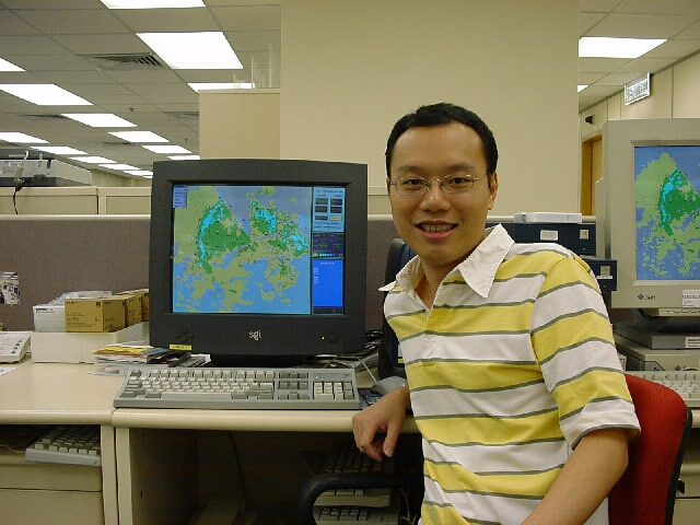
Figure 32 Raymond Wong testing the computer programme for AMO
Summer helper
Howard Chan
This past summer, I was fortunate enough to have worked at the Observatory as a summer helper for two months. It was an entirely new experience. Previously I thought all the Observatory did was to forecast the weather. Not any more after this summer - the Observatory does a lot more than just forecasting.
My work at the Observatory involved the preparation of computer programs for archiving and studying windshear and turbulence. In comparison, the computer programs that I wrote in the university were more complicated, but they needed not be too vigorous. I could afford to lose a few marks for some careless mistakes. On the other hand, it was more demanding at the Observatory. A single mistake could cause confusion, leading to a series of problems for colleagues and users.
For all the summer helpers, the Observatory arranged a day trip during the period. It was great to be able to see for ourselves Tai Mo Shan, as well as the big and strange-looking structure at the hilltop that was in fact the Observatory weather radar station. At the Observatory headquarters, we were shown the super-computer and the caesium beam atomic clock, both of them eye-openers for all of us.
I gained a lot for the work at the Observatory. It certainly will help my future career. Come to think of it, it wouldn't be a bad idea to work there after graduation!
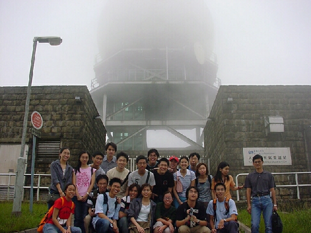
Figure 33: The writer (eighth from the left in rear row) and other summer students visiting the Observatory's weather radar station at Tai Mo Shan
|
Telephone and Fax Numbers | |
|
Enquiry on flight documents |
(852) 2910 6922 |
|
|
|
|
|
|
|
|
|
|
|
|
|
Hong Kong Observatory Home Page | |
|
Web Page for Aviation Weather Services | |
|
http://www.weather.gov.hk/aviation | |
Editor this issue C.K. So | |
Hong Kong Observatory : 134A Nathan Road, Kowloon, Hong Kong
Email: mailbox@hko.gov.hk