TROPICAL CYCLONES IN 2012
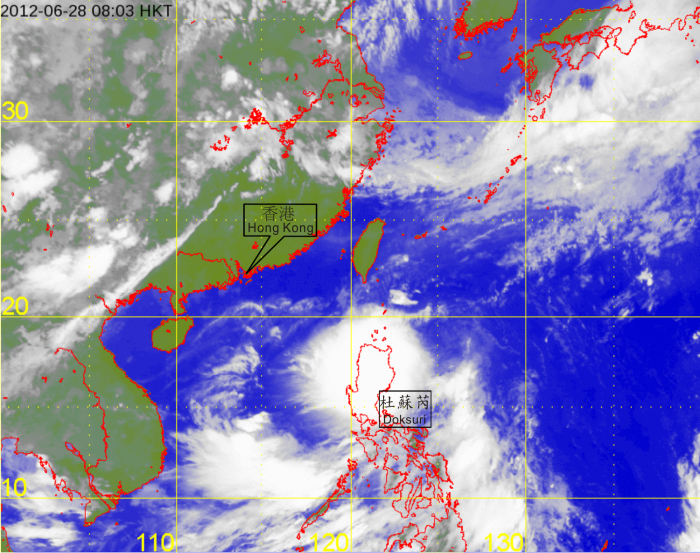
| Figure 3.2.4 |
Infra-red satellite imagery of Tropical Storm Doksuri at 8 a.m. on 28 June 2012. The centre of Doksuri was located over the western North Pacific to the northeast of Luzon at that time and at its peak intensity with estimated maximum sustained winds of 85 kilometres per hour near its centre. [The satellite imagery was originally captured by the Multi-functional Transport Satellite (MTSAT-2) of Japan Meteorological Agency (JMA).] |