Waterspout spotted in Hong Kong waters
22 July 2015
The Hong Kong Observatory received a report from the public about the sighting of a waterspout near Kau Yi Chau at around 8am this morning (22 July) (Figure 1). As indicated by the Observatory's weather radar at that time, the rain was particularly heavy over the region (Figure 2).
Under the influence of an active southwesterly airstream, the weather in Hong Kong was unsettled with heavy rain and squally thunderstorms today, giving rise to the formation of waterspout.
Heavy rain was mainly confined to the southern part of Hong Kong this morning, shifting northward gradually to Kowloon and Shatin in the afternoon. Since midnight last night till 4 pm today, more than 150 millimetres of rainfall were recorded over the urban areas, and up to 300 millimetres of rainfall over the western part of Hong Kong Island (Figure 3).
The active southwesterly airstream is expected to persist over the coastal areas of Guangdong in the next few days, when the weather will remain unsettled with occasional thundery showers. For the latest weather forecast, please refer to the following webpages:
http://www.weather.gov.hk/wxinfo/currwx/flw.htm (Local Weather Forecast) and
http://www.weather.gov.hk/wxinfo/currwx/fnd.htm (9-day Weather Forecast).
In Hong Kong, waterspouts are most commonly seen during the rainy season between May and October. A waterspout was last spotted near Shek Pik on 3 October 2014. Since 1959, there have been a total of 33 cases of waterspouts sighted in Hong Kong.
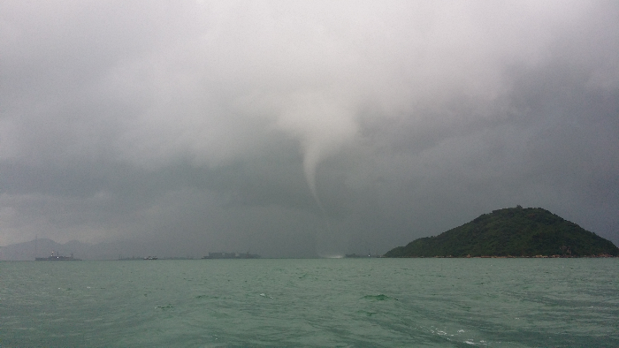
Figure 1: A waterspout sighted near Kau Yi Chau (Photo provided by a citizen)
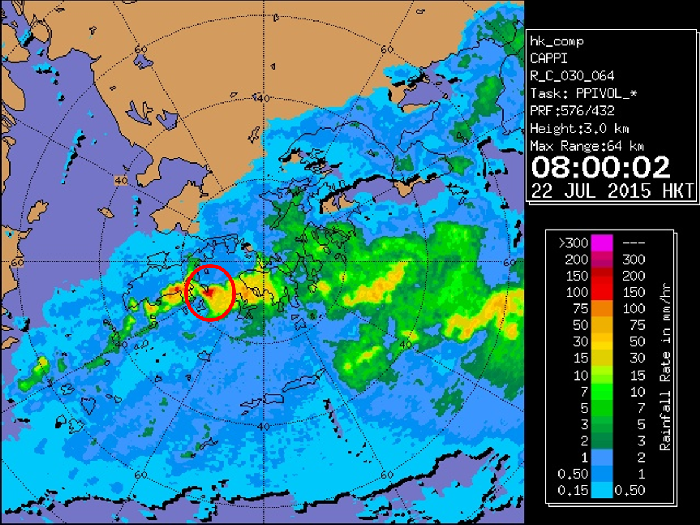
Figure 2: The Hong Kong Observatory's weather radar picture at 8am on 22 July 2015
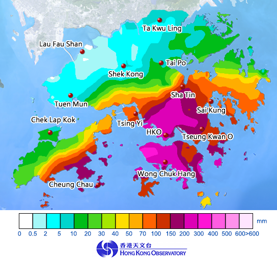
Figure 3: Rainfall distribution in Hong Kong from midnight to 4pm on 22 July 2015