Uncertainty in future track of tropical cyclone Utor
10 August 2013
Uncertainty in future track of tropical cyclone Utor
(10 August 2013)
Tropical cyclone Utor intensified rapidly over the Pacific to the east of the Philippines today (10 August 2013) and tracked to the west-northwest. On its forecast track (Figure 1), Utor will move in the general direction of northern Luzon and will move into the South China Sea early next week. At 4 pm today, Utor was over 1,800 kilometres from Hong Kong. In general, the uncertainty of Utor's forecast position will increase with increase in forecast time. On the other hand, an area of low pressure is lingering around the South China Sea (Figure 2). If Utor enters the South China Sea, it will be affected by this area of low pressure, resulting in change to its movement. It is now still early to say how Utor will affect Hong Kong early next week. Members of the public shall stay tuned to the latest forecast on Utor by the Observatory.
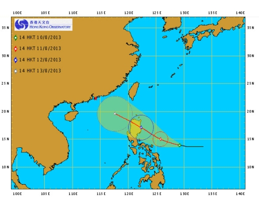
Figure 1: Forecast track of Utor at 2 pm, 10 August 2013
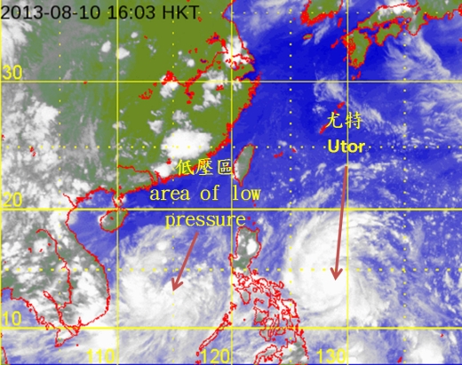
Figure 2: Satellite image at 4 pm, 10 August 2013