The Observatory launches real-time weather photos at Sai Kung
11 July 2012
|
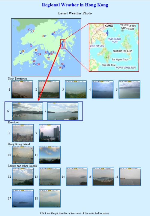
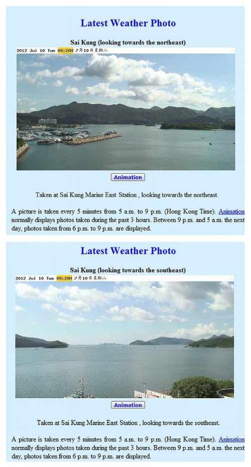
The Hong Kong Observatory has further enhanced its regional weather information service by adding real-time weather photos at Sai Kung to its website starting from today (July 11). Weather photos captured by the two cameras installed at the Sai Kung Marine East Station help to monitor the weather conditions over Sai Kung Hoi, Port Shelter and their surrounding areas. In recent years, a number of ecological tourist spots have been developed in Sai Kung such as the Hong Kong Global Geopark of China, attracting nature enthusiasts to the region for sightseeing. Many visitors and tourists also go to Sai Kung for leisure and vacation during weekends and public holidays. In addition, the coast of Sai Kung Hoi and Port Shelter is a hotspot for water sports activities where numerous training centres and yacht clubs are located. The newly launched weather photos will provide more weather information for the local residents of Sai Kung as well as people engaged in outdoor activities there. Senior Country Parks Officer of the Agriculture, Fisheries and Conservation Department, Mr Lam Yui-fong, welcomed the Observatory's initiative in providing weather photos at Sai Kung. "People visiting the country parks and geoparks can readily check the weather conditions near Sai Kung through the Observatory's webpage. They would be able to make plans for various outdoor activities and reduce the impact brought by inclement weather," he said. An aviator holding a record in long-distance cross-country flight and an experienced flying instructor, Mr Francis Chin, commended the Observatory's efforts over the years in continually enhancing its weather services and contributing to flight safety both locally and internationally. He stressed that the provision of Sai Kung real-time weather photos was particularly useful to local aviators within the general aviation community. "The newly added weather photos provide visual observations of the weather conditions. This is better than the traditional means of disseminating weather information in the formats of texts and diagrams which are rather difficult to visualise. The weather photos will be useful for pilots to monitor weather conditions at Sai Kung such as cloud cover, cloud base height and visibility etc., which facilitate flight planning by both helicopter and fixed-wing pilots, and greatly enhance flight safety," he added. With the inclusion of weather photos at Sai Kung, the number of sites providing weather photos on the Observatory's website has increased to 18. The Observatory will also provide higher resolution weather photos in phases to meet the needs of the public. All real-time weather photos are updated every five minutes and the photos are available from 5 am to 9 pm every day. Members of the public can access the weather photos through the Observatory's regional webpage (www.hko.gov.hk/wxinfo/ts/index_e_webcam.htm), weather information for water sports (www.hko.gov.hk/sports/watersports.shtml) and mobile platform webpage (m.hko.gov.hk/wxreport/wxphoto.htm). The weather photos at Sai Kung will also be available in the next upgrading of "MyObservatory", a smartphone weather service application developed by the Observatory. |
|
|