Waterspout spotted in Hong Kong Waters
22 July 2010
The Hong Kong Observatory had received a report from a member of the public at around 5pm today (July 22) about a waterspout that occurred around 4:30pm near Siu Sai Wan (see Figure 1). An area of intense convection was also indicated by the Observatory's weather radar at that time (see Figure 2). Locally, under the influence of the outer rainbands of Typhoon Chanthu, the weather was unstable with strong convective activities, giving rise to heavy rain and favourable conditions for the formation of waterspout.
A waterspout occurs over water, and a tornado is its equivalent over land. It usually involves a fast rotating column of air extending from the base of a convective cloud to the water surface. A rotating column of air that does not touch the water surface is called a funnel cloud.
Waterspouts are most commonly seen in June and July. In
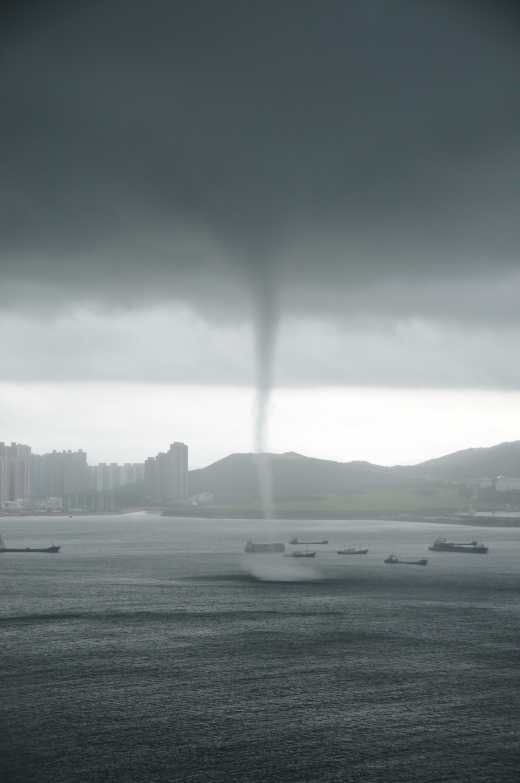
Fig. 1 Waterspout appearing near Siu Sai Wan (picture courtesy of Mr Thomas Chong)
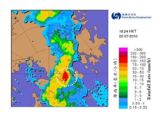
Fig. 2 An area of intense convection near Siu Sai Wan indicated by the Hong Kong Observatorys weather radar around 4:30pm.