The Observatory adds more real-time weather photos
9 June 2010
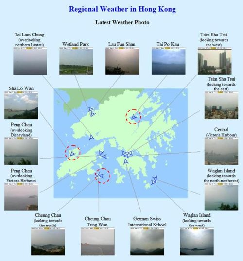
The Hong Kong Observatory is enhancing the content of regional weather information on its website today (9 June) by adding real-time weather photos at Sha Lo Wan, Tolo Harbour and the eastern waters of Cheung Chau.
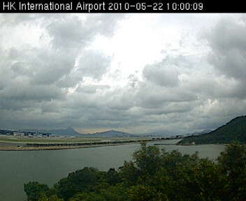
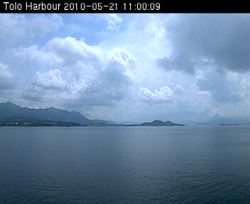
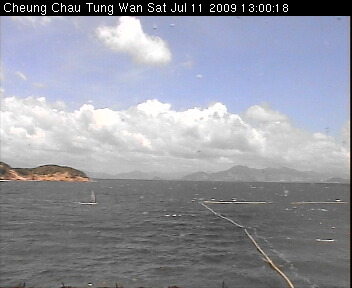
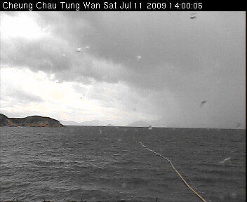
The weather camera at Sha Lo Wan captures images that reveal the weather conditions, such as the amount of cloud and the visibility, near the Hong Kong International Airport. The camera that provides weather photos at Tolo Harbour is installed at Tai Po Kau. Locals and tourists can know the weather conditions at various tourist spots in Tolo Harbour, Tai Mei Tuk and Plover Cove Reservoir through the weather photos, which helps them to better plan their travels. The camera at Cheung Chau Tung Wan provides weather photos of the eastern waters of Cheung Chau. The weather photos not only provide a good source of information of real-time weather conditions for people engaged in water activities, but also help monitor the sea conditions, particularly when there is a strong monsoon or tropical cyclone near Hong Kong.
These weather photos are also useful for aviation and marine users, such as helicopter pilots and ship masters, to understand the latest weather conditions for better navigation safety.
In addition to the weather photos taken at these three sites, the number of locations where real-time weather photos are accessible has increased to 15. These photos are available from 6am to 9pm everyday and are updated every 15 minutes at the Regional Weather webpage of the Hong Kong Observatory website (http://www.hko.gov.hk/wxinfo/ts/index_e_webcam.htm) or PDA webpage (http://pda.weather.gov.hk/wxphotoe.htm).
|
|
|
|
|
|
|
|