The Observatory adds real-time weather photos overlooking northern Lantau
29 April 2009
The Hong Kong Observatory has enhanced its regional weather information by adding real-time weather photos overlooking northern Lantau on its website today (April 29). The photos will enable the public to see the latest weather situation in the region for better planning of their journey.
The weather camera is installed at the Tai Lam Chung Terminal Doppler Weather Radar Station. The radar monitors wind shear and turbulence in the vicinity of the airport for safeguarding the safety of aircraft during take-off and landing. The radar station overlooks the mountain ranges in northern Lantau and its adjacent waters. The newly added weather photos are useful for monitoring the weather conditions such as amount of cloud, cloud base height and visibility in the area.
"When the atmosphere is sufficiently moist, clouds develop around the mountain ranges of Lantau Island. When wave clouds or rotor clouds form, their shape and movement provide visual information of the atmospheric conditions such as wind shear and turbulence in the area," the Observatory's Senior Scientific Officer in charge of Aerodrome Forecast, Ms Lam Ching-chi, said.
"General aviation users such as helicopter pilots and vessel navigators, or people and tourists going there for hiking or other activities can also make use of the latest weather photos to plan their journey."
Northern Lantau is an important juxtaposition of Hong Kong's land, sea and air traffic. The sea route connecting Kap Shui Mun, Ma Wan Channel and Urmston Road is a vital waterway between Hong Kong and the Mainland. The North Lantau Highway is the main route to the Hong Kong International Airport on land. In the air, there are busy flight paths where aircraft take off and land.
With the inclusion of the photos of northern Lantau, real-time weather photos at 11 different places are now available on the Observatory's website. The Observatory will continue to enhance its public weather services through the addition of more weather photos and information at other suitable places.
Real-time photos of northern Lantau are available at the "Regional Weather" webpage
(http://www.weather.gov.hk/wxinfo/ts/webcam/TLC_e_realtime.htm) or PDA webpage (http://pda.hko.gov.hk/wxphotoe_tlc.htm) . Photos taken between 7am and 7pm are displayed and updated every 15 minutes.
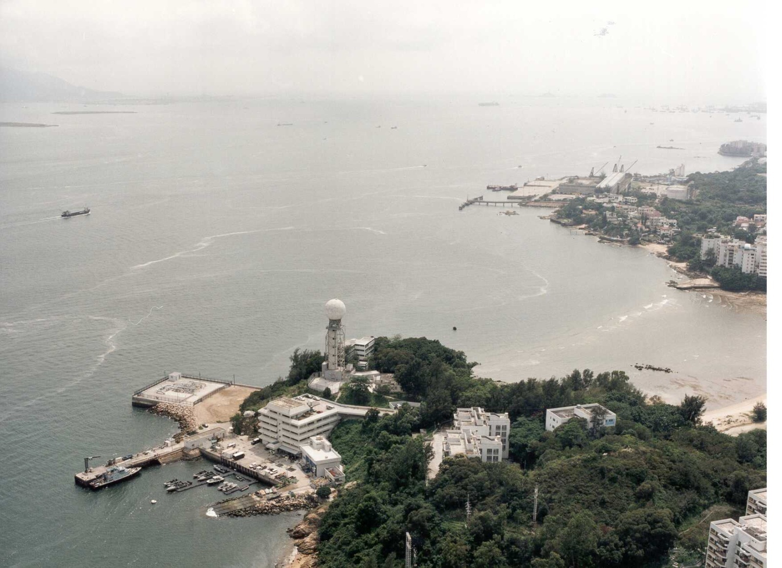
Tai Lam Chung Terminal Doppler Weather Radar Station.
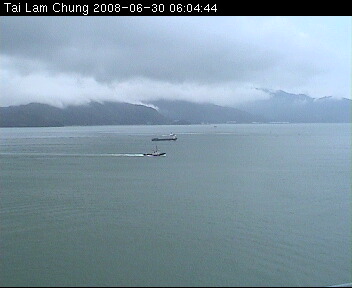
A weather photo overlooking northern Lantau. On the day of the photo was taken, the cloud base was rather low with a height of around 300 metres. The weather condition was very unstable, as manifested by the clouds streaming from the mountain gaps.