Severe Typhoon Vicente
|
|---|
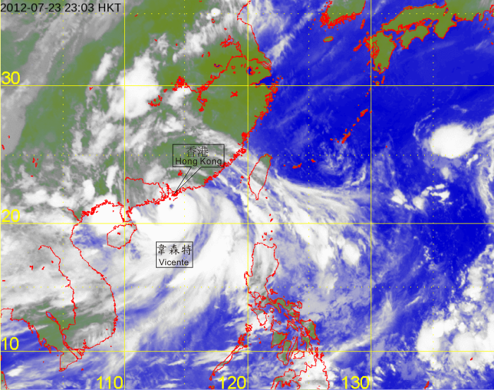
Infra-red satellite imagery at 11 p.m. on 23 July 2012 of Severe Typhoon Vicente, showing a distinct eye at about 120 km south-southwest of Hong Kong. Vicente was at its peak intensity with estimated maximum sustained winds of 155 kilometres per hour near its centre.
[The satellite imagery was originally captured by Multi-functional Transport Satellite-2 (MTSAT-2) of Japan Meteorological Agency (JMA).]