Typhoon Toraji (2423) > Figure 6
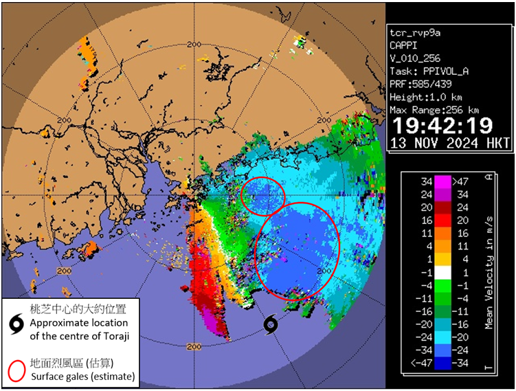
Figure 6
Radar imagery showing the Doppler velocity at around 7:42 p.m. on 13 November 2024. The image revealed the radial winds at around 1 km (i.e. the velocity of rain echoes relative to the radar, and positive (negative) values indicates rain echoes moving away from (towards) the radar). The image showed that the surface gale winds to the north of Toraji was rather close to Hong Kong. When Toraji was moving west or west-northwest, its associated gale force winds was expected to pose a threat to the territory.
Note:
For the method of estimating the surface gales, please refer to "Using Doppler Radar Wind to Estimate the Surface Wind Distribution of Tropical Cyclones (Chinese Only)".