Overview of Tropical Cyclone in June 2023
|
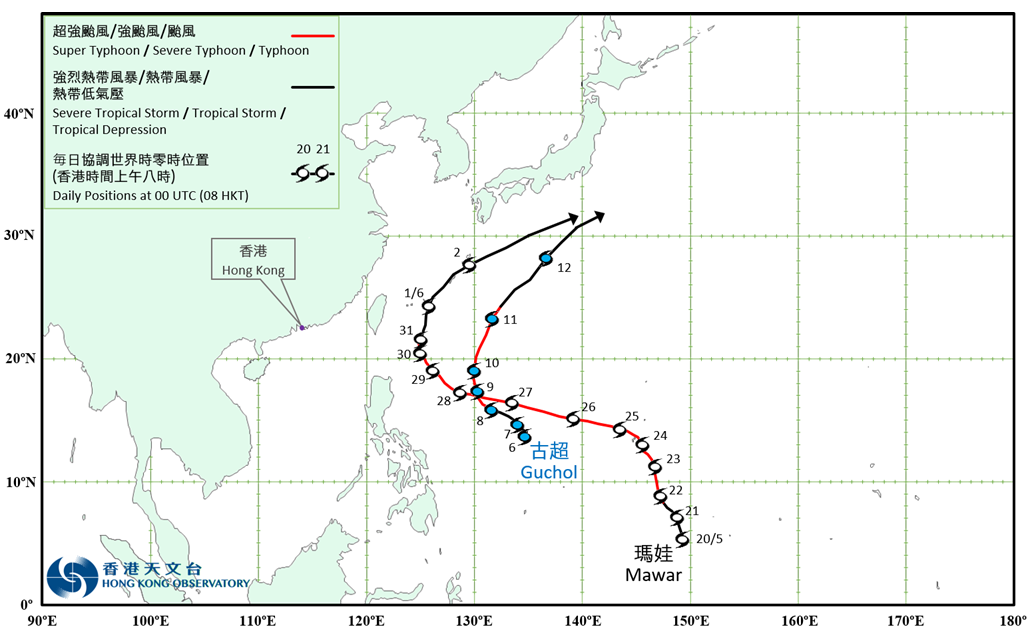
Two tropical cyclones occurred over the western North Pacific in June 2023. Mawar formed as a tropical depression over the western North Pacific about 1 070 km south-southeast of Guam in the small hours on 20 May. It moved north-northwestwards and intensified gradually. Mawar intensified into a super typhoon on the morning of 23 May. After skirting past Guam, it turned to move west-northwestwards towards the seas east of Luzon the next day. Mawar reached its peak intensity with an estimated sustained wind of 250 km/h near the centre in the small hours on 26 May. It weakened gradually afterwards and became a severe typhoon on 28 May. Mawar turned gradually to move northeastwards across the vicinity of Ryukyu Islands and continued to weaken in the following five days. Mawar finally evolved into an extratropical cyclone over the western North Pacific to the south of Japan on 3 June. Guchol formed as a tropical depression over the western North Pacific about 560 km northwest of Yap in the small hours on 6 June. It moved generally northwestwards and intensified gradually. Guchol intensified into typhoon on the afternoon of 8 June and reached its peak intensity with an estimated sustained wind of 145 km/h near the centre in the small hours on 10 June. It turned to move northeastwards and weakened gradually afterwards. Guchol finally evolved into an extratropical cyclone over the western North Pacific to the south of Japan on 12 June. |
Provisional Tropical Cyclone Tracks in June 2023