Overview of Tropical Cyclones in May 2016
Overview of Tropical Cyclones in May 2016
Monday, 13th June 2016
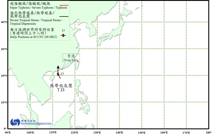
The formation of a tropical depression over the northern part of the South China Sea led to the issuance of tropical cyclone warning signals by the Hong Kong Observatory for the first time in 2016.
After formation over the northern part of the South China Sea on the night of 26 May, the tropical depression moved north-northwestwards and edged closer to the coast of western Guangdong. It took on a more northerly track the next day and slightly intensified, reaching peak intensity with an estimated sustained wind of 55 km/h near its centre. It made landfall near Yangjiang in western Guangdong on the evening of 27 May and soon degenerated into an area of low pressure that night.
According to press reports, the tropical depression brought rainstorms to western Guangdong. A bridge was destroyed by flood, causing a bus to plunge into the river and injuring two persons. At the Macao Maritime Ferry Terminal, two passengers were injured during an incident of vessel collision. The tropical depression did not cause any significant damage in Hong Kong during its passage.
 |
|---|
Tropical Cyclone Track in May 2016