Overview of Tropical Cyclones in April 2015
Overview of Tropical Cyclones in April 2015
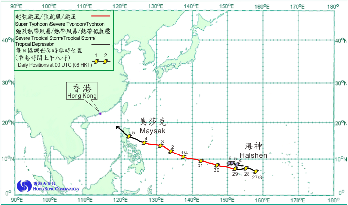
Two tropical cyclones occurred over the western North Pacific and the South China Sea in April 2015.
Maysak formed as a tropical depression over the western North Pacific about 1 640 km east-southeast of Guam on the morning of 27 March. Moving generally westwards, Maysak intensified gradually in the next four days. It developed into a super typhoon on the morning of 31 March and reached its peak intensity that night with an estimated sustained winds of 230 km/h near its centre. Maysak moved west-northwestwards towards Luzon in the following days, crossing Luzon on 5 April and entering the South China Sea that night. It weakened rapidly and degenerated into an area of low pressure over the northeastern part of the South China Sea the next morning.
According to press reports, Maysak wreaked havoc in the Federated States of Micronesia. At least nine people were killed and several thousand people had to be evacuated.
Haishen formed as a tropical depression over the western North Pacific about 1 220 km east-southeast of Guam on the night of 3 April. Moving generally westwards, it intensified into a tropical storm the following afternoon. Haishen reached its peak intensity that night with an estimated sustained winds of 75 km/h near its centre. It became slow-moving and weakened gradually in the next couple of days. Haishen eventually dissipated over the western North Pacific southeast of Guam on the afternoon of 6 April.
 |
|---|
Tropical cyclone tracks in April 2015