Overview of Tropical Cyclones in May 2008
Overview of Tropical Cyclones in May 2008
(Tracks)
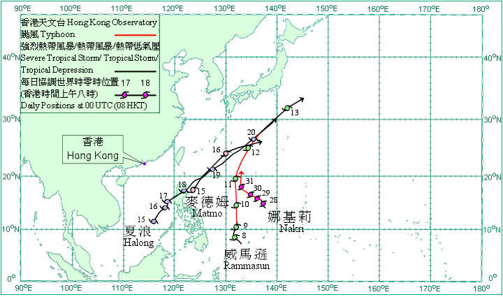
Four tropical cyclones occurred over the western North Pacific and South China Sea in May 2008, more than the average of one to two for the same period in 1971-2000.
Rammasun formed as a tropical depression over the western North Pacific about 1 510 km east-southeast of Manila on 7 May and moved northwestwards. It intensified into a tropical storm and turned to move northwards the next day. Rammasun intensified first into a severe tropical storm on 9 May, and then further into a typhoon. It turned to move north-northeastwards on 11 May, while weakening into a severe tropical storm and moved northeastwards the next day. Rammasun became an extra-tropical cyclone over the western North Pacific to the southeast of Japan on 13 May.
Matmo formed as a tropical depression over the western North Pacific about 430 km northeast of Manila on 15 May and moved northeastwards. It intensified into a tropical storm on 16 May but weakened into a tropical depression again that evening. Matmo became an extra-tropical cyclone over the western North Pacific south of Japan the next day.
Halong formed as a tropical depression over the central part of the South China Sea about 650 km west-southwest of Manila on 15 May and moved northeastwards. It intensified into a tropical storm on 16 May and then a severe tropical storm the next day. Halong weakened into a tropical storm after crossing Luzon on the night of 17 May and the early morning of 18 May. According to press reports, at least 44 people were killed in the Philippines. Halong re-intensified into a severe tropical storm on 19 May but weakened into a tropical storm on 20 May. Halong became an extra-tropical cyclone over the western North Pacific south of Japan that day.
Nakri developed as a tropical depression over the western North Pacific about 500 km north of Yap on 27 May and moved generally northwestwards. It intensified into a tropical storm that evening and a severe tropical storm the next day. Nakri intensified further into a typhoon on 29 May, and then turned to move northwards on the last day of the month.

Track of tropical cyclones in May 2008

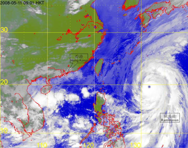
Satellite infra-red imagery at around 9 a.m. on 11 May 2008 of Typhoon Rammasun.
[The imagery was originally captured by Multi-functional Transport Satellite-1R (MTSAT-1R) of Japan Meteorological Agency (JMA).]