Super Typhoon Sarika

|
|---|
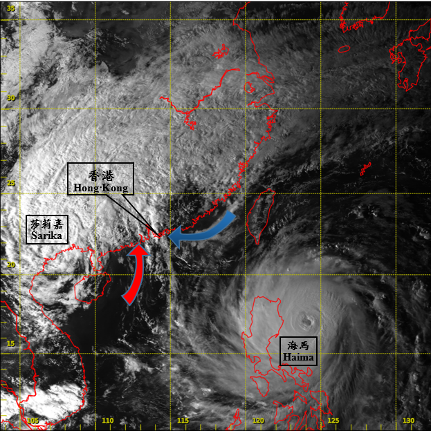
Visible satellite imagery around 4 p.m. on 19 October 2016. Sarika had already weakened into a tropical depression over inland Guangxi. However, the convergence between the southerly airstream associated with Sarika (arrow in red) and the northeast monsoon (arrow in blue) triggered heavy rain and thunderstorm development near Hong Kong. Meanwhile, Super Typhoon Haima over the western North Pacific was moving towards Luzon.
[The satellite imagery was originally captured by Himawari-8 Satellite (H-8) of Japan Meteorological Agency (JMA)]