Severe Tropical Storm Prapiroon (2404) > Figure 3
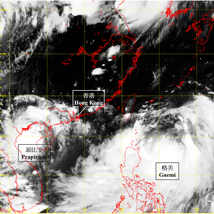
Figure 3 Infra-red satellite imagery at around 5 p.m. on 22 July 2024 when Prapiroon was at its peak intensity with an estimated maximum sustained wind of 105 km/h near its centre. Besides, severe tropical storm Gaemi to the east of Luzon was moving northwards.
[The satellite imagery was originally captured by Himawari-9 Satellite (H-9) of Japan Meteorological Agency.]