Typhoon Rose
Typhoon Rose
August 10 - 17, 1971
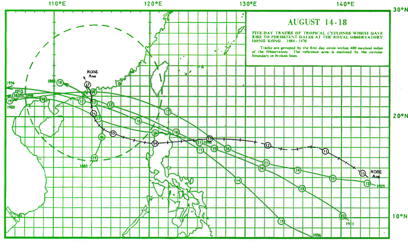
The track of this typhoon is shown in Figure 1
Typhoon "Rose" was one of the most intense and violent typhoons that have affected Hong Kong. Maximum wind speeds were only slightly lower than in Typhoon "Ruby" of 1964 and Typhoon "Wanda" of 1962 and they occurred during the night whereas both "Ruby" and "Wanda" passed in daylight. Like other tropical cyclones that approached from the south, such as Typhoon "Mary" of 1960, "Rose" caused very heavy rainfall. The strongest winds were from the east-southeast whereas in "Wanda" the strongest winds were from the north.
On August 10, "Rose" developed as a tropical depression about 110 miles west of Guam and soon intensified to a typhoon. It moved west-northwestwards at 11 knots at first but then followed a westerly track at about 14 knots for the next three days. During the period August 11 - 12, the reported maximum winds within the circulation of "Rose" fluctuated between storm and hurricane force. However, it remained as a typhoon from August 13 onwards. The centre of Typhoon "Rose" started to cross north Luzon early in the morning of August 14 and entered the South China Sea later in the day. Satellite pictures (Figures 2 - 4) showed that during the period August 12 - 14 the circulation of Typhoon "Rose" was characterized by a relatively small cloud mass covering an area between 240 and 360 miles in diameter.
In Hong Kong, the Stand By Signal, No. 1, was hoisted at 5.00 p.m. on August 14, when "Rose" was centred about 400 miles southeast of the Colony, and was moving west-northwest at about 10 knots.
|
|---|
Figure 1. Track of Typhoon "Rose" : August 10 - 17, 1971.
On August 15, "Rose" slowed down to about 7 knots as it turned to a northwesterly course. Positions of the typhoon located by reconnaissance aircraft formed a very erratic track and the eye diameter fluctuated between 13 and 50 miles. However, the reconnaissance reports showed that "Rose" was continuously intensifying with its central pressure falling from an estimated 987 millibars at 1.25 p.m. on August 14 to 959 millibars by midnight on August 15 - 16. The intensification was also substantiated by a marked increase in the symmetry of the cloud mass associated with the typhoon as revealed by a satellite picture taken on the morning of August 15 (Figure 5). At 7.00 p.m. on the same day, a reconnaissance aircraft reported a maximum surface wind of 130 knots near the centre of "Rose". By the late afternoon, it was possible to identify the eye of Typhoon "Rose" on the Observatory's radar displays. The radar presentation revealed that the rainbands of Typhoon "Rose" were well organized but only covered an area about 100 miles in diameter. The eye was well defined most of the time and was about 20 miles in diameter. These features (Figures 6 and 7) indicated that "Rose" was a compact and well-developed typhoon.
On August 16, the typhoon began to move on a northerly course at about 7 knots towards Hong Kong and the Strong Wind Signal, No. 3, was hoisted at 5.05 a.m. when it was about 150 miles away to the south. A statement was issued by the Royal Observatory to warn the community that because of the relatively small size of Typhoon "Rose" winds might increase very rapidly over the Colony. The Northeast Gale or Storm Signal, No. 7, was hoisted at 9.50 a.m. as Typhoon "Rose" continued to approach the Colony. Satellite pictures taken during the morning (Figure 8) showed that the circulation of "Rose" was still very well organized and that clouds covered an area about 360 miles in diameter.
At about 10 a.m. a ship, S.S. Nuddea, reported that she was experiencing 90 to 110 knot winds some 10 miles east-northeast of the typhoon centre. At 12.25 p.m. when the eye (Figure 9) was about 100 miles away, the Southeast Gale or Storm Signal, No. 8, was hoisted to replace No. 7 to warn a change in the direction of the gales. At about 1.00 p.m. S.S. Nuddea, one of Hong Kong's voluntary observing ships, went into the eye of Typhoon "Rose" where the wind suddenly ceased and the lowest pressure recorded was 953.7 millibars. At 2.45 p.m. the vessel was approaching a rainband when gale force winds of 41 - 47 knots commenced suddenly from south by east. At 3.30 p.m. the pressure remained at 953.7 millibars but started to rise to 955.7 millibars by 4.00 p.m. By then the wind had veered to southwest and had increased to a sustained speed of over 130 knots. At about the same time another ship within 7 miles of the centre recorded a minimum pressure of 952 millibars.
During the morning on August 16, surface winds over the Colony were mainly fresh from the northeast quarter. The wind speed increased gradually in the afternoon and gales were experienced in outlying islands by the early evening. Sustained winds of gale force were reported by all local stations soon after dark and the wind direction turned first east and later southeast.
The Increasing Gale or Storm Signal, No. 9, was hoisted at 9.10 p.m. on August 16 when "Rose" was about 50 miles south-southwest of the Royal Observatory and was replaced by the Hurricane Signal, No. 10, at 10.50 p.m. as the eye of the typhoon continued to move northwards at 10 knots. During the night of August 16 - 17, winds of hurricane force were experienced in many places, particularly over the western part of the Colony. The edge of the eye of Typhoon "Rose" passed close to the west of Cheung Chau at about 1.52 a.m. on August 17. The surface wind at Cheung Chau decreased from 66 to below 25 knots in 15 minutes and the sea level pressure fell to 963.2 millibars. At about the same time a minimum pressure of 982.8 millibars was recorded at the Royal Observatory.
Barograms of Typhoon "Rose" recorded at various meteorological stations in Hong Kong during the period August 16 - 17 are reproduced in Figure 10 and the anemograms for the same period are shown in Figures 11 - 15. Winds at Tai O fell to almost calm around 2.20 a.m. when the eye passed over but returned to hurricane force shortly after 2.45 a.m. Calm wind conditions were also experienced for about half an hour between 2.00 a.m. and 3.00 a.m. in Castle Peak, Shek Kok Tsui and Tsing Shau Tsuen#. Winds were reported to have died down around 3.00 a.m. over coastal areas southwest of Ngau Hom Sha.
However, no noticeable calm intervals were reported in places east of So Kwun Tan and Lau Fau Shan Market. The central calm region or the "wind eye" in Typhoon "Rose" was well defined and covered an area of about 10 miles in diameter. The gale area of Typhoon "Rose" was about 120 miles in diameter when gales were first experienced in exposed places over the Colony. However, the gale area gradually reduced to about 60 miles in diameter as the centre of "Rose" passed over Lantau lsland and the western districts of the Colony.
After crossing the western coast of Castle Peak, the centre of "Rose" passed over Deep Bay and moved away from the Colony north-northwestwards towards Canton. The trajectory of the centre of the eye over the western part of the Colony is depicted in Figure 16.
As the typhoon began to weaken overland, No. 10 was replaced by the Southwest Gale or Storm Signal, No. 6, at 4.40 a.m. This was followed by the Strong Wind Signal, No. 3, at 9.15 a.m. All signals were lowered at noon on August 17.
"Rose" weakened to a tropical storm at about noon on August 17 and dissipated near Canton about 110 miles north-northwest of the Colony. Fresh southerly winds prevailed over the Colony for several hours in the early afternoon.
During the passage of "Rose", there were 6 hours of gales at the Royal Observatory, while hurricane force winds were recorded for 1 hour at the Hong Kong Airport, 2 hours at Cape Collinson and Waglan lsland, 3 hours at Cheung Chau, and 4 hours at Tate's Cairn. The maximum gust peak speeds recorded were 102 knots at Waglan Island, 103 knots at Cape Collinson, 105 knots at Cheung Chau, and 121 knots at the Royal Observatory. At the top of Tai Mo Shan, a maximum gust peak speed of 150 knots was recorded at 1.43 a.m. just before the anemometer was broken at 2.11 a.m. on August 17.
The weather in Hong Kong was cloudy with scattered showers on the morning of August 16, but the showers became frequent and squally during the day and heavy rain set in towards midnight. Torrential rain occurred during the early morning of August 17 and a total of 167.5 mm of rainfall was recorded at the Royal Observatory in the three hours between 1.00 a.m. and 4.00 a.m. Brilliant flashes of lightning were also observed at this time but because of the noise caused by the wind no thunder could be heard at the observing stations. During the heavy rain on August 17 the trace of the "Jardi" rate-of-rainfall recorder at Tate's Cairn rose to above the upper limit of the chart and the maximum instantaneous rate which occurred around 8.30 a.m. was estimated to be 513 mm/h. The weather improved rapidly during the afternoon of August 17 and no rainfall was recorded after 5.00 p.m.
An unusual phenomenon observed was the development of sea fog at Waglan lsland, Cheung Chau and Cape Collinson during the morning of August 18. This was probably caused by a lowering of the sea surface temperature by Typhoon "Rose". Fog is rare in Hong Kong in August.
The following daily amounts of rainfall were recorded at the Royal Observatory:
| August 14 | Trace |
| August 15 | Nil |
| August 16 | 52.8 mm |
| August 17 | 288.1 mm |
| August 18 | Nil |
The daily total rainfall of 288.1 mm on August 17 is the highest value ever recorded in one calendar day in August in Hong Kong. Figure 17 shows the hourly amounts of rainfall and the barometric pressure profile as recorded at the Royal Observatory during the passage of Typhoon "Rose". The heaviest hourly rainfall of 63.3 mm occurred at the hour of minimum barometric pressure at the Observatory.
The times and heights of the highest tides and maximum storm surges recorded at the various locations in the Colony during Typhoon "Rose" were as follows:
| Location |
Highest Tide Above Chart Datum |
Maximum Storm Surge Above Predicted Level | ||||
|
Height (m) |
Date |
Time |
Height (m) |
Date |
Time | |
| North Point |
2.56 |
Aug 17 |
2.20 a.m. |
0.64 |
Aug 17 |
2.20 a.m. |
| Tai Po Kau |
3.00 |
Aug 17 |
3.25 a.m. |
0.98 |
Aug 17 |
3.25 a.m. |
| Chi Ma Wan (Lantau) |
2.98 |
Aug 17 |
1.05 a.m. |
1.23 |
Aug 17 |
1.05 a.m. |
Wind-generated waves of about 9.5 metres from trough to crest were registered by the electronic wave-recorder near Waglan lsland at noon on August 16 just before the submerged cable lead was broken by a landslide. However, waves estimated to be 14 metres high were observed by H.M.S. Argonaut about 70 miles north of the typhoon a few hours later. A survey of coastal areas in the west of the Colony showed that the rise of water did not exceed 3 metres,equivalent to a surge of about 1 metre. This is less than would be expected considering the intensity of the typhoon and past records.
Tragically, "Rose" was the worst typhoon for fatalities and heavy damage to property in Hong Kong since Typhoon "Wanda" in 1962. In general, heavier damage was reported in the western than in the eastern side of the Colony. Over 30 ocean-going vessels went aground or suffered collision. About 300 small craft, including 100 pleasure craft, were sunk or damaged. Three of the 14 hydrofoils on the Hong Kong - Macau run were severely damaged and a total of 6 Hong Kong & Yaumati ferries went aground while taking shelter in Kowloon Bay. In addition, the "Fat Shan", a Hong Kong - Macau Ferry, capsized and the 'Lee Hong', a laid-up ferry vessel, was sunk. The death toll from Typhoon "Rose" stood at 110 confirmed deaths. Most of the deaths occurred on board the capsized "Fat Shan". Of the 92 people on board, there were only four survivors, 73 confirmed deaths and the others were still missing and presumed dead. 286 persons were injured of whom 90 had to be hospitalized.
A total of 5,644 people from 1,032 families was made homeless and 653 huts were destroyed. About 24 buildings were damaged in 12 locations, of which 6 were beyond repair or collapsed. Cables affecting some 30,000 telephones were out of order. There were numerous landslides resulting in 110 cases of road blockage of which 30 were serious. Flooding occurred in 35 locations in low-lying and coastal areas. Fallen scaffoldings and signboards, uprooted trees and broken boughs were common scenes all around the city.
Amidst the fury of Typhoon "Rose" a fire broke out shortly after 9.00 p.m. on August 16 in a large power sub-station in Kwun Tong, Kowloon and the flames were fanned by the high winds to such an intensity that firefighters were unable to control it at times. Although the fire was put out at about 10.30 p.m. it triggered a general power failure, resulting in a blackout in Kowloon and the New Territories. Thousands of people were trapped in elevators during the power cut. There were 43 fire alarms altogether.
Hundreds of pigs and over 40,000 chickens as well as other poultry were killed, about 1,356 hectares of vegetable and garden crops damaged and some 20,000 fruit trees blown down. Considerable loss of pond fish due to overflow was also reported.
#Place names referred to in this context are given on the base map in Figure 16.