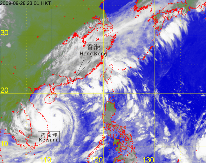
Typhoon Ketsana
 |
|
Infra-red satellite imagery at 11 p.m. on 28 September 2009 of Typhoon Ketsana. Ketsana was at its peak intensity with estimated maximum sustained winds of 140 kilometres per hour near its centre and its eye was located about 780 km south-southwest of Hong Kong at that time. |
|
[The satellite imagery was originally captured by Multi-functional Transport Satellite-1R (MTSAT-1R) of Japan Meteorological Agency (JMA).]
|