Typhoon Dujuan - a Typhoon with Double Eye Walls
Typhoon Dujuan - a Typhoon with Double Eye Walls
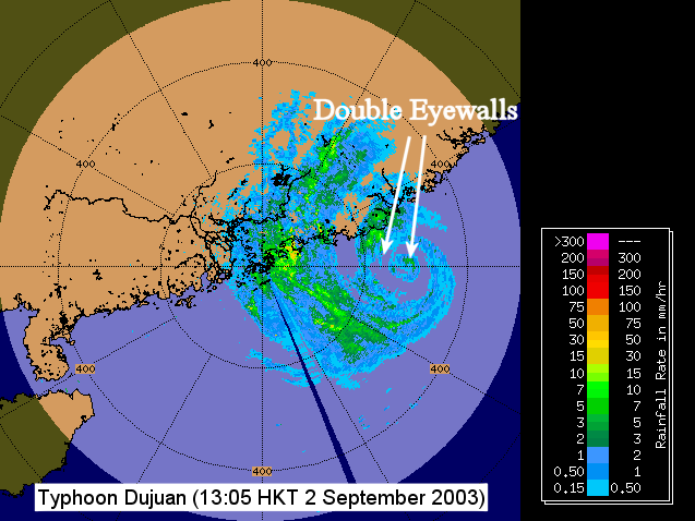
Typhoon Dujuan passed to the south of Taiwan and moved towards the Pearl River Estuary during the day (2 September 2003). Over the northern part of the South China Sea, Dujuan exhibited a double-eye-walled structure (Figure 1). The diameter of the inner and outer eyes are about 20km and 100km respectively.
The eye wall is the inner most ring of convection near the centre of a typhoon, containing most intense winds and fiercest rain. While most typhoons have a single eye wall, many strong and mature typhoons develop the double-eye-walled structure (up to 50 % of hurricanes in the United States). However, it should be noted not all strong typhoons have double eye walls.
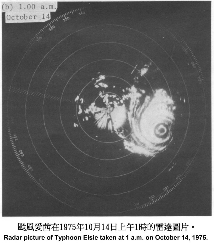
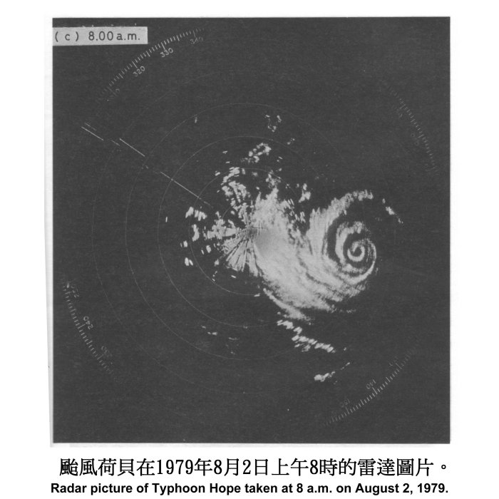
In the west Pacific, development of the double-eye-walled structure was not rare. It was observed, among others, in Typhoon Kujira (2003), in Typhoon Kirogi and Typhoon Kai-Tak (2000), in Typhoon Winnie (1997), and Typhoon Dinah (1987). Double eye walls were observed by the Hong Kong Observatory's weather radar for Typhoon Elsie (Figure 2) in 1975 and Typhoon Hope (Figure 3) in 1979. Both Elise and Hope were intense typhoons with maximum winds near their centres exceeding 200km/h. On both occasions, the Hurricane Signal Number 10 was hoisted in Hong Kong.
When strong typhoons show a double eye-walled structure, they are often in the process of undergoing a "eye wall replacement cycle" where a new eye wall develops and replaces an existing one. The cycle begins with a concentrated ring of convection that develops outside the eye wall. The ring of convection then propagates inward leading to a double-eye. The inner eye wall eventually dissipates while the outer intensifies and moves inward. The double-eye-walled structure usually marks the end of an episode of intensification and may last for a day or two.